


 Windermere lake
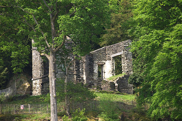
BPD54.jpg (taken 12.5.2008)
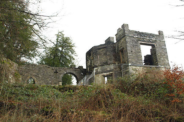
BVV06.jpg (taken 27.1.2012)
placename:- Station, The
placename:- station, Windermere, West 1
 goto source
Page 57:- "STATION I [Windermere], near the isthmus of the ferry point [1]. In front, Rampsholme, or Berkshire-island, presents itself in all its length, clothed in wood. To the left, the ferry point closing with Crow-holme, a wooded island, forms a fine promontory. Just behind this, the mountain retiring inward, makes a semi-circular bay, surrounded by a few acres of the most elegant verdure, sloping upwards from the water's edge, graced with a cottage in the finest point of view. Above it, the mountain rises in an agreeable wildness, variegated with scattered trees, and silver-grey rocks. An extent of water of twelve miles in circum-"
"[1] This station is now sufficiently pointed out by the elegant building lately erected thereon, belonging to John Christian Curwen, Esq. and called THE STATION, which, with the improvements made in the Ferry-house Inn, and grounds adjoining, render it one of the most delightful places near the lakes."
 goto source
Page 58:- "[circum]ference, spreads itself to the north, frequently intersected with promontories, or spotted with islands. Amongst them, the Holme, or Great Island, an oblong tract of thirty acres, traverses the lake in an oblique line, surrounded by a number of inferior isles, finely formed and dressed in wood. The pointed dark rocks of Curlew-craggs appear above the water, and others just concealed, give a sable hue to that part of the lake. Rough-holme, is a circular isle, covered with trees. Lady-holme, where in ancient times stood an oratory, is an isle of an oval form, vested with coppice-wood. Hen-holme is a rock covered with shrubs. Grass-holme is shaded with a grove of oaks. And two smaller islets borrow their names form the lilies of the valley, which decorate them. These with Crow-holme and Berkshire island, form this Archipelago."
"To the north of this magnificent scene, a glorious sheet of water expands itself to the right and left, in curves bearing from the eye; bounded on the west by the continuation of the mountain where you stand, whose bold lofty side is embellished with growing trees, shrubs, and coarse vegetation, intermixed with grey rocks, that group finely with the deep green of yews and hollies. The eastern view is a noble contrast to this, adorned with"
 goto source
Page 59:- "all that is beautiful, grand and sublime.- The immediate space is much cultivated, (sic) The variety of hanging grounds are immense, consisting of woods, groves, and inclosures, all terminated in rocky woodlands of various forms. It spreads above in a beautiful variety of waving inclosures, intermixed with hanging woods, and shrubby circular spots, over-topped with wild grounds and rocky ridges of broken mountains. In some places it swells into spacious bays, fringed with trees, whose bushy heads wave beautifully over the crystal waters. The parsonage-house is seen sweetly seated under a range of tall firs. Following the same line of shore, above the east, ferry point, and on the banks of the bay, the tops of the houses and the church of Bowness are just seen. Above that, Bannerigg and Orresthead rise gradually into points, cultivated to the top, and cut into inclosures. These are contrasted by the rugged craggs of Biscot-how. Troutbeck-park comes next in view, and over that, Hill-bell rears its conic top, and Fair-field swells in Alpine pride, rivalled only by Rydal's loftier head."
"The eastern coast, to the south of what has been described, is still more pleasing in variety of little groves, interposed inclosures, and scattered houses, sweetly secreted. To"
 goto source
Page 60:- "the south, and from the western coast, at three miles distance, Rawlinson's nab, a high-crowned promontory, shoots far into the lake; and from the opposite shore, you see the Storrs, another wooded promontory, stretching far into the water, pointing at the rocky isle of Ling-holme. Over Rawlinson's nab, the lake spreads out in a magnificent sheet of water; and following the winding shore far to the south, it seems lost hehind (sic) a promontory on the eastern side. Over two woody mountains, Park and Landen-nab, the blue summits of other distant mountains in various forms, close the scene."
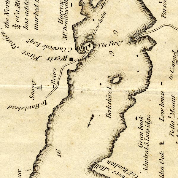
CT9SD39X.jpg
"Wests First Station,"
square symbol
item:- Armitt Library : 2008.14.102
Image © see bottom of page
placename:- station, Windermere, West 1
marked on the map of lake Windermere, west shore above the ferry landing "West's First Station ..."
placename:- Station, The
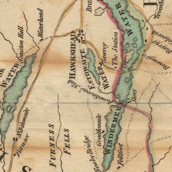
Ws02SD39.jpg
"The Station"
item:- Armitt Library : A1221.1
Image © see bottom of page
 click to enlarge
GRA1Lk.jpg
"Mr Wests Station"
item:- Hampshire Museums : FA2000.62.5
Image © see bottom of page
 goto source
Gentleman's Magazine 1805 p.1010 "... The shores (as might be expected) are low and uncommanding. A lofty point of rock on the Western beach is occupied by a station house, erected by the same gentleman [as Belle Isle]. Here, after a laborious ascent, we gained little novelty of prospect, and surrendered much of the grandeur of the mountain scenery."
"..."
placename:- Station House
 goto source
page 15:- "..."
"The Station House stands on a hill above the ferry, and was built by Mr. Brathwaite, from whom it was purchased by John Christian Curwen Esq. who likewise belongs to, and occasionally resides upon, the island. The"
 goto source
page 16:- "Station commands an extensive and enchanting view of Windermere, and Curwen Island is the grand leading feature to which the eye is involuntarily led. ..."
"Comprehended under that angle of vision prescribed by the laws of perspective, all the principal islands with the well wooded Ferry House, are discovered in this view, and give an extraordinary richness to it; the lands on the opposite shores gracefully intersecting each other, and abundantly decorated with woods, are in unison with the islands. Cultivation is extended beyond the margin of the lake, high into Troutbeck and Applethwaite; and"
page 17:- "the scene is closed at many miles distant from the eye by grand mountains, the principal of which is Hillbell."
"Near the banks of the lake, on the western shore, and to the left of the Great Island, comfortably situated, stands Calgarth, the seat of the Lord Bishop of Llandaff; and over the other end of the island, Brayrigg, that of the Rev. Fletcher Fleming; Old Calgarth lies between these houses. Bowness with its church and the pleasantly dispersed houses belonging to Mr. Taylor and Mr. Crump, appear beyond Crow Holm and the Ferry House. - South of Bowness, on a beautiful promontory, see Story, the property of Colonel Bolton, who has recently added a magnificent house to that built by the late Sir John Ledger, Bart. - should the grounds be appropriately decorated, the mansion, with its appendages, will be the most splendid on the banks of Windermere."
 goto source
page 18:- "The view down the lake, if not equal to that over the island, is, at least, pleasing; it is featured with bays, several wooded promontories shooting far into the water; these are principally Stor's and Rawlinson's Nab."
placename:- Station
item:- larch trees
 goto source
page vi "... The view from the Pleasure-house of the Station near the Ferry has suffered much from Larch plantations; this mischief, however, is gradually disappearing, and the Larches, under the management of the proprietor, Mr. Curwen, are giving way to the native wood. ..."
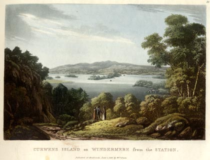 click to enlarge
GN0509.jpg
Plate 10 in Lake Scenery.
printed at upper right:- "10"
printed at bottom:- "CURWENS ISLAND on WINDERMERE from the STATION. / Published at Ambleside, June 1, 1815, by Wm. Green."
item:- Armitt Library : A6646.9
Image © see bottom of page
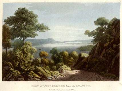 click to enlarge
GN0510.jpg
Plate 11 in Lake Scenery.
printed at upper right:- "11"
printed at bottom:- "FOOT of WINDERMERE from the STATION. / Published at Ambleside, June 1, 1815, by Wm. Green."
item:- Armitt Library : A6646.10
Image © see bottom of page
placename:- Station
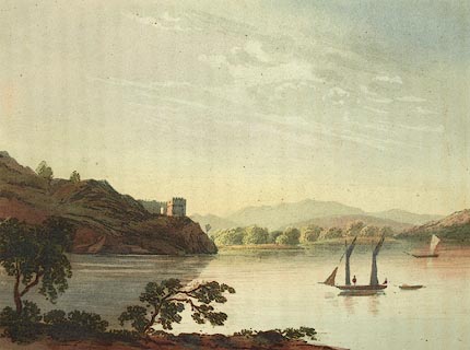 click to enlarge
FW0110.jpg
Tipped in opposite p.38 in A Picturesque Tour of the English Lakes.
item:- Dove Cottage : 1993.R566.10
Image © see bottom of page
item:- stained glass
 goto source
Page 4:- "..."
"The Station, belonging to Mr. Curwen, is a building erected upon a rocky eminence above the Ferry house. The path leading to it is decorated with native and exotic trees and shrubs; the upper story commands extensive views of the lake and"
 goto source
Page 5:- "surrounding scenery: and the windows, being partly of stained glass, give a good representation of the manner in which the landscape would be affected in different seasons. The view towards the north has every essential for a beautiful landscape; a bold foreground, a fine sheet of water graced with islands, the large one of Mr. Curwen, with its dome-topped building, being a principal feature; the village of Bowness, the mansions placed at various points, the rich woods, and distant mountains, all contribute to enrich the scene. Towards its foot, the shores of the lake appear beautifully broken, by several promontories stretching far into the water from each side."
"..."
 goto source
"... passing beneath the station, which is built upon a rock, tastefully ornamented with evergreens and flowering shrubs, and may be visited by the way. ..."
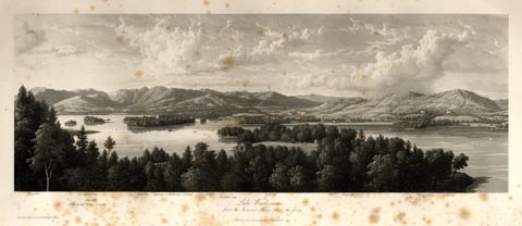 click to enlarge
WTL305.jpg
"Wansfell. Lilly of the Valley Islands. Kirkstone. Calgarth. Hill Bell. Curwen's, or Berkshire Island. Ellery. Bowness-bay. Bowness. Vicarage. Ferry. Ferney Green. Bellfield. / Lake Windermere, / from the Summer House above the ferry. / Drawn & Engraved by W. Westall A.R.A. / Published by Ackermann & Co, 96 Strand."
item:- Armitt Library : A6658.5
Image © see bottom of page
placename:- Station, House
placename:- Station, The
 goto source
Page 29:- "..."
"On a hill above the Ferry is the Station House;"
 goto source
Page 30:- "its windows are filled with glass, coloured so as to represent the landscape as it appears at the different seasons of the year. The lake is here seen at your feet, Curwen and all the islands studding its waters - the wooded parks and uplands of Troutbeck and Applethwaite - Hill Bell and High Street terminating the prospect. The view to the southward is a great contrast to this. Here the promontories of Rawlinson's Nab and Storrs Hall push boldly into the waste of waters, while the well-wooded but moderate heights of Gunner's How and Fell Foot close the distance."
 goto source
Page 158:- "..."
"... Above the inn [Ferry House] is a pleasure-house, called the Station, whence some exquisite views are to be had."
placename:- Station
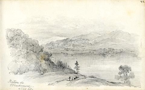 click to enlarge
AS0624.jpg
"Station &c / Windermere. / Nov 68."
page number "22"
item:- Armitt Library : 2008.61.24
Image © see bottom of page
placename:- Station House
item:- laurel
 goto source
Page 30:- "... Station House, which he must have seen from the opposite side of the lake, peeping out of the ever-green woods. There he obtains fine views, up and down the lake, and may mark, on the way up, the largest laurels he has ever seen. His driver, or some resident, will probably take care that he does not stay till it is more than reasonably dusk. ..."
placename:- Summer House Station
p.19:- "... let us take a trip to the Ferry Hotel and "The Station." The landing-place for passengers at the ferry is facing the hotel, where stands a row of tall plane-trees with their shadows reflected in the translucent lake. Beyond the avenue of trees, on the right hand, pass through the little gate into a private cart road; and a few steps further on is the high road; then turn to your right, and you will see a pair of gates on the left, which is the lodge-entrance to the Summer House Station. Take the footpath which goes winding away amid fir, wild-cherry, and large laurel trees, to the Summer House, an octagon building one storey high, with an embattled arch stretching away to the left, the property of Mr. Curwen, of Belle Isle, who kindly permits visitors to enter. On gaining the hall, and passing up a wide staircase on the left, we pass into a room with double glass windows which are coloured to represent the seasons, and looking out of these from this little fairy retreat we behold some of the most enchanting and illusive scenes of Summer, Spring, Autumn, and Winter presented to the eye. One masks the lake in the soft beauty of monlight; another a dark storm difficult to describe; while in"
p.20:- "the winter scene the house-top on the opposite shore, looks as if it were covered with snow. From another pane is embodied the glories of summer. Evening is the best time to view from it, just before the clouds put on their ruddy burning tinges. Water, earth, and air are bathed in beauty as cirrus-clouds hang on the upper region of the atmosphere, chequered by the bending blue of space. The tone of the whole subject is a beautiful subdued harmony of the scenery around this delightful part of the lake. There is a melting and graceful beauty which charms into perfect repose, as the gazer involuntary sympathises with the listless happy rowers in the boats. The whole atmosphere breathes heat, and the golden sky is reflected back from the gently rippling water in blended beauty; the snow-white sails of the graceful yachts are tinged by the beams of the drooping god of day, and scarcely swell to the zephyr. ..."
placename:- Station, The
courtesy of English Heritage
"THE STATION / / B 5285 / CLAIFE / SOUTH LAKELAND / CUMBRIA / II / 76726 / SD3883895472"
courtesy of English Heritage
"Viewing station. Late C18. Stone rubble. 2 storeys, with canted bays to front and rear, and embattled parapet. Now ruinous, the front wall collapsed. lst floor sill band, some slate hanging remains to rear. Large window openings to 1st floor of returns and narrow opening to remaining part of front wall. Lower recesses to ground floor of returns. Rear has canted bay with entrance and 1st floor window opening with flanking blind windows; narrow window openings to either side, with slate hanging to remains of parapet. Wall connects station with rock outcrop to rear, with round-headed archway and round-headed opening with foundations of structure to rear. Interior has remains of cross walls, rear gabled wall with stack and fireplace. Vaulted chamber to ground floor, rear canted bay has stone flying stair with moulded treads. The Station was used as a viewing point for Lake Windermere at the time when picturesque principles suggested that landscape should be viewed from certain points only, where the elements of scenery were most pictorial, and is associated with the early tourist industry. Property of The National Trust."
: West, Thomas
