 Old Cumbria Gazetteer
 |
 |
|
| Rayne Bridge, Orton S | ||
| Rayne Bridge | ||
| site name:- | Lune, River | |
| civil parish:- | Orton S (formerly Westmorland) | |
| county:- | Cumbria | |
| locality type:- | bridge | |
| coordinates:- | NY64490547 | |
| 1Km square:- | NY6405 | |
| 10Km square:- | NY60 | |
|
|
||
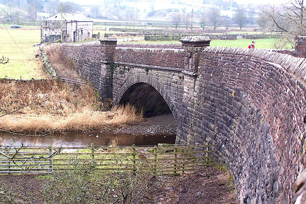 BLL30.jpg (taken 9.12.2005) |
||
|
|
||
| evidence:- | old map:- OS County Series (Wmd 29 5) placename:- Rayne Bridge |
|
| source data:- | Maps, County Series maps of Great Britain, scales 6 and 25
inches to 1 mile, published by the Ordnance Survey, Southampton,
Hampshire, from about 1863 to 1948. |
|
|
|
||
| evidence:- | old map:- Jefferys 1770 (Wmd) |
|
| source data:- | Map, 4 sheets, The County of Westmoreland, scale 1 inch to 1
mile, surveyed 1768, and engraved and published by Thomas
Jefferys, London, 1770.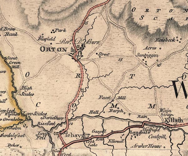 J5NY60NW.jpg double line, road, across a stream; bridge W of Kelleth item:- National Library of Scotland : EME.s.47 Image © National Library of Scotland |
|
|
|
||
| evidence:- | old map:- Cary 1789 (edn 1805) |
|
| source data:- | Map, uncoloured engraving, Westmoreland, scale about 2.5 miles
to 1 inch, by John Cary, London, 1789; edition 1805.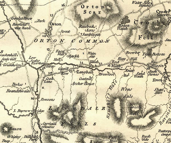 CY24NY60.jpg road across a stream; bridge over the Lune item:- JandMN : 129 Image © see bottom of page |
|
|
|
||
| evidence:- | old map:- Ford 1839 map placename:- Rain Bridge |
|
| source data:- | Map, uncoloured engraving, Map of the Lake District of
Cumberland, Westmoreland and Lancashire, scale about 3.5 miles
to 1 inch, published by Charles Thurnam, Carlisle, and by R
Groombridge, 5 Paternoster Row, London, 3rd edn 1843.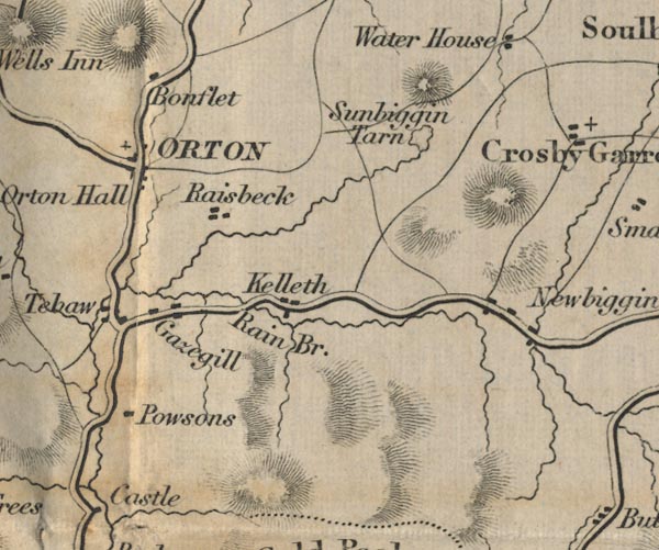 FD02NY60.jpg "Rain Br." Road across stream. item:- JandMN : 100.1 Image © see bottom of page |
|
|
|
||
 Lakes Guides menu.