 Old Cumbria Gazetteer
 |
 |
|
| Millom Station, Millom | ||
| Millom Station | ||
| Holborn Hill Station | ||
| site name:- | Whitehaven and Furness Junction Railway | |
| locality:- | Millom | |
| civil parish:- | Millom (formerly Cumberland) | |
| county:- | Cumbria | |
| locality type:- | railway station | |
| coordinates:- | SD17218019 | |
| 1Km square:- | SD1780 | |
| 10Km square:- | SD18 | |
| SummaryText:- | Opened as Holborn Hill Station 1850; renamed Millom Station 1866. | |
|
|
||
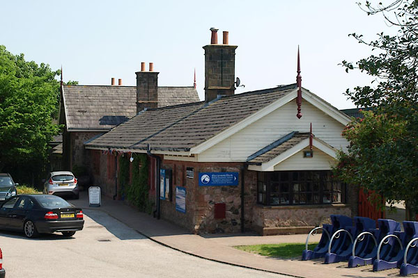 BWO89.jpg (taken 28.5.2012) 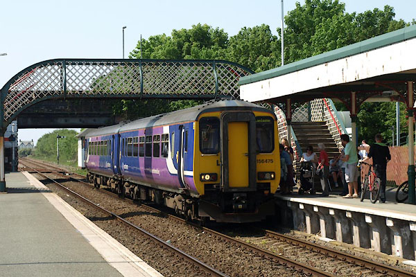 BWO84.jpg Train towards Barrow. (taken 28.5.2012) |
||
|
|
||
| evidence:- | old map:- OS County Series (Cmd 90 2) item:- railway bridge |
|
| source data:- | Maps, County Series maps of Great Britain, scales 6 and 25
inches to 1 mile, published by the Ordnance Survey, Southampton,
Hampshire, from about 1863 to 1948.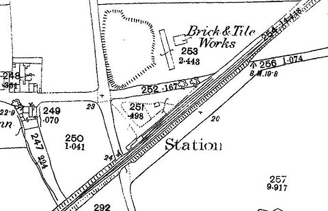 click to enlarge click to enlargeCSRY0111.jpg "Station" at Holborn Hill; there is no place called Millom on the map. |
|
|
|
||
| evidence:- | old map:- Garnett 1850s-60s H |
|
| source data:- | Map of the English Lakes, in Cumberland, Westmorland and
Lancashire, scale about 3.5 miles to 1 inch, published by John
Garnett, Windermere, Westmorland, 1850s-60s.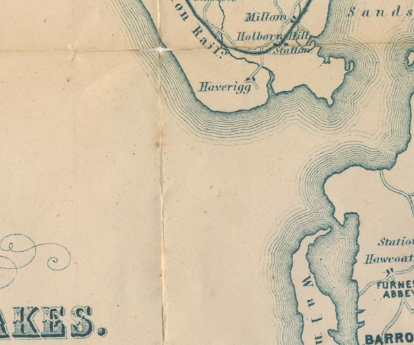 GAR2SD17.jpg "Station" dot by railway item:- JandMN : 82.1 Image © see bottom of page |
|
|
|
||
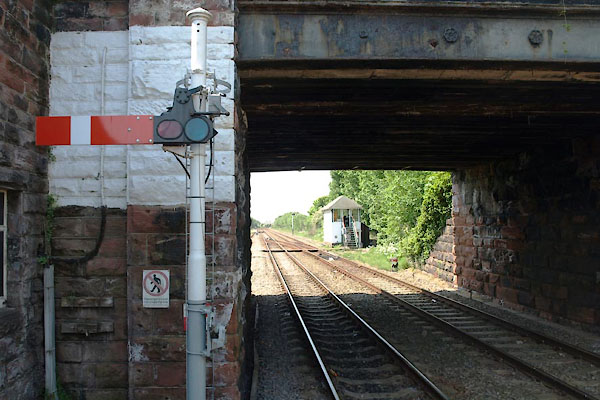 BWO88.jpg View NW. (taken 28.5.2012) 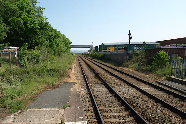 BWO87.jpg View SE. (taken 28.5.2012) |
||
|
|
||
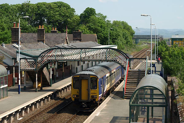 BWO83.jpg Train towards Carlisle. (taken 28.5.2012) 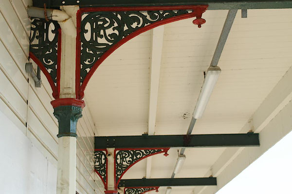 BWO85.jpg FR in a cast iron bracket. (taken 28.5.2012) 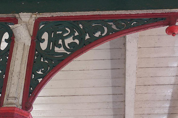 BJR58.jpg FR in a cast iron bracket. (taken 5.8.2005) 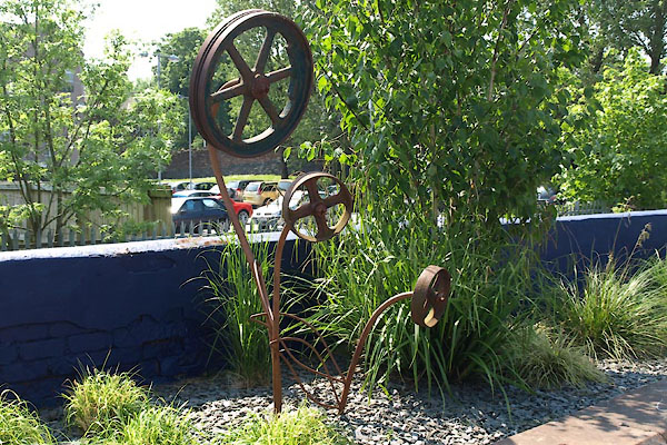 BWO86.jpg A different sort of station gardening (taken 28.5.2012)  BWP16.jpg Goods shed, now Tesco (taken 28.5.2012) 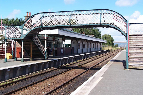 BJR57.jpg (taken 5.8.2005) 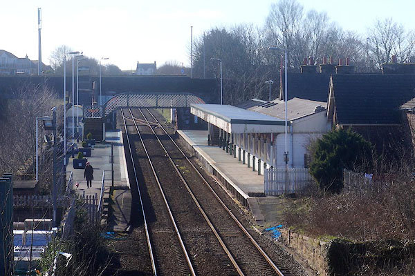 CEP12.jpg (taken 23.2.2016) |
||
|
|
||
| Paley and Austin series | ||
| person:- | architect : Paley, Edward G |
|
| person:- | architect : Austin, Hubert J |
|
| date:- | 1874 |
|
| New building. |
||
|
|
||
 Lakes Guides menu.