 Old Cumbria Gazetteer
 |
 |
|
| milestone, Natland | ||
| site name:- | road, Lancaster to Kendal E | |
| locality:- | Barrow Green (near) | |
| civil parish:- | Natland (formerly Westmorland) | |
| county:- | Cumbria | |
| locality type:- | milestone | |
| coordinates:- | SD52658839 | |
| 1Km square:- | SD5288 | |
| 10Km square:- | SD58 | |
|
|
||
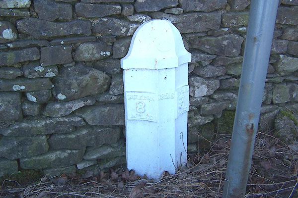 BLQ40.jpg "[T.] WINDER GATEBECK FOUNDRY" "BURTON 8 MILES / 1826 / KENDAL 3 MILES" (taken 1.3.2006) |
||
|
|
||
| evidence:- | old map:- OS County Series (Wmd 38 16) |
|
| source data:- | Maps, County Series maps of Great Britain, scales 6 and 25
inches to 1 mile, published by the Ordnance Survey, Southampton,
Hampshire, from about 1863 to 1948. "M.S KENDAL .. 3 BURTON .. 8" |
|
|
|
||
| evidence:- | old map:- Jefferys 1770 (Wmd) |
|
| source data:- | Map, 4 sheets, The County of Westmoreland, scale 1 inch to 1
mile, surveyed 1768, and engraved and published by Thomas
Jefferys, London, 1770.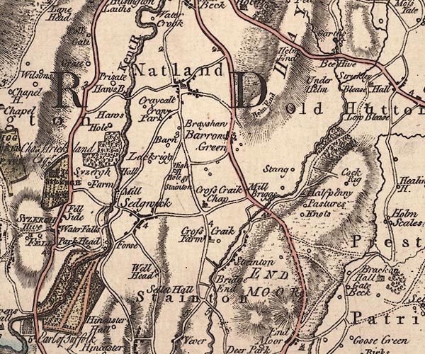 J5SD58NW.jpg "3" milestone marked by road item:- National Library of Scotland : EME.s.47 Image © National Library of Scotland |
|
|
|
||
| evidence:- | database:- Listed Buildings 2010 |
|
| source data:- | courtesy of English Heritage "MILESTONE APPROXIMATELY 250 YARDS NORTH OF PUNCH BOWL PUBLIC HOUSE / / A6 / NATLAND / SOUTH LAKELAND / CUMBRIA / II / 76448 / SD5265188386" |
|
| source data:- | courtesy of English Heritage "Milestone. Dated 1826. Cast-iron. Half-hexagonal with fluted faced and domed top, painted black and white. Marked:" "BURTON / 8 / MILES" "on North Side and" "KENDAL / 3 / MILES" "on South Side" "One of a series of similar Milestones and Boundary Stones on the old Turnpike Road." |
|
|
|
||
 Lakes Guides menu.