 Old Cumbria Gazetteer
 |
 |
|
| Matson Ground, Windermere | ||
| Matson Ground | ||
| Street:- | Helm Road | |
| locality:- | Windermere | |
| civil parish:- | Windermere (formerly Westmorland) | |
| county:- | Cumbria | |
| locality type:- | buildings | |
| locality type:- | locality | |
| coordinates:- | SD41649663 | |
| 1Km square:- | SD4196 | |
| 10Km square:- | SD49 | |
|
|
||
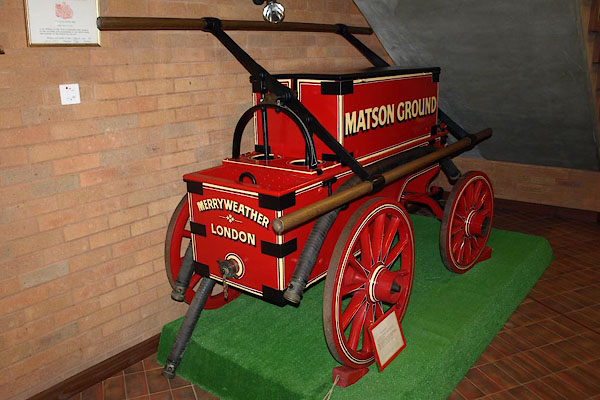 BRI50.jpg Manual fire engine made by Merryweather, London, 19th century; at Cumbria Fire and Rescue service HQ, Cockermouth. (taken 2.9.2009) 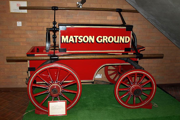 BRI51.jpg Manual fire engine made by Merryweather, London, 19th century; at Cumbria Fire and Rescue service HQ, Cockermouth. (taken 2.9.2009) |
||
|
|
||
| evidence:- | old map:- OS County Series (Wmd 32 12) placename:- Matson Ground |
|
| source data:- | Maps, County Series maps of Great Britain, scales 6 and 25
inches to 1 mile, published by the Ordnance Survey, Southampton,
Hampshire, from about 1863 to 1948. |
|
|
|
||
| evidence:- | old map:- Jefferys 1770 (Wmd) placename:- Masons |
|
| source data:- | Map, 4 sheets, The County of Westmoreland, scale 1 inch to 1
mile, surveyed 1768, and engraved and published by Thomas
Jefferys, London, 1770.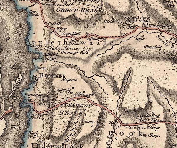 J5SD49NW.jpg "Masons" circle, labelled in italic lowercase text; settlement, farm, house, or hamlet? item:- National Library of Scotland : EME.s.47 Image © National Library of Scotland |
|
|
|
||
| evidence:- | database:- Listed Buildings 2010 placename:- Matson Ground |
|
| source data:- | courtesy of English Heritage "MATSON GROUND (HOUSE TO SOUTH EAST) / / HELM ROAD / WINDERMERE TOWN / SOUTH LAKELAND / CUMBRIA / II / 351681 / SD4164696633" |
|
|
|
||
| evidence:- | database:- Listed Buildings 2010 placename:- Matson Ground item:- date stone (1721) |
|
| source data:- | courtesy of English Heritage "MATSON GROUND (HOUSE TO WEST), WITH ATTACHED BUILDINGS / / HELM ROAD / WINDERMERE TOWN / SOUTH LAKELAND / CUMBRIA / II / 351680 / SD4160996659" |
|
|
|
||
 Lakes Guides menu.