 Old Cumbria Gazetteer
 |
 |
|
| Lorton Hall, Low Lorton | ||
| Lorton Hall | ||
| locality:- | Low Lorton | |
| civil parish:- | Lorton (formerly Cumberland) | |
| county:- | Cumbria | |
| locality type:- | buildings | |
| coordinates:- | NY15292580 | |
| 1Km square:- | NY1525 | |
| 10Km square:- | NY12 | |
|
|
||
| MN photo:- |
Pele; attached living range, 1663; and more additions 1880. |
|
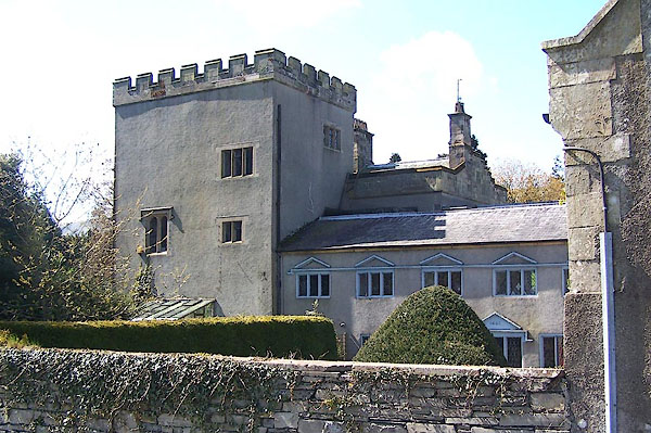 BLZ94.jpg (taken 3.5.2006) |
||
|
|
||
| evidence:- | old map:- OS County Series (Cmd 55 13) placename:- Lorton Hall |
|
| source data:- | Maps, County Series maps of Great Britain, scales 6 and 25
inches to 1 mile, published by the Ordnance Survey, Southampton,
Hampshire, from about 1863 to 1948. |
|
|
|
||
| evidence:- | old map:- Donald 1774 (Cmd) |
|
| source data:- | Map, hand coloured engraving, 3x2 sheets, The County of Cumberland, scale about 1
inch to 1 mile, by Thomas Donald, engraved and published by Joseph Hodskinson, 29
Arundel Street, Strand, London, 1774.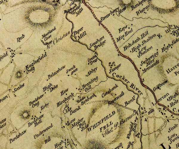 D4NY12NW.jpg "Hall / Thos. P. Barnes Esqr." house item:- Carlisle Library : Map 2 Image © Carlisle Library |
|
|
|
||
| evidence:- | old map:- Ford 1839 map placename:- Lorton Hall |
|
| source data:- | Map, uncoloured engraving, Map of the Lake District of
Cumberland, Westmoreland and Lancashire, scale about 3.5 miles
to 1 inch, published by Charles Thurnam, Carlisle, and by R
Groombridge, 5 Paternoster Row, London, 3rd edn 1843.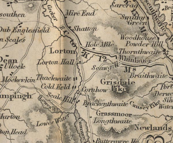 FD02NY12.jpg "Lorton Hall" item:- JandMN : 100.1 Image © see bottom of page |
|
|
|
||
| evidence:- | database:- Listed Buildings 2010 placename:- Lorton Hall |
|
| source data:- | courtesy of English Heritage "LORTON HALL / / / LORTON / ALLERDALE / CUMBRIA / II / 72670 / NY1528125763" |
|
|
|
||
| evidence:- | database:- Listed Buildings 2010 |
|
| source data:- | courtesy of English Heritage "FOUNTAIN IN FRONT OF LORTON HALL / / / LORTON / ALLERDALE / CUMBRIA / II / 72671 / NY1530025767" |
|
|
|
||
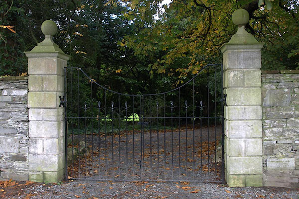 BVO84.jpg Gate. (taken 1.11.2011) |
||
|
|
||
| notes:- |
possible pele tower |
|
| Perriam, D R &Robinson, J: 1998: Medieval Fortified Buildings of Cumbria: CWAAS::
ISBN 1 873124 23 6 |
||
|
|
||
 Lakes Guides menu.