 Old Cumbria Gazetteer
 |
 |
|
| Holbeck Ghyll, Lakes | ||
| Holbeck Ghyll | ||
| civil parish:- | Lakes (formerly Westmorland) | |
| county:- | Cumbria | |
| locality type:- | buildings | |
| coordinates:- | NY39160221 | |
| 1Km square:- | NY3902 | |
| 10Km square:- | NY30 | |
|
|
||
| evidence:- | old map:- OS County Series (Wmd 26 15) placename:- Holbeck House |
|
| source data:- | Maps, County Series maps of Great Britain, scales 6 and 25
inches to 1 mile, published by the Ordnance Survey, Southampton,
Hampshire, from about 1863 to 1948. |
|
|
|
||
| evidence:- | probably old map:- Ogilby 1675 (plate 96) |
|
| source data:- | Road strip map, hand coloured engraving, the Road from Kendal to
Cockermouth, and the Road from Egremond to Carlisle, scale about
1 inch to 1 mile, by John Ogilby, London, 1675.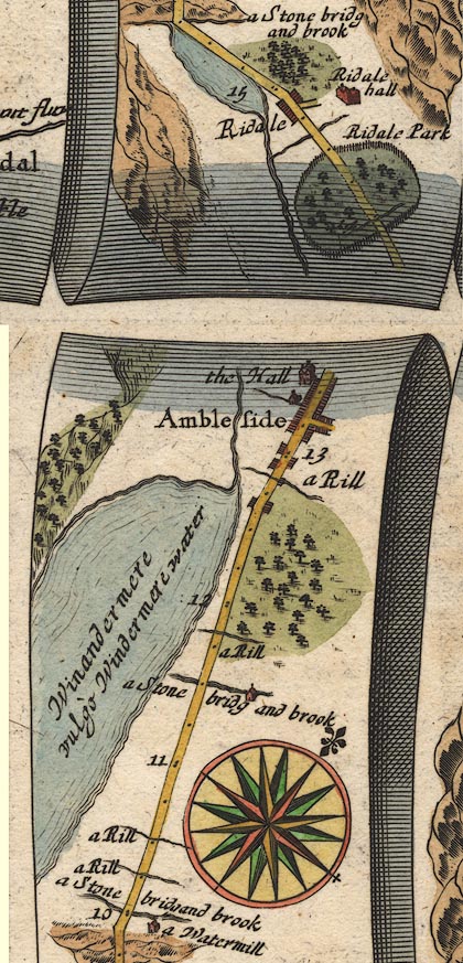 OG96m010.jpg In mile 11, Westmoreland. House drawn on the right of the road, on the bank of a river item:- JandMN : 22 Image © see bottom of page |
|
|
|
||
| evidence:- | old map:- Garnett 1850s-60s H placename:- Holbeck |
|
| source data:- | Map of the English Lakes, in Cumberland, Westmorland and
Lancashire, scale about 3.5 miles to 1 inch, published by John
Garnett, Windermere, Westmorland, 1850s-60s.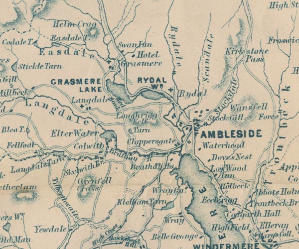 GAR2NY30.jpg "Holbeck" block, building item:- JandMN : 82.1 Image © see bottom of page |
|
|
|
||
| evidence:- | old map:- Prior 1874 map 1 placename:- Holbeck |
|
| source data:- | Map, uncoloured engraving or lithograph? Winander Mere, scale
about 2.5 miles to 1 inch, published by John Garnett,
Windermere, Westmorland, 1874. click to enlarge click to enlargePI03M1.jpg "Holbeck" block/s; building/s item:- private collection : 133.1 Image © see bottom of page |
|
|
|
||
 Lakes Guides menu.