 |
 |
|
|
|
|
Holehird |
| civil parish:- |
Windermere (formerly Westmorland) |
| county:- |
Cumbria |
| locality type:- |
locality |
| locality type:- |
buildings |
| coordinates:- |
NY41030082 (etc) |
| 1Km square:- |
NY4100 |
| 10Km square:- |
NY40 |
|
|
| evidence:- |
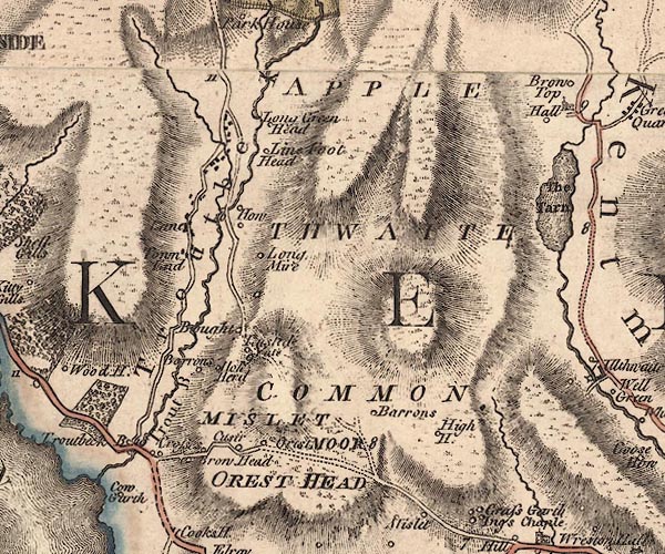
old map:- OS County Series (Wmd 32 4)
placename:- Hole Hird
|
| source data:- |
Maps, County Series maps of Great Britain, scales 6 and 25
inches to 1 mile, published by the Ordnance Survey, Southampton,
Hampshire, from about 1863 to 1948.
|
|
|
| evidence:- |
old map:- Jefferys 1770 (Wmd)
placename:- Hole Herd
|
| source data:- |
Map, 4 sheets, The County of Westmoreland, scale 1 inch to 1
mile, surveyed 1768, and engraved and published by Thomas
Jefferys, London, 1770.
J5NY40SW.jpg
"Hole Herd"
circle, labelled in italic lowercase text; settlement, farm, house, or hamlet?
item:- National Library of Scotland : EME.s.47
Image © National Library of Scotland |
|
|
| places:- |
 |
NY41090098 Holehird Farm (Windermere) |
|
|
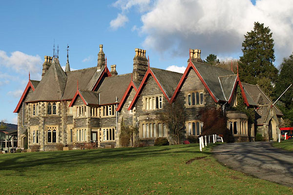 |
NY41010084 Holehird House (Windermere) L |
|
|
|
NY41130111 North Lodge (Windermere) |
|
|
|
NY40740045 South Lodge (Windermere) |
|
|
|
NY40830079 Holehird Tarn (Windermere) |
|
|
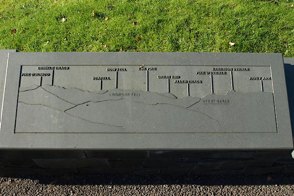 |
NY41050077 viewpoint, Holehird (Windermere) |
|
|
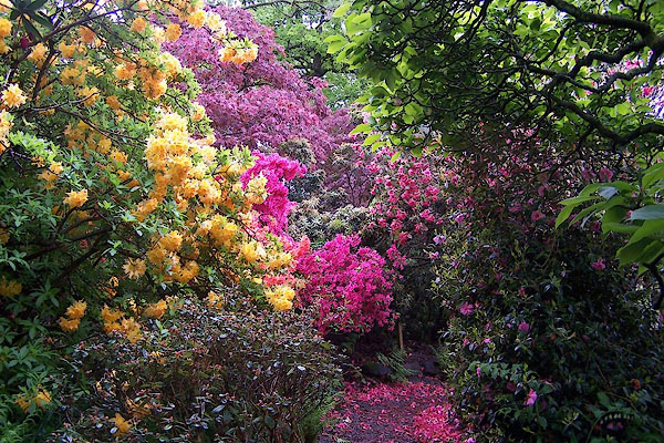 |
NY411008 Holehird Gardens (Windermere) |
|
