 Old Cumbria Gazetteer
 |
 |
|
| High Side Farm, Bassenthwaite | ||
| High Side Farm | ||
| locality:- | High Side | |
| civil parish:- | Bassenthwaite (formerly Cumberland) | |
| county:- | Cumbria | |
| locality type:- | buildings | |
| coordinates:- | NY23503061 | |
| 1Km square:- | NY2330 | |
| 10Km square:- | NY23 | |
|
|
||
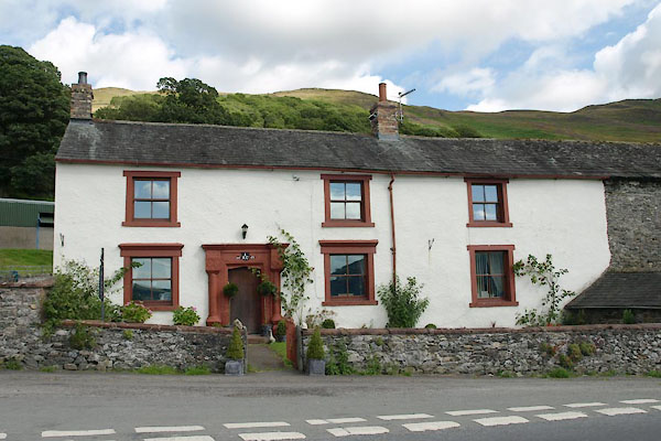 BVE50.jpg (taken 9.8.2011)  BVE51.jpg Date stone:- "E / 16 R G 68" (taken 9.8.2011) |
||
|
|
||
| evidence:- | old map:- OS County Series (Cmd 56 1) placename:- Spout House |
|
| source data:- | Maps, County Series maps of Great Britain, scales 6 and 25
inches to 1 mile, published by the Ordnance Survey, Southampton,
Hampshire, from about 1863 to 1948. |
|
|
|
||
| evidence:- | database:- Listed Buildings 2010 placename:- High Side Farm item:- date stone (1668) |
|
| source data:- | courtesy of English Heritage "HIGH SIDE FARMHOUSE AND ADJOINING BARN / / / BASSENTHWAITE / ALLERDALE / CUMBRIA / II / 72109 / NY2348130602" |
|
|
|
||
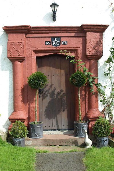 BVE52.jpg Door. (taken 9.8.2011) |
||
|
|
||
 Lakes Guides menu.