 Old Cumbria Gazetteer
 |
 |
|
| Harter Fell, Shap Rural | ||
| Harter Fell | ||
| civil parish:- | Shap Rural (formerly Westmorland) | |
| civil parish:- | Longsleddale (formerly Westmorland) | |
| county:- | Cumbria | |
| locality type:- | hill | |
| locality type:- | fell | |
| coordinates:- | NY459093 | |
| 1Km square:- | NY4509 | |
| 10Km square:- | NY40 | |
|
|
||
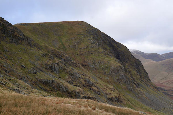 BZT02.jpg Facing Mardale. (taken 28.12.2013) 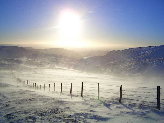 BJM32.jpg Early sun. (taken 26.12.2004) |
||
|
|
||
| evidence:- | old map:- Jefferys 1770 (Wmd) placename:- Harter Fell |
|
| source data:- | Map, 4 sheets, The County of Westmoreland, scale 1 inch to 1
mile, surveyed 1768, and engraved and published by Thomas
Jefferys, London, 1770.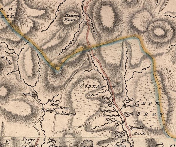 J5NY40NE.jpg "HARTER FELL" hill hachuring; hill or mountain item:- National Library of Scotland : EME.s.47 Image © National Library of Scotland |
|
|
|
||
| evidence:- | descriptive text:- West 1778 (11th edn 1821) |
|
| source data:- | Guide book, A Guide to the Lakes, by Thomas West, published by
William Pennington, Kendal, Cumbria once Westmorland, and in
London, 1778 to 1821. goto source goto sourcePage 165:- "..." "... In approaching the mountain [ascending from Mardale], Harter-fell scowls forward in all the terrific grandeur of hanging rock. ..." |
|
|
|
||
| evidence:- | old map:- West 1784 map placename:- Harter Fell |
|
| source data:- | Map, hand coloured engraving, A Map of the Lakes in Cumberland,
Westmorland and Lancashire, scale about 3.5 miles to 1 inch,
engraved by Paas, 53 Holborn, London, about 1784.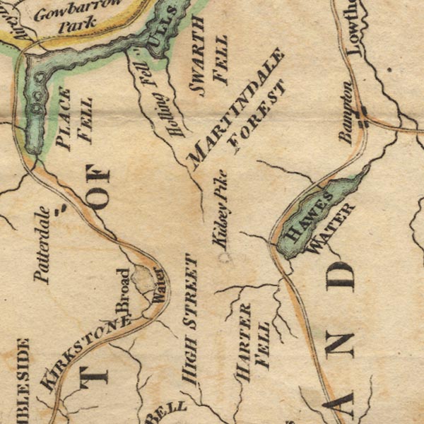 Ws02NY41.jpg "HARTER FELL" item:- Armitt Library : A1221.1 Image © see bottom of page |
|
|
|
||
| evidence:- | old map:- Cary 1789 (edn 1805) placename:- Harter Fell |
|
| source data:- | Map, uncoloured engraving, Westmoreland, scale about 2.5 miles
to 1 inch, by John Cary, London, 1789; edition 1805.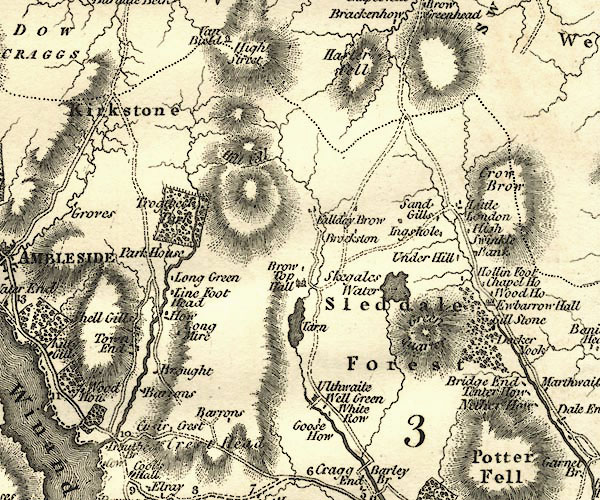 CY24NY40.jpg "Harter Fell" hill hachuring item:- JandMN : 129 Image © see bottom of page |
|
|
|
||
| evidence:- | old print:- Green 1814 (plate 60) |
|
| source data:- | Print, uncoloured soft ground etching, Haws Water from Fordingdale Beck, Bampton,
Westmorland, by William Green, Ambleside, Westmorland, 1814.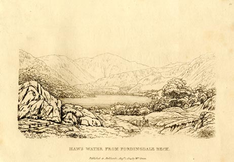 click to enlarge click to enlargeGN0960.jpg Plate 60 in Sixty Small Prints. printed at top right:- "60" printed at bottom:- "HAWS WATER FROM FORDINGDALE BECK. / Published at Ambleside Augst. 1, 1814, by Wm. Green." item:- Armitt Library : A6656.60 Image © see bottom of page |
|
|
|
||
| evidence:- | old print:- Green 1814 (plate 60) |
|
| source data:- | Print, tinted soft ground etching, Haws Water from Fordingdale Beck, Bampton, Westmorland,
by William Green, Ambleside, Westmorland, 1814.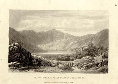 click to enlarge click to enlargeGN1060.jpg Plate 60 in Sixty Small Prints. printed at top right:- "60" printed at bottom:- "HAWS WATER FROM FORDINGDALE BECK. / Published at Ambleside Augst. 1, 1814, by Wm. Green." item:- Armitt Library : A6653.60 Image © see bottom of page |
|
|
|
||
| evidence:- | old map:- Otley 1818 placename:- Harter Fell |
|
| source data:- | Map, uncoloured engraving, The District of the Lakes,
Cumberland, Westmorland, and Lancashire, scale about 4 miles to
1 inch, by Jonathan Otley, 1818, engraved by J and G Menzies,
Edinburgh, Scotland, published by Jonathan Otley, Keswick,
Cumberland, et al, 1833.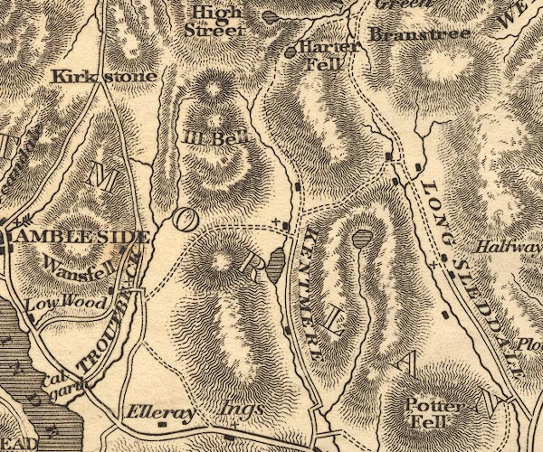 OT02NY40.jpg item:- JandMN : 48.1 Image © see bottom of page |
|
|
|
||
| evidence:- | outline view:- Otley 1823 (8th edn 1849) placename:- Harter Fell |
|
| source data:- | Engraving, outline view of mountains, Hawes Water from Measand Beck, drawn by T Binns,
engraved by O Jewitt, opposite p.16 of A Descriptive Guide of the English Lakes, by
Jonathan Otley, 8th edition, 1849.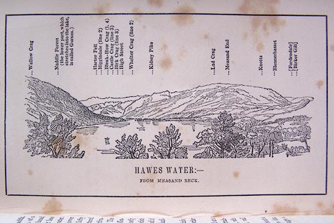 click to enlarge click to enlargeO80E09.jpg item:- Armitt Library : A1180.10 Image © see bottom of page |
|
|
|
||
| evidence:- | old map:- Hodgson 1828 placename:- Harter Fell |
|
| source data:- | Map, hand coloured engraving, 4 sheets mounted together on linen and rolled, Plan
of the County of Westmorland, scale about 1.25 inches to 1 mile, by Thomas Hodgson,
engraved by W R Gardner, Harpur Street, London, published by Thomas Hodgson, Lancaster,
and perhaps by C Smith, 172 Strand, London,1828. HDG6lsl5.jpg map courtesy of Mark Cropper "HARTER FELL" item:- private collection : 371 Image © see bottom of page |
|
|
|
||
| evidence:- | old map:- Garnett 1850s-60s H placename:- Harter Fell |
|
| source data:- | Map of the English Lakes, in Cumberland, Westmorland and
Lancashire, scale about 3.5 miles to 1 inch, published by John
Garnett, Windermere, Westmorland, 1850s-60s. GAR2NY40.jpg "Harter Fell" hill hachuring item:- JandMN : 82.1 Image © see bottom of page |
|
|
|
||
| evidence:- | old text:- Prior 1865 placename:- Harter Fell |
|
| source data:- | Guide book, Ascents and Passes in the Lake District of England,
by Herman Prior, published by John Garnett, Windermere,
Westmorland, and by Simpkin, Marshall and Co, London, 1865. Pages 113-347 have descriptions of mountains, amongst which:- "Harter Fell, Kentmere.- 2,509 feet." "The summit of this Harter Fell is called 'The Knowe,' and has been repeatedly referred to in the Pedestrian Routes to and from Hawes-Water, as forming the eastern side of Nan Bield Pass, and stretching down into Kentmere and Longsleddale. See Pedestrian Route III. It is not a mountain the ascent of which can be recommended, as it has no special features." |
|
|
|
||
| evidence:- | old map:- OS 1881-82 New Series (outline edition) placename:- Harter Fell |
|
| source data:- | Map, engraving, area north of Kendal, Westmorland, New Series
one inch map, outline edition, sheet 39, scale 1 inch to 1 mile,
published by the Ordnance Survey, Southampton, Hampshire,
1881-82. O21NY40U.jpg "Harter Fell" item:- JandMN : 61 Image © see bottom of page |
|
|
|
||
| evidence:- | old print:- Pyne 1853 |
|
| source data:- | Drawn by James Barker Pyne, 1848-1853, lithographed by T Picken, 1859.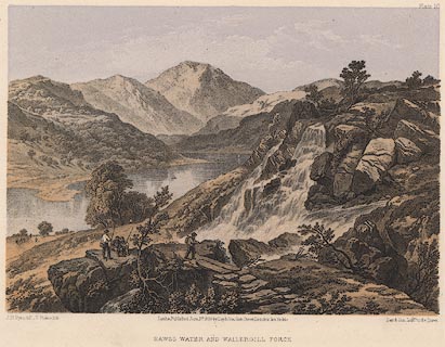 click to enlarge click to enlargePY10.jpg "Hawes Water and Wallergill Force" item:- JandMN : 97.11 Image © see bottom of page |
|
|
|
||
| evidence:- | outline view:- Tattersall 1836 (version 1869) placename:- Harter Fell |
|
| source data:- | Print, hand coloured, Hawes Water, from Thwaite Force, Westmorland, drawn by George
Tattersall, 1836, engraved by W F Topham, published by T J Allman, 463 Oxford Street,
London, 1869.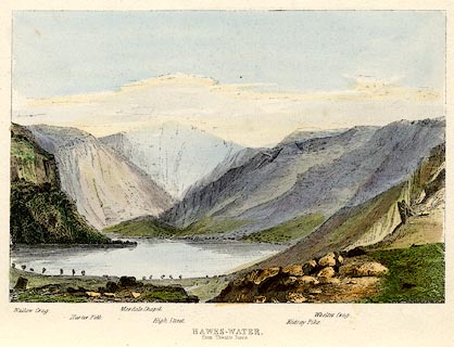 click to enlarge click to enlargeTAT217.jpg Included in The Lakes of England, by W F Topham. printed at bottom:- "HAWES-WATER, / from Thwaite Force." printed at bottom:- "Wallow Crag. / Harter Fell. / Mardale Chapel. / High Street. / Kidsay Pike. / Whelter Crag." item:- Armitt Library : A1067.17 Image © see bottom of page |
|
|
|
||
| evidence:- | outline view:- Tattersall 1836 placename:- Harter Fell |
|
| source data:- | Print, engraving, Hawes Water, from Thwaite Force, Westmorland, drawn by George Tattersall,
engraved by W F Topham, published by Sherwood and Co, Paternoster Row, London, about
1836.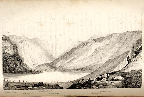 click to enlarge click to enlargeTAT139.jpg The print is captioned with mountain names and acts as an outline view. Tipped in opposite p.109 of The Lakes of England, by George Tattersall. printed at bottom:- "HAWES-WATER, / from Thwaite Force." printed at bottom left to right:- "Wallow Crag. / Harter Fell. / Mardale Chapel. / High Street. / Kidsay Pike. / Whelter Crag." item:- Armitt Library : A1204.40 Image © see bottom of page |
|
|
|
||
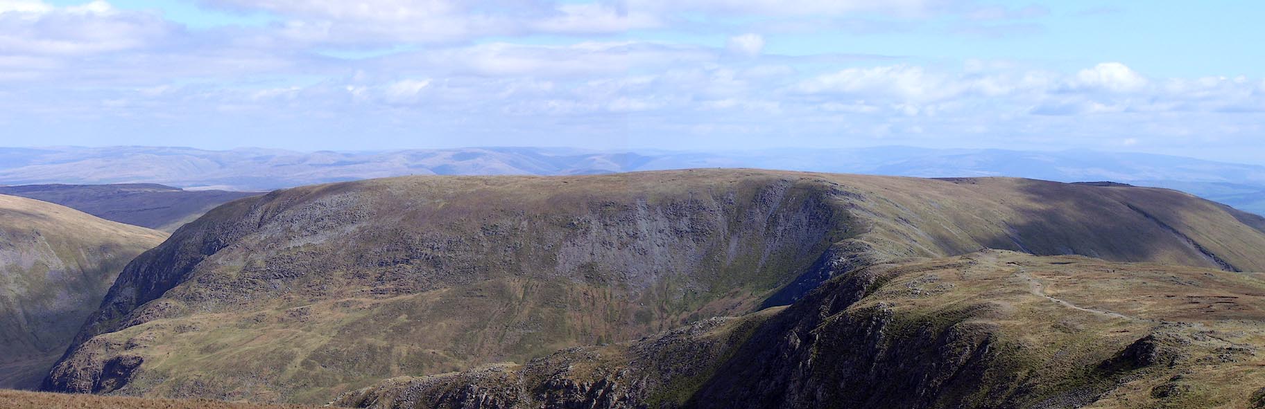 Click to enlarge BNO87.jpg (taken 18.4.2007) 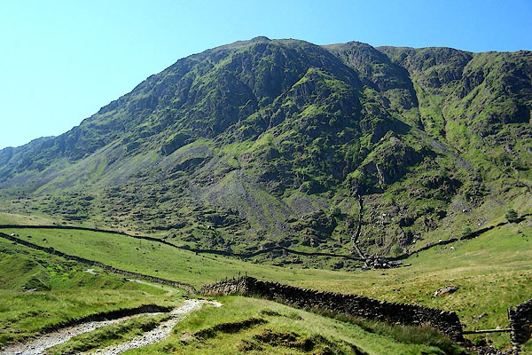 BMF84.jpg From the north. (taken 10.6.2006) 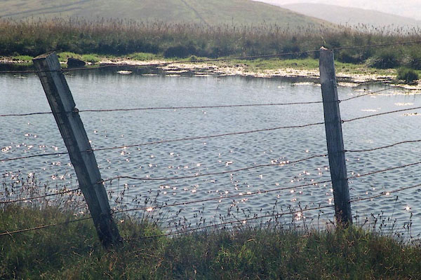 BJE36.jpg A small tarn, (taken 7.9.2004) 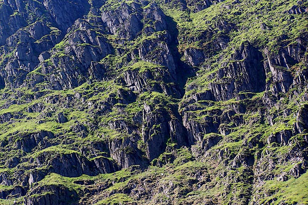 BMF86.jpg Rocks, from Gatescarth track. (taken 10.6.2006) 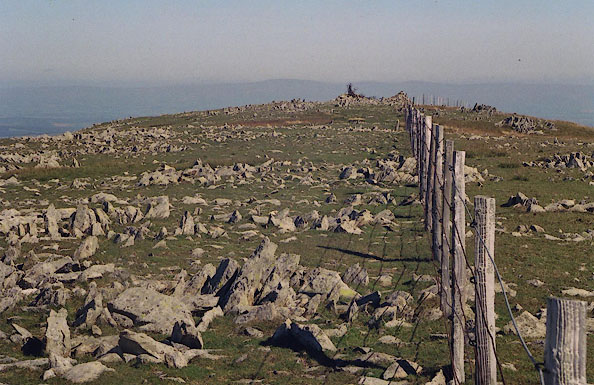 BJF02.jpg The area is 'littered' with upstanding pieces of stone. Westmorland is to the south ie right of the fence. (taken 7.9.2004) 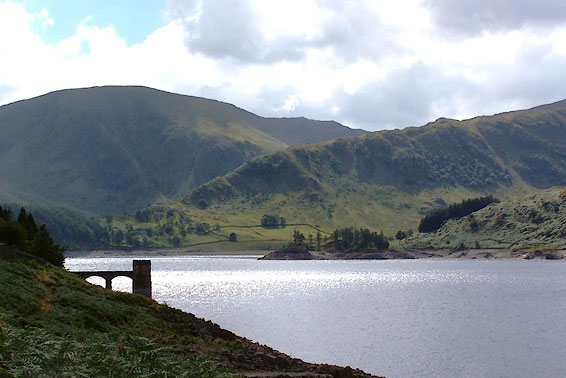 BJT66.jpg Riggindale Crag, The Rigg, Harter Fell, and Haweswater. (taken 22.8.2005) 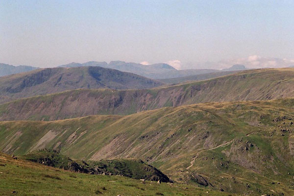 BJE14.jpg View west, (taken 7.9.2004) 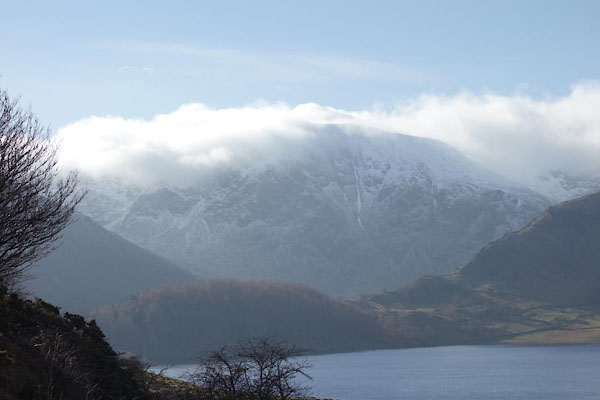 BZW36.jpg (taken 10.2.2014) 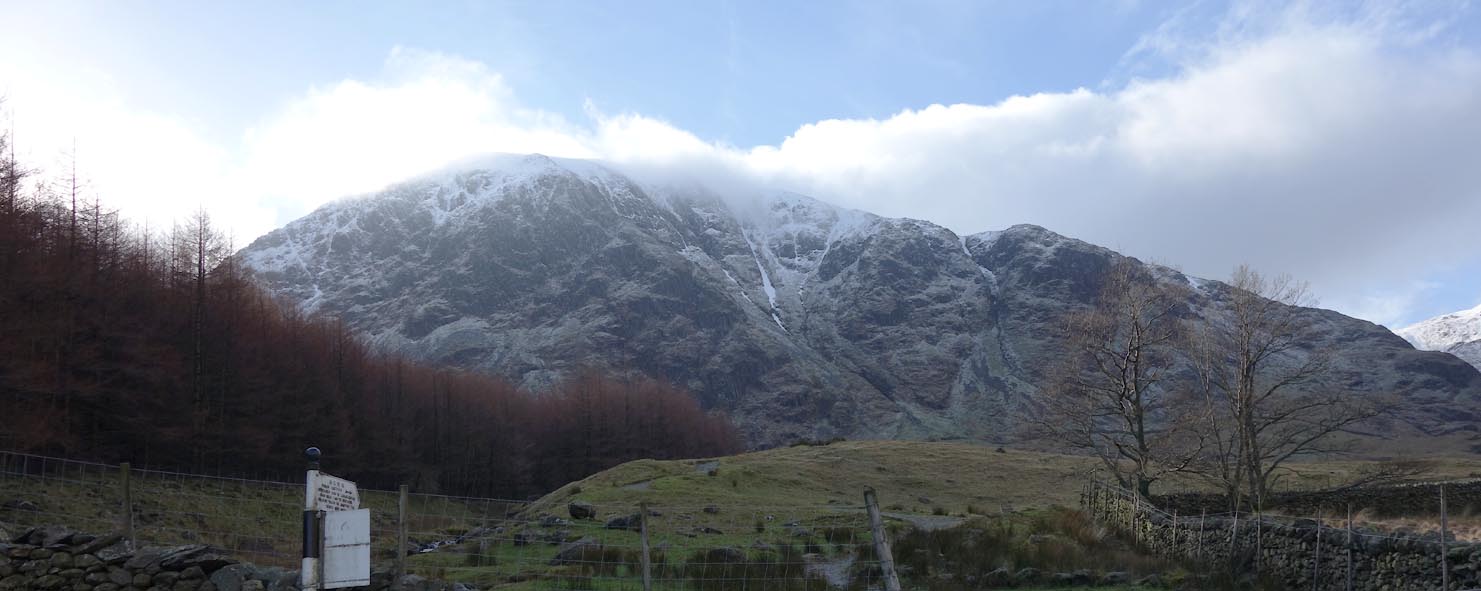 Click to enlarge BZW37.jpg (taken 10.2.2014) 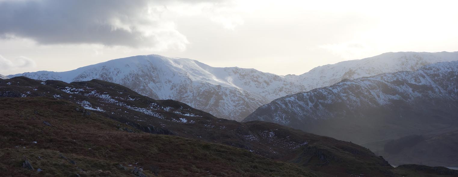 Click to enlarge BZW93.jpg (taken 16.2.2014) |
||
|
|
||
| fiction:- |
In |
|
| Ward, Humphrey, Mrs: 1888: Robert Elsmere |
||
| Mary Backhouse who dies after seeing the High Fell ghost on Harter Fell; she walks
at midnight on Midsummer eve. |
||
| "... If you see her and she passes you in silence, why you only get a fright for your
pains. But if she speaks to you, you die within the year ..." |
||
|
|
||
Lakes Guides menu.