 |
 |
   |
|
|
|
Hard Knott |
| civil parish:- |
Eskdale (formerly Cumberland) |
| civil parish:- |
Ulpha (formerly Cumberland) |
| county:- |
Cumbria |
| locality type:- |
hill |
| coordinates:- |
NY23180237 |
| 1Km square:- |
NY2302 |
| 10Km square:- |
NY20 |
| altitude:- |
1801 feet |
| altitude:- |
549m |
|
|
|
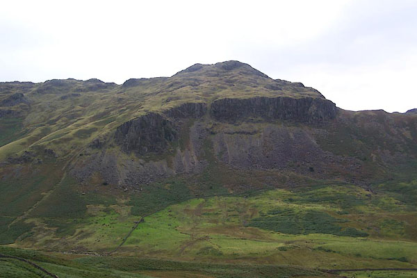
BRM31.jpg (taken 14.9.2009)
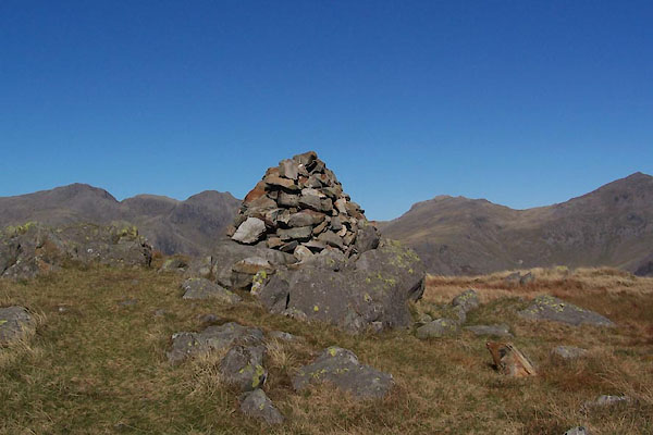
BTR11.jpg Cairn.
(taken 11.10.2010)
|
|
|
| evidence:- |
old map:- OS County Series (Cmd 80 9)
placename:- Hard Knott
|
| source data:- |
Maps, County Series maps of Great Britain, scales 6 and 25
inches to 1 mile, published by the Ordnance Survey, Southampton,
Hampshire, from about 1863 to 1948.
|
|
|
| evidence:- |
old map:- Speed 1611 (Cmd)
placename:- Hard Knot
|
| source data:- |
Map, hand coloured engraving, Cumberland and the Ancient Citie
Carlile Described, scale about 4 miles to 1 inch, by John Speed,
1610, published by J Sudbury and George Humble, Popes Head
Alley, London, 1611-12.
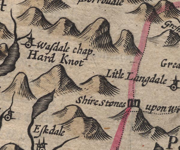
SP11NY20.jpg
"Hard Knot"
large hillock
item:- private collection : 16
Image © see bottom of page
|
|
|
| evidence:- |
old map:- Morden 1695 (Cmd)
placename:- Hard Knot Hill
|
| source data:- |
Map, uncoloured engraving, Cumberland, scale about 4 miles to 1
inch, by Robert Morden, 1695, published by Abel Swale, the
Unicorn, St Paul's Churchyard, Awnsham, and John Churchill, the
Black Swan, Paternoster Row, London, 1695-1715.
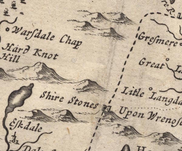
MD12NY20.jpg
"Hard Knot Hill"
Large hillock.
item:- JandMN : 90
Image © see bottom of page
|
|
|
| evidence:- |
old map:- Badeslade 1742
placename:- Hardknot Hill
|
| source data:- |
Map, uncoloured engraving, A Map of Cumberland North from
London, scale about 11 miles to 1 inch, with descriptive text,
by Thomas Badeslade, London, engraved and published by William
Henry Toms, Union Court, Holborn, London, 1742.
 click to enlarge click to enlarge
BD10.jpg
"Hardknot Hill"
hillock
item:- JandMN : 115
Image © see bottom of page
|
|
|
| evidence:- |
descriptive text:- Simpson 1746
placename:- Hardknot Hill
|
| source data:- |
Atlas, three volumes of maps and descriptive text published as
'The Agreeable Historian, or the Compleat English Traveller
...', by Samuel Simpson, 1746.
 goto source goto source
"..."
"Hardknot-Hill, a ragged Mountain, so steep, that it is almost impossible to ascend
it, yet on the Top of it a-"
 goto source goto source
"[a]bout 100 Years ago, not without great Admiration, were dug up some huge Stones,
which looked like the Foundation of a Castle; but it is more probable, that they were
the Ruins of some Church or Chapel built upon the Mountain, because it was thought
an extraordinary Piece of Devotion in those Parts, (and Wormius testifies the same
of Denmark) to erect Crosses and build Chapels in the most eminent Places, as being
nearer Heaven, and more conspicuous: they were commonly dedicated to St. Michael:
..."
|
|
|
| evidence:- |
old map:- Simpson 1746 map (Wmd)
placename:- Hard Knot Hill
|
| source data:- |
Map, uncoloured engraving, Westmorland, scale about 8 miles to 1
inch, printed by R Walker, Fleet Lane, London, 1746.
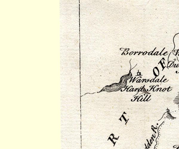
SMP2NYA.jpg
"Hard Knot Hill"
Hillock.
item:- Dove Cottage : 2007.38.59
Image © see bottom of page
|
|
|
| evidence:- |
old map:- Bickham 1753-54 (Cmd)
placename:- Hardknothill
|
| source data:- |
Map, uncoloured engraving, perspective map, Map of Cumberland
North from London, by George Bickham, James Street, Bunhill
Fields, London, 1753, published by F Jollie and Sons, Carlisle,
Cumberland, 1811.
 click to enlarge click to enlarge
JL05.jpg
"Hardknothill"
view (sort of)
item:- Carlisle Library : 4.2
Image © Carlisle Library |
|
|
| evidence:- |
old map:- Bowen and Kitchin 1760
placename:- Hard Knot Hill
|
| source data:- |
Map, hand coloured engraving, A New Map of the Counties of
Cumberland and Westmoreland Divided into their Respective Wards,
scale about 4 miles to 1 inch, by Emanuel Bowen and Thomas
Kitchin et al, published by T Bowles, Robert Sayer, and John
Bowles, London, 1760.
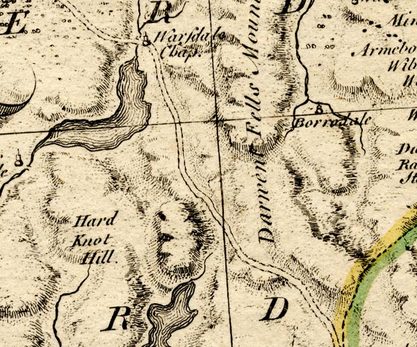
BO18NY10.jpg
"Hard Knot Hill"
hill hachuring
item:- Armitt Library : 2008.14.10
Image © see bottom of page
|
|
|
| evidence:- |
old map:- Donald 1774 (Cmd)
placename:- Hard Knot
|
| source data:- |
Map, hand coloured engraving, 3x2 sheets, The County of Cumberland, scale about 1
inch to 1 mile, by Thomas Donald, engraved and published by Joseph Hodskinson, 29
Arundel Street, Strand, London, 1774.
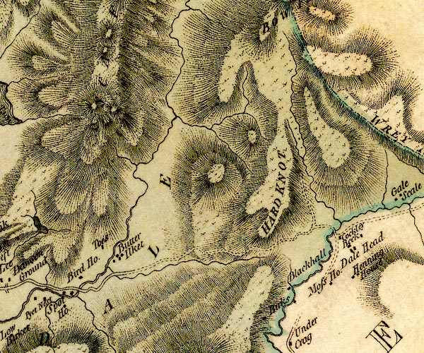
D4NY20SW.jpg
"HARD KNOT"
hill hachuring; a hill or mountain
item:- Carlisle Library : Map 2
Image © Carlisle Library |
|
|
| evidence:- |
descriptive text:- West 1778 (11th edn 1821)
placename:- Hardknot
|
| source data:- |
Guide book, A Guide to the Lakes, by Thomas West, published by
William Pennington, Kendal, Cumbria once Westmorland, and in
London, 1778 to 1821.
 goto source goto source
Addendum; Mr Gray's Journal, 1769
Page 213:- "... at the head [of Windermere] two vallies open among the mountains: one, that by
which we came down, the other Langdale, in which Wrynose and Hardknot, two great mountains,
rise above the rest: ..."
 goto source goto source
Rev Plumtre's Night Piece on Windermere, 1797
Page 230:- "..."
"Say, Brathay, as I walk your side, / List'ning to your murmuring tide, / What sights,
what wonders have you seen, / Passing your barrier hills between? / View'd you old
Langdale's solid towers, / And Elter-water's peaceful bowers; / Where the quarry's
yawning scar / Hangs hideous in the midnight air! / Or, rather higher Langdale's rocks,
/ Hardknot and his mountain twin, / ..."
|
|
|
| evidence:- |
old map:- Cooke 1802
placename:- Hard Knot
|
| source data:- |
Map, The Lakes, Westmorland and Cumberland, scale about 8.5
miles to 1 inch, engravedby Neele and Son, published by
Sherwood, Jones and Co, Paternoster Road, London, 1824.
 click to enlarge click to enlarge
GRA1Lk.jpg
"Hard Knot"
hillock; mountain
item:- Hampshire Museums : FA2000.62.5
Image © see bottom of page
|
|
|
| evidence:- |
old text:- Gents Mag
placename:- Wryknot
placename:- Hardnose
|
| source data:- |
Magazine, The Gentleman's Magazine or Monthly Intelligencer or
Historical Chronicle, published by Edward Cave under the
pseudonym Sylvanus Urban, and by other publishers, London,
monthly from 1731 to 1922.
 goto source goto source
Gentleman's Magazine 1805 p.919 "... Before us rose, in a magnificent cluster, the rocks of Hardnose, Wryknot, ..."
|
|
|
| evidence:- |
old text:- Gents Mag 1805
item:- placename, Hard Knott
|
| source data:- |
 goto source goto source
Gentleman's Magazine 1805 p.1012 "..."
"Erratum.- In the last paper, for Wryknot, read Wrynose; for Hardnose, read Hardknot."
"The origin of these outlandish terms has been in some few instances successfully traced
from the Greek, from the connexion existing between that language and the antient
Celtic. ..."
|
|
|
| evidence:- |
old map:- Cooper 1808
placename:- Hard Knot
|
| source data:- |
Map, uncoloured engraving, Cumberland, scale about 10.5 miles to
1 inch, drawn and engraved by Cooper, published by R Phillips,
Bridge Street, Blackfriars, London, 1808.
 click to enlarge click to enlarge
COP3.jpg
"Hard Knot"
hill hachuring; mountain or hill
item:- JandMN : 86
Image © see bottom of page
|
|
|
| evidence:- |
old map:- Otley 1818
placename:- Hard Knot
|
| source data:- |
Map, uncoloured engraving, The District of the Lakes,
Cumberland, Westmorland, and Lancashire, scale about 4 miles to
1 inch, by Jonathan Otley, 1818, engraved by J and G Menzies,
Edinburgh, Scotland, published by Jonathan Otley, Keswick,
Cumberland, et al, 1833.
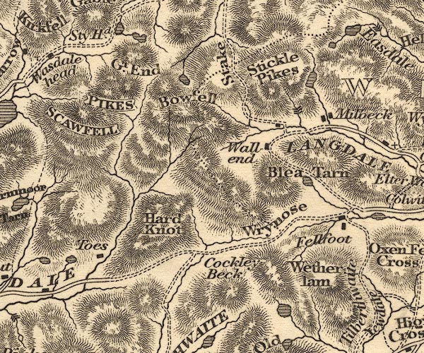
OT02NY20.jpg
item:- JandMN : 48.1
Image © see bottom of page
|
|
|
| evidence:- |
old drawing:- Aspland 1840s-60s
placename:- Hardknot
|
| source data:- |
Drawing, pencil and ink wash, view from Hard Knott, Eskdale, Cumberland, by Theophilus
Lindsey Aspland, 1852.
 click to enlarge click to enlarge
AS0341.jpg
"with Mr Anderton. Sept ? 2 from Hardknot"
"Scawfell / Bowfell"
page number "31"
item:- Armitt Library : 1958.390.41
Image © see bottom of page
|
|
|
| evidence:- |
old map:- Garnett 1850s-60s H
placename:- Hard Knot
|
| source data:- |
Map of the English Lakes, in Cumberland, Westmorland and
Lancashire, scale about 3.5 miles to 1 inch, published by John
Garnett, Windermere, Westmorland, 1850s-60s.
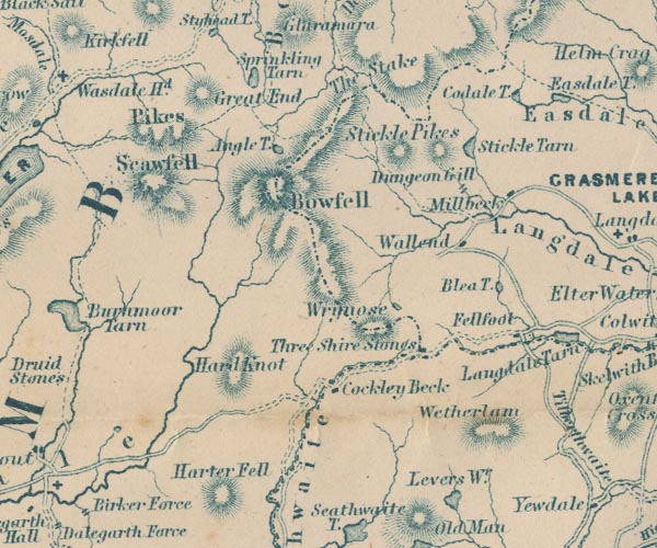
GAR2NY20.jpg
"Hard Knot"
hill hachuring
item:- JandMN : 82.1
Image © see bottom of page
|
|
|
| evidence:- |
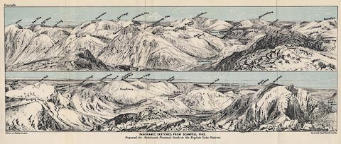
outline view:- Jenkinson 1875
placename:- Hard Knott
|
| source data:- |
Print, lithograph, outline view, Panoramic Sketches from Scawfell Pike, Cumberland,
by Edwin A Pettitt, London, published by Edward Stanford, 55 Charing Cross, London,
1875.
 click to enlarge click to enlarge
Jk01E3.jpg
"... Hard Knott ..."
item:- JandMN : 28.9
Image © see bottom of page
|
|
|
|

Click to enlarge
BTR13.jpg Panorama - Slight Side, Sca Fell, Scafell Pike, Ill Crag, Esk Pike, Bowfell, Crinkle
Crags.
(taken 11.10.2010)
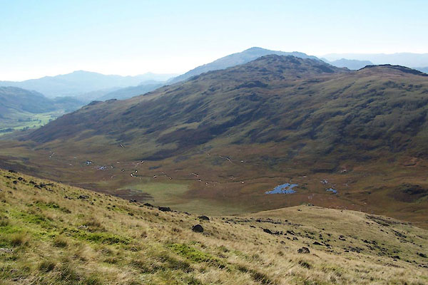
BTR14.jpg and Moasdale.
(taken 11.10.2010)
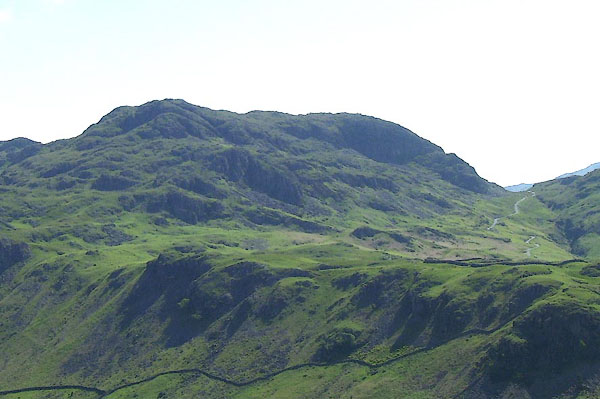
BNU94.jpg (taken 9.6.2007)
|
|
|


 click to enlarge
 goto source
 goto source
 click to enlarge

 goto source
 goto source
 click to enlarge
 goto source
 goto source
 click to enlarge
 click to enlarge
 click to enlarge


