 Old Cumbria Gazetteer
 |
 |
|
| Dufton Fell, Dufton | ||
| Dufton Fell | ||
| civil parish:- | Dufton (formerly Westmorland) | |
| county:- | Cumbria | |
| locality type:- | hill | |
| locality type:- | fell | |
| locality type:- | military range (small part) | |
| coordinates:- | NY754293 (etc) | |
| 1Km square:- | NY7529 | |
| 10Km square:- | NY72 | |
|
|
||
| MN photo:- |
Most of the ranges are south of here, Murton Fell, Hilton Fell, etc. |
|
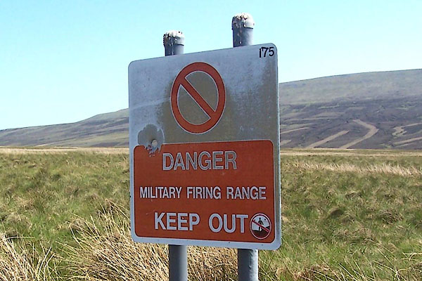 BQS05.jpg (taken 1.6.2009) 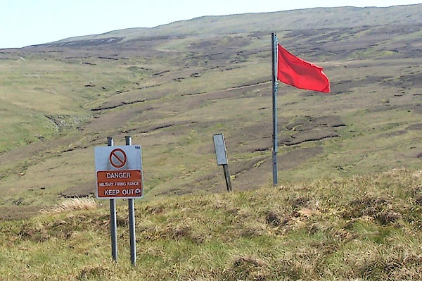 BQS06.jpg (taken 1.6.2009) |
||
|
|
||
| evidence:- | old map:- OS County Series (Wmd 6 10) placename:- Dufton Fell |
|
| source data:- | Maps, County Series maps of Great Britain, scales 6 and 25
inches to 1 mile, published by the Ordnance Survey, Southampton,
Hampshire, from about 1863 to 1948. |
|
|
|
||
| evidence:- | possibly old map:- Morden 1695 (Wmd) placename:- Meldon Forrest |
|
| source data:- | Map, hand coloured engraving, Westmorland, scale about 2.5 miles to 1 inch, by Robert
Morden, published by Abel Swale, the Unicorn, St Paul's Churchyard, Awnsham, and John
Churchill, the Black Swan, Paternoster Row, London, 1695.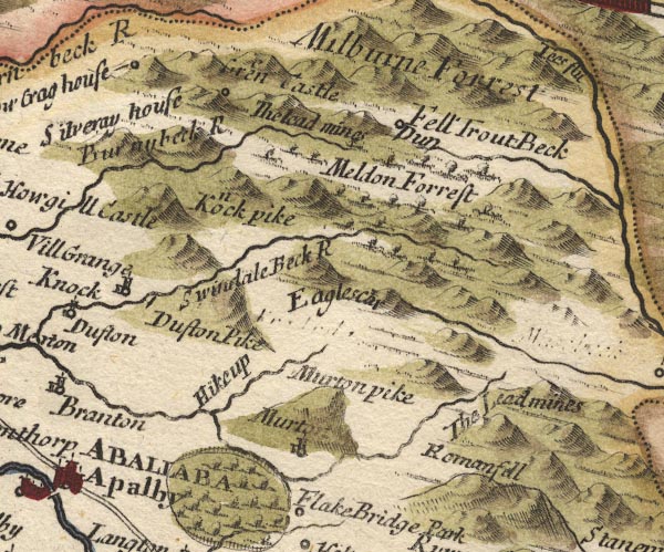 MD10NY72.jpg "Meldon Forrest" Trees. item:- JandMN : 24 Image © see bottom of page |
|
|
|
||
| evidence:- | old map:- Jefferys 1770 (Wmd) placename:- Dufton Fell |
|
| source data:- | Map, 4 sheets, The County of Westmoreland, scale 1 inch to 1
mile, surveyed 1768, and engraved and published by Thomas
Jefferys, London, 1770.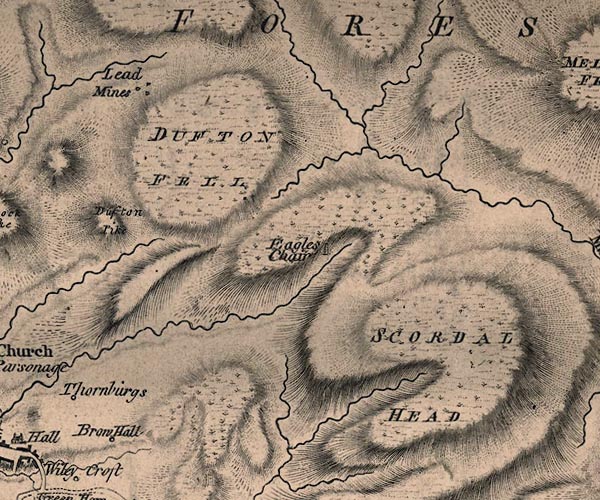 J5NY72NW.jpg "DUFTON FELL" hill hachuring; hill or mountain item:- National Library of Scotland : EME.s.47 Image © National Library of Scotland |
|
|
|
||
| evidence:- | old map:- Cary 1789 (edn 1805) placename:- Dufton Fell |
|
| source data:- | Map, uncoloured engraving, Westmoreland, scale about 2.5 miles
to 1 inch, by John Cary, London, 1789; edition 1805.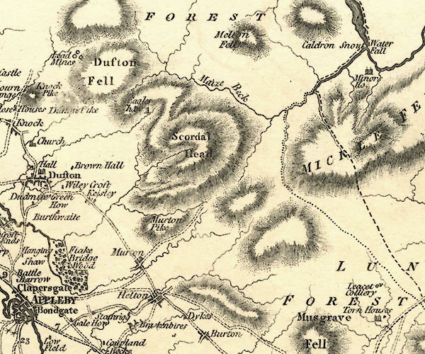 CY24NY72.jpg "Dufton Fell" hill hachuring item:- JandMN : 129 Image © see bottom of page |
|
|
|
||
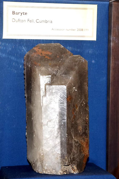 CEV76.jpg Baryte crystal from a mine. (taken 15.4.2016) |
||
| Now in Killhope Lead Mining Museum, item 2008.199. |
||
|
|
||
 Lakes Guides menu.