 Old Cumbria Gazetteer
 |
 |
|
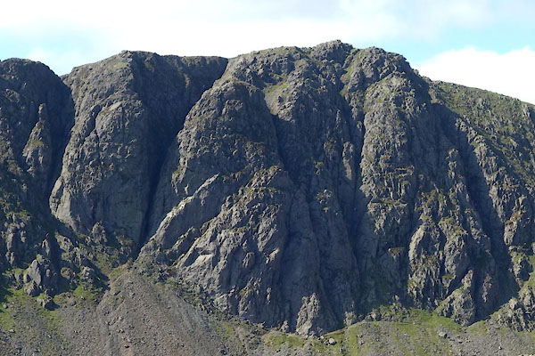
| Dow Crag, Torver | ||
| Dow Crag | ||
| locality:- | Old Man of Coniston | |
| civil parish:- | Torver (formerly Lancashire) | |
| civil parish:- | Dunnerdale-with-Seathwaite (formerly Lancashire) | |
| county:- | Cumbria | |
| locality type:- | rocks | |
| coordinates:- | SD26259778 | |
| 1Km square:- | SD2697 | |
| 10Km square:- | SD29 | |
| altitude:- | 2552 feet | |
| altitude:- | 778m | |
|
|
||
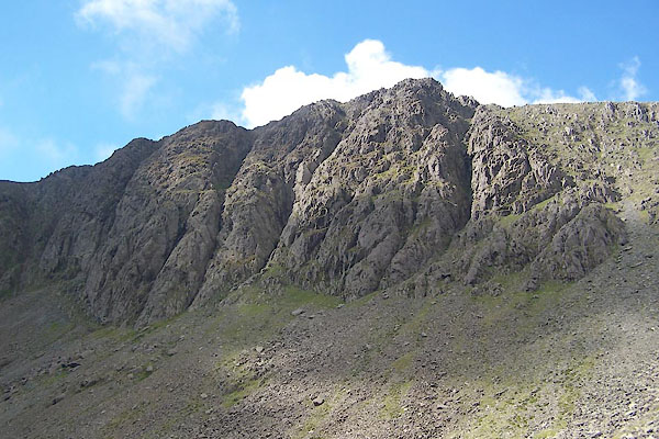
 CBP12.jpg (taken 2.9.2014) 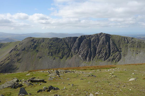 CBP11.jpg (taken 2.9.2014) |
||
|
|
||
| evidence:- | old text:- Green 1810 placename:- Dove Crag |
|
| source data:- | Set of prints, soft ground etchings, Sixty Studies from Nature,
by William Green, Ambleside, Westmorland, drawn 1808-10,
published 1810. goto source goto sourcepage 2:- "..." "The view here presented ... is of the Man mountain, or, as it is more frequently called, the Old Man, with the pointed summit of Enfoot on the right, and Dove Crag on the left, ..." |
|
|
|
||
| evidence:- | old print:- Green 1814 (plate 1) |
|
| source data:- | Print, tinted soft ground etching, Coniston Water, Coniston, Lancashire, by William
Green, Ambleside, Westmorland, 1814.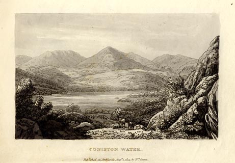 click to enlarge click to enlargeGN1001.jpg Plate 1 in Sixty Small Prints. printed at top right:- "1" printed at bottom:- "CONISTON WATER. / Published at Ambleside Augst. 1, 1814, by Wm. Green." item:- Armitt Library : A6653.1 Image © see bottom of page |
|
|
|
||
| evidence:- | old print:- Green 1814 (plate 1) |
|
| source data:- | Print, uncoloured soft ground etching, Coniston Water, Coniston, Lancashire, by William
Green, Ambleside, Westmorland, 1814.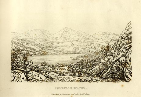 click to enlarge click to enlargeGN0901.jpg Plate 1 in Sixty Small Prints. printed at top right:- "1" printed at bottom:- "CONISTON WATER. / Published at Ambleside Augst. 1, 1814, by Wm. Green." item:- Armitt Library : A6656.1 Image © see bottom of page |
|
|
|
||
| evidence:- | old text:- Green 1814 placename:- Dove Crag |
|
| source data:- | Set of prints, soft ground etchings, Sixty Small Prints, with
text, A Description of a Series of Sixty Small Prints, by
William Green, Ambleside, Westmorland, 1814. goto source page 4:- "... The view here presented [plate 1] is a mile from the foot of the lake, and is of the Man mountain, or, as it is more frequently called, the "Old Man," with the pointed summit of Enfoot on the right, and Dove Crag on the left ..." |
|
|
|
||
| evidence:- | descriptive text:- Otley 1823 (5th edn 1834) placename:- Dow Crag placename:- Dove Crag item:- trout; char; fishing |
|
| source data:- | Guide book, A Concise Description of the English Lakes, the
mountains in their vicinity, and the roads by which they may be
visited, with remarks on the mineralogy and geology of the
district, by Jonathan Otley, published by the author, Keswick,
Cumberland now Cumbria, by J Richardson, London, and by Arthur
Foster, Kirkby Lonsdale, Cumbria, 1823; published 1823-49,
latterly as the Descriptive Guide to the English Lakes. goto source Page 36:- "... Gates Water, ... reposes between the Old Man's western side, and the foot of the precipitous Dow Crag; (Dove Crag.) ..." goto sourcePage 80:- "THE CRAGS." "... Dow Crag (Dove Crag) in Coniston Fells, ..." |
|
|
|
||
| evidence:- | outline view:- Jenkinson 1875 placename:- Dow Crags |
|
| source data:- | Print, lithograph, outline view, Panoramic Sketches from Skiddaw, Cumberland, by Edwin
A Pettitt, London, published by Edward Stanford, 55 Charing Cross, London, 1875. click to enlarge click to enlargeJk01E2.jpg "... Dow Crags ..." item:- JandMN : 28.8 Image © see bottom of page |
|
|
|
||
| evidence:- | outline view:- Jenkinson 1875 placename:- Dow Crags |
|
| source data:- | Print, lithograph, outline view, Panoramic Sketches from Scawfell Pike, Cumberland,
by Edwin A Pettitt, London, published by Edward Stanford, 55 Charing Cross, London,
1875. click to enlarge click to enlargeJk01E3.jpg "... Dow Crags ..." item:- JandMN : 28.9 Image © see bottom of page |
|
|
|
||
 BTN40.jpg ... the Great Gully (taken 8.9.2010) 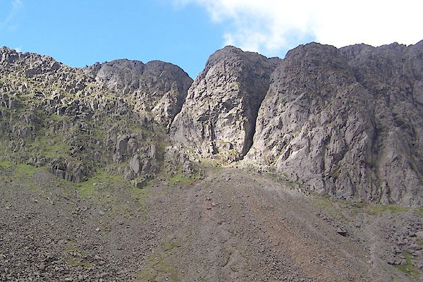 BTN41.jpg (taken 8.9.2010) 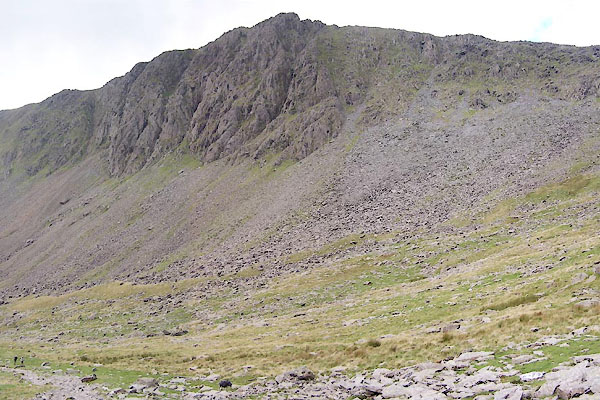 BTN39.jpg (taken 8.9.2010) 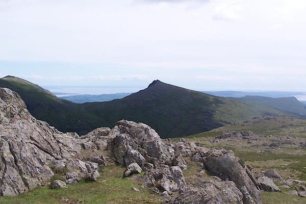 BWU70.jpg (taken 18.6.2012) |
||
|
|
||
Lakes Guides menu.