 Old Cumbria Gazetteer
 |
 |
|
| Deepdale, Patterdale | ||
| Deepdale | ||
| civil parish:- | Patterdale (formerly Westmorland) | |
| county:- | Cumbria | |
| locality type:- | valley | |
| coordinates:- | NY38861304 (etc) | |
| 1Km square:- | NY3813 | |
| 10Km square:- | NY31 | |
|
|
||
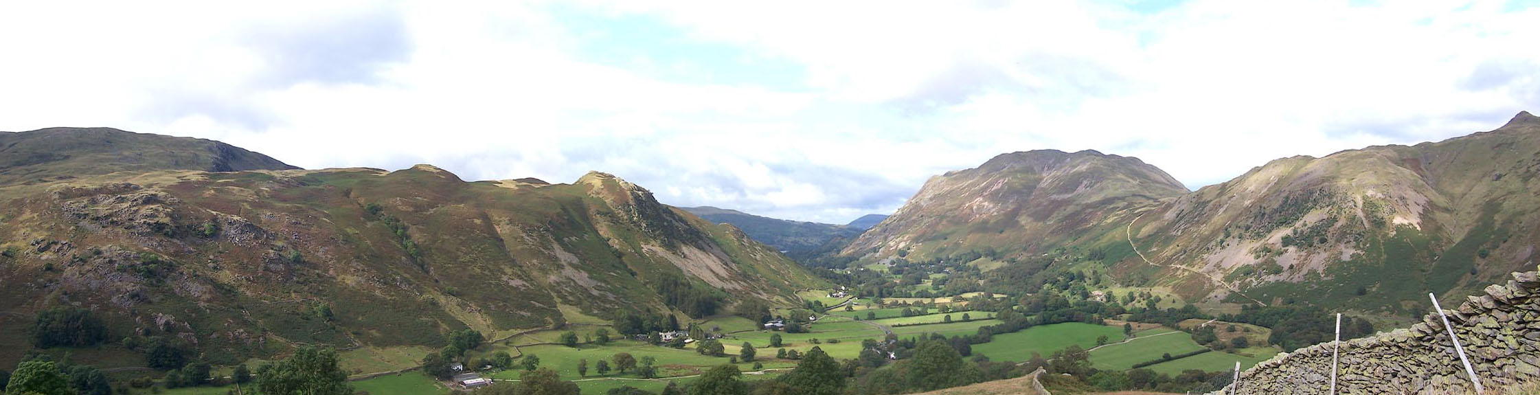
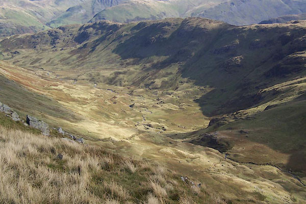 BVL41.jpg (taken 26.9.2011) 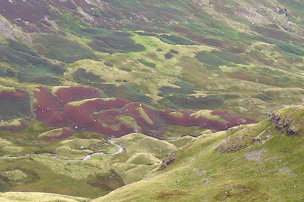 BOE56.jpg Near the dale head. (taken 11.9.2007) |
||
|
|
||
| evidence:- | old map:- OS County Series (Wmd 19 3) placename:- Deep Dale |
|
| source data:- | Maps, County Series maps of Great Britain, scales 6 and 25
inches to 1 mile, published by the Ordnance Survey, Southampton,
Hampshire, from about 1863 to 1948. |
|
|
|
||
| evidence:- | old map:- Speed 1611 (Wmd) placename:- Deepdale |
|
| source data:- | Map, hand coloured engraving, The Countie Westmorland and
Kendale the Cheif Towne, scale about 2.5 miles to 1 inch, by
John Speed, 1610, published by George Humble, Popes Head Alley,
London, 1611-12.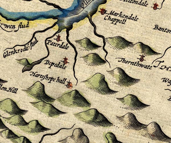 SP14NY41.jpg "Deepdale" circle, tower item:- Armitt Library : 2008.14.5 Image © see bottom of page |
|
|
|
||
| evidence:- | old map:- Bowen and Kitchin 1760 placename:- Depedale |
|
| source data:- | Map, hand coloured engraving, A New Map of the Counties of
Cumberland and Westmoreland Divided into their Respective Wards,
scale about 4 miles to 1 inch, by Emanuel Bowen and Thomas
Kitchin et al, published by T Bowles, Robert Sayer, and John
Bowles, London, 1760.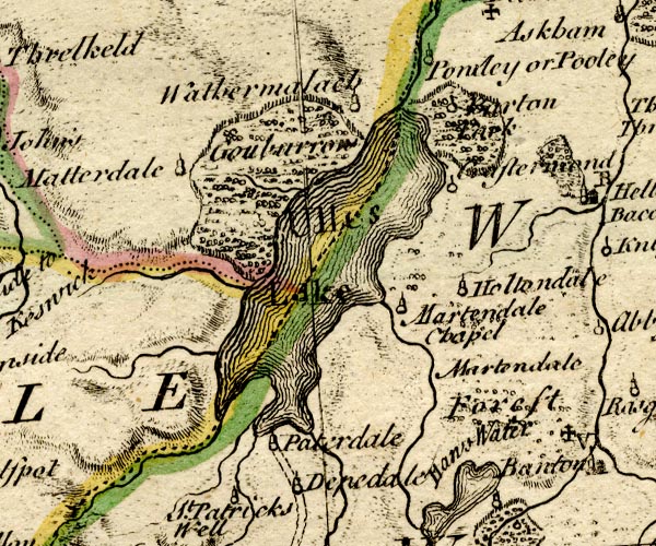 BO18NY31.jpg "Depedale" circle, tower item:- Armitt Library : 2008.14.10 Image © see bottom of page |
|
|
|
||
| evidence:- | old map:- Jefferys 1770 (Wmd) placename:- Dibdale |
|
| source data:- | Map, 4 sheets, The County of Westmoreland, scale 1 inch to 1
mile, surveyed 1768, and engraved and published by Thomas
Jefferys, London, 1770.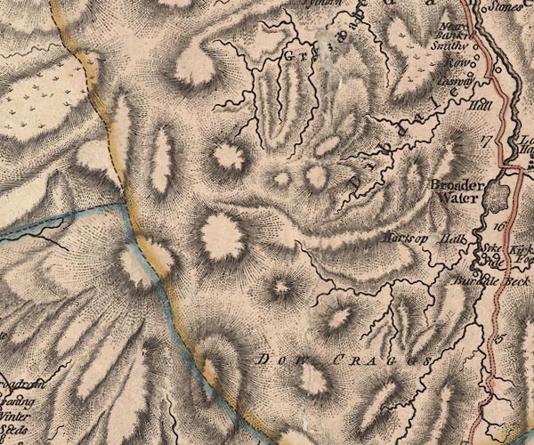 J5NY31SE.jpg "Dibdale" hill hachuring; valley item:- National Library of Scotland : EME.s.47 Image © National Library of Scotland |
|
|
|
||
| evidence:- | old text:- Clarke 1787 placename:- Deep Dale |
|
| source data:- | Guide book, A Survey of the Lakes of Cumberland, Westmorland,
and Lancashire, written and published by James Clarke, Penrith,
Cumberland, and in London etc, 1787; published 1787-93. goto source goto sourcePage 32:- "... The whole Dale [Patterdale] consists at present of five small manors; Hartsop, the property of the Earl of Lonsdale; Deep-Dale, of the Duke of Norfolk; Griesdale and Pless-Fell, of William Hassel, Esq; of Dalemain; and Glenridding, of John Mounsey, Esquire." |
|
|
|
||
| evidence:- | old map:- Cary 1789 (edn 1805) placename:- Dibdale |
|
| source data:- | Map, uncoloured engraving, Westmoreland, scale about 2.5 miles
to 1 inch, by John Cary, London, 1789; edition 1805.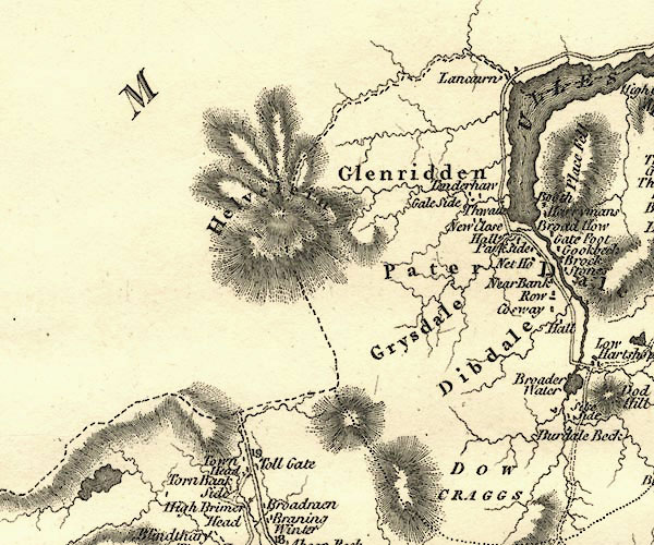 CY24NY31.jpg "Dibdale" area item:- JandMN : 129 Image © see bottom of page |
|
|
|
||
| evidence:- | old map:- Otley 1818 placename:- Deepdale |
|
| source data:- | Map, uncoloured engraving, The District of the Lakes,
Cumberland, Westmorland, and Lancashire, scale about 4 miles to
1 inch, by Jonathan Otley, 1818, engraved by J and G Menzies,
Edinburgh, Scotland, published by Jonathan Otley, Keswick,
Cumberland, et al, 1833.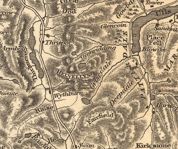 OT02NY31.jpg item:- JandMN : 48.1 Image © see bottom of page |
|
|
|
||
| evidence:- | old print:- Fielding and Walton 1821 (plate 46) placename:- Deepdale |
|
| source data:- | Print, coloured aquatint, Deepdale, Patterdale? Westmorland, drawn by Theodore H A
Fielding, published by R Ackermann, 101 Strand, London, 1821.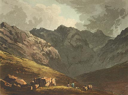 click to enlarge click to enlargeFW0146.jpg Tipped in opposite p.279 in A Picturesque Tour of the English Lakes. item:- Dove Cottage : 1993.R566.46 Image © see bottom of page |
|
|
|
||
| evidence:- | descriptive text:- Ford 1839 (3rd edn 1843) placename:- Deepdale |
|
| source data:- | Guide book, A Description of Scenery in the Lake District, by
Rev William Ford, published by Charles Thurnam, Carlisle, by W
Edwards, 12 Ave Maria Lane, Charles Tilt, Fleet Street, William
Smith, 113 Fleet Street, London, by Currie and Bowman,
Newcastle, by Bancks and Co, Manchester, by Oliver and Boyd,
Edinburgh, and by Sinclair, Dumfries, 1839. goto source Page 149:- "..." "Leaving the inn [at Patterdale], we shall proceed up the dale. On the right is Deepdale, which is terminated by a cove, a craggy and gloomy abyss, with precipitous sides, the receptacle of the snows of Fairfield. ..." |
|
|
|
||
| evidence:- | old map:- Ford 1839 map placename:- Deepdale |
|
| source data:- | Map, uncoloured engraving, Map of the Lake District of
Cumberland, Westmoreland and Lancashire, scale about 3.5 miles
to 1 inch, published by Charles Thurnam, Carlisle, and by R
Groombridge, 5 Paternoster Row, London, 3rd edn 1843.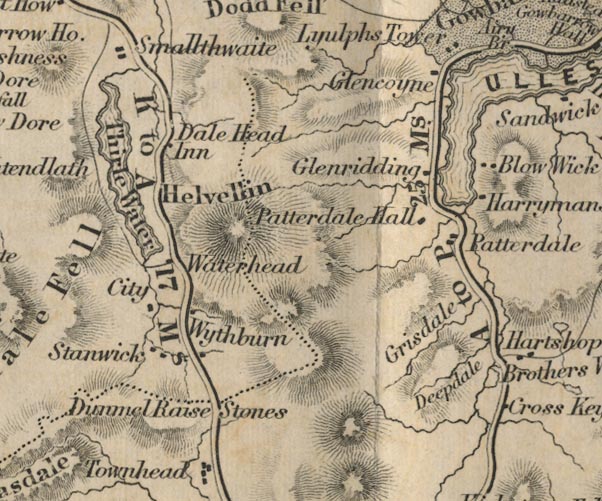 FD02NY31.jpg "Deepdale" Between hill hachures. item:- JandMN : 100.1 Image © see bottom of page |
|
|
|
||
| evidence:- | old map:- Garnett 1850s-60s H placename:- Deepdale |
|
| source data:- | Map of the English Lakes, in Cumberland, Westmorland and
Lancashire, scale about 3.5 miles to 1 inch, published by John
Garnett, Windermere, Westmorland, 1850s-60s.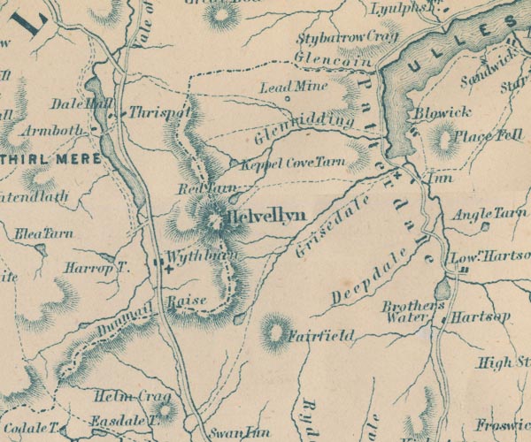 GAR2NY31.jpg "Deepdale" river valley item:- JandMN : 82.1 Image © see bottom of page |
|
|
|
||
 Click to enlarge BOE36.jpg View north from a little way up Deepdale. (taken 11.9.2007) 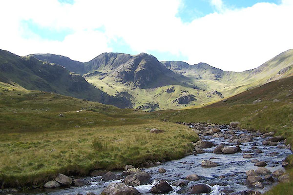 BXI58.jpg (taken 18.9.2012) |
||
|
|
||
Lakes Guides menu.