 Old Cumbria Gazetteer
 |
 |
|
| Crookdake Hall, Crookdake | ||
| Crookdake Hall | ||
| locality:- | Crookdake | |
| civil parish:- | Bromfield (formerly Cumberland) | |
| county:- | Cumbria | |
| locality type:- | buildings | |
| coordinates:- | NY19754430 | |
| 1Km square:- | NY1944 | |
| 10Km square:- | NY14 | |
|
|
||
| evidence:- | old map:- OS County Series (Cmd 36 3) placename:- Crookdake Hall |
|
| source data:- | Maps, County Series maps of Great Britain, scales 6 and 25
inches to 1 mile, published by the Ordnance Survey, Southampton,
Hampshire, from about 1863 to 1948. |
|
|
|
||
| evidence:- | old map:- Saxton 1579 placename:- Crockdale |
|
| source data:- | Map, hand coloured engraving, Westmorlandiae et Cumberlandiae Comitatus ie Westmorland
and Cumberland, scale about 5 miles to 1 inch, by Christopher Saxton, London, engraved
by Augustinus Ryther, 1576, published 1579-1645.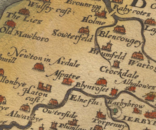 Sax9NY14.jpg Tower, symbol for a house, hall, tower, etc. "Crockdale" item:- private collection : 2 Image © see bottom of page |
|
|
|
||
| evidence:- | old map:- Jansson 1646 placename:- Crockdake |
|
| source data:- | Map, hand coloured engraving, Cumbria and Westmoria, ie
Cumberland and Westmorland, scale about 3.5 miles to 1 inch, by
John Jansson, Amsterdam, Netherlands, 1646.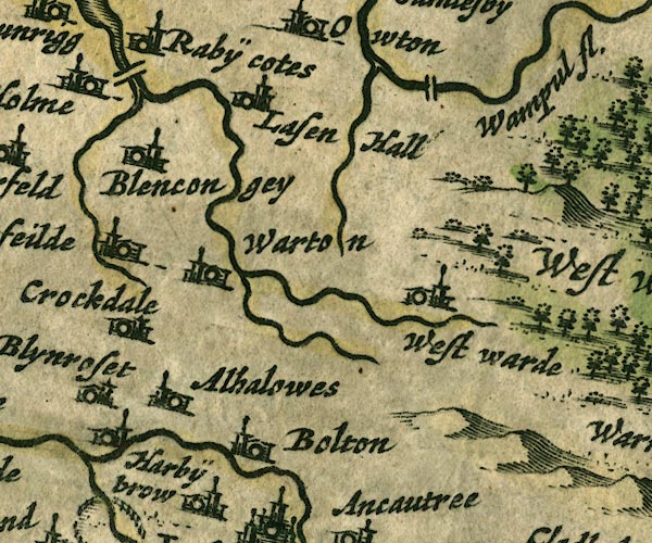 JAN3NY24.jpg "Crockdake" Buildings and tower. item:- JandMN : 88 Image © see bottom of page |
|
|
|
||
| evidence:- | old map:- Morden 1695 (Cmd) placename:- Crokedake |
|
| source data:- | Map, uncoloured engraving, Cumberland, scale about 4 miles to 1
inch, by Robert Morden, 1695, published by Abel Swale, the
Unicorn, St Paul's Churchyard, Awnsham, and John Churchill, the
Black Swan, Paternoster Row, London, 1695-1715.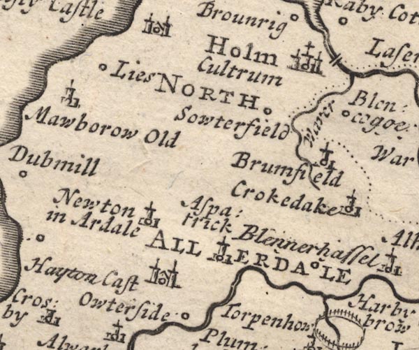 MD12NY14.jpg "Crokedake" Circle, building and tower. item:- JandMN : 90 Image © see bottom of page |
|
|
|
||
| evidence:- | probably descriptive text:- Simpson 1746 placename:- Croke Dake |
|
| source data:- | Atlas, three volumes of maps and descriptive text published as
'The Agreeable Historian, or the Compleat English Traveller
...', by Samuel Simpson, 1746. goto source goto source"... Croke Dake, Mr. Ballendin's. ..." |
|
|
|
||
| evidence:- | old map:- Donald 1774 (Cmd) |
|
| source data:- | Map, hand coloured engraving, 3x2 sheets, The County of Cumberland, scale about 1
inch to 1 mile, by Thomas Donald, engraved and published by Joseph Hodskinson, 29
Arundel Street, Strand, London, 1774.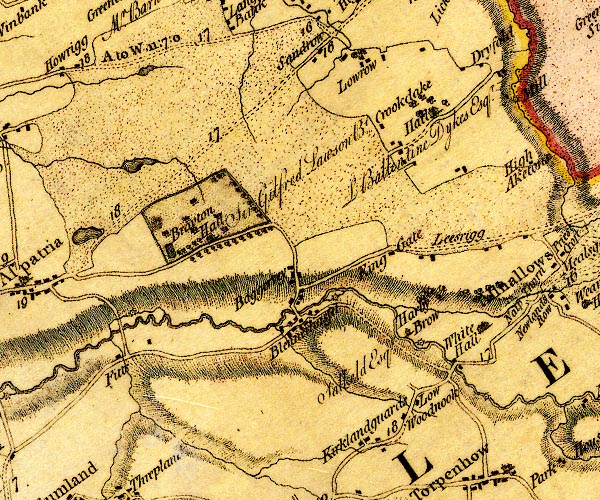 D4NY14SE.jpg "Hall / L Ballentine Dykes Esqr." house at Crookdake with trees around item:- Carlisle Library : Map 2 Image © Carlisle Library |
|
|
|
||
| evidence:- | database:- Listed Buildings 2010 placename:- Crookdake Hall |
|
| source data:- | courtesy of English Heritage "CROOKDAKE HALL / / / BROMFIELD / ALLERDALE / CUMBRIA / II / 411225 / NY1971444333" |
|
|
|
||
| evidence:- | database:- Listed Buildings 2010 item:- date stone (1840); date stone (1893) |
|
| source data:- | courtesy of English Heritage "BARNS TO EAST OF CROOKDAKE HALL / / / BROMFIELD / ALLERDALE / CUMBRIA / II / 411227 / NY1974744358" |
|
|
|
||
| evidence:- | database:- Listed Buildings 2010 |
|
| source data:- | courtesy of English Heritage "WALL TO SOUTH OF CROOKDAKE HALL / / / BROMFIELD / ALLERDALE / CUMBRIA / II / 411226 / NY1972344314" |
|
|
|
||
| notes:- |
Possibly a fortified site, perhaps developed from a pele tower. |
|
| Perriam, D R &Robinson, J: 1998: Medieval Fortified Buildings of Cumbria: CWAAS::
ISBN 1 873124 23 6; plan |
||
|
|
||
Lakes Guides menu.