 Old Cumbria Gazetteer
 |
 |
|
| Coniston Waterfall, Coniston | ||
| Coniston Waterfall | ||
| site name:- | Church Beck | |
| civil parish:- | Coniston (formerly Lancashire) | |
| county:- | Cumbria | |
| locality type:- | waterfall | |
| coordinates:- | SD29449802 (about) | |
| 1Km square:- | SD2998 | |
| 10Km square:- | SD29 | |
|
|
||
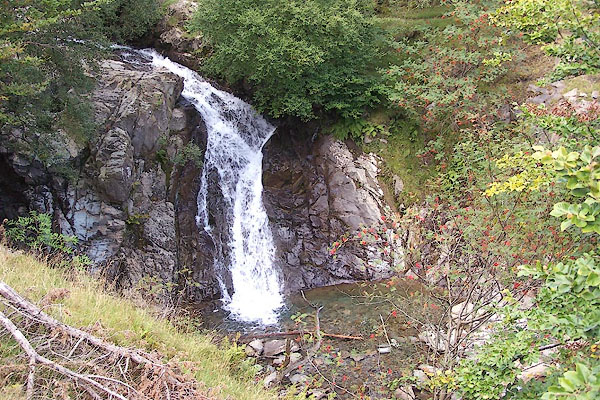 BOC26.jpg (taken 3.9.2007) 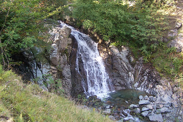 BTN82.jpg (taken 8.9.2010) |
||
|
|
||
| evidence:- | old map:- OS County Series (Lan 4 3) placename:- Coniston Waterfall |
|
| source data:- | Maps, County Series maps of Great Britain, scales 6 and 25
inches to 1 mile, published by the Ordnance Survey, Southampton,
Hampshire, from about 1863 to 1948. |
|
|
|
||
| evidence:- | probably descriptive text:- West 1778 (11th edn 1821) |
|
| source data:- | Guide book, A Guide to the Lakes, by Thomas West, published by
William Pennington, Kendal, Cumbria once Westmorland, and in
London, 1778 to 1821. goto source goto sourcePage 51:- "... [from station, Coniston 3] Looking across the lake, by the south end of the grove that conceals Coniston-hall, and over the cultivated tract that rises behind it, between two swells of rocks, a cataract will meet the eye, issuing from the bosom of the mountains. ..." |
|
|
|
||
Lakes Guides menu.