 Old Cumbria Gazetteer
 |
 |
|
| Castle Hill, Kendal | ||
| Castle Hill | ||
| locality:- | Kendal | |
| civil parish:- | Kendal (formerly Westmorland) | |
| county:- | Cumbria | |
| locality type:- | hill | |
| coordinates:- | SD52229249 | |
| 1Km square:- | SD5292 | |
| 10Km square:- | SD59 | |
| altitude:- | 305 feet | |
| altitude:- | 93m | |
|
|
||
| evidence:- | old map:- OS County Series (Wmd 38 8) placename:- Castle Hill |
|
| source data:- | Maps, County Series maps of Great Britain, scales 6 and 25
inches to 1 mile, published by the Ordnance Survey, Southampton,
Hampshire, from about 1863 to 1948. labelled along the track up to the castle |
|
|
|
||
| evidence:- | old map:- Jefferys 1770 |
|
| source data:- | Map, 4 sheets, The County of Westmoreland, scale 1 inch to 1
mile, surveyed 1768, and engraved and published by Thomas
Jefferys, London, 1770.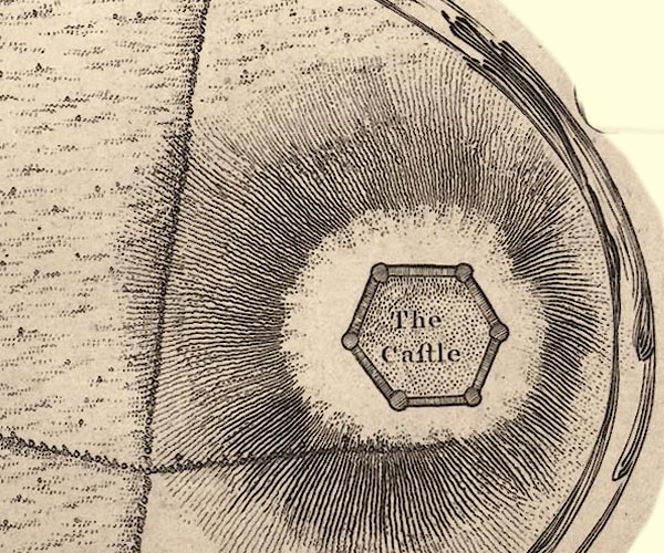 J55292C.jpg hill hachuring item:- National Library of Scotland : EME.s.47 Image © National Library of Scotland |
|
|
|
||
| evidence:- | descriptive text:- Baker 1802 |
|
| source data:- | Perspective road map with sections in Lancashire, Westmorland,
and Cumberland, by J Baker, London 1802. pp.25-26:- "[Kendal] ... on a hill to the right, are the ruins of the castle. ..." |
|
|
|
||
| evidence:- | old map:- Baker 1802 |
|
| source data:- | Perspective road maps with sections in Lancashire, Westmorland
and Cumberland, by J Baker, London 1802.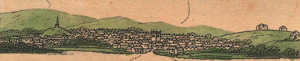 Bk03Vg13.jpg item:- private collection : 3 Image © see bottom of page |
|
|
|
||
 Lakes Guides menu.