 Old Cumbria Gazetteer
 |
 |
|
| Broadness, Bassenthwaite | ||
| Broadness | ||
| Broadness Farm | ||
| civil parish:- | Bassenthwaite (formerly Cumberland) | |
| county:- | Cumbria | |
| locality type:- | buildings | |
| locality type:- | locality | |
| locality type:- | promontory | |
| coordinates:- | NY22252971 | |
| 1Km square:- | NY2229 | |
| 10Km square:- | NY22 | |
|
|
||
| evidence:- | possibly old map:- Ogilby 1675 (plate 96) placename:- Basinthwait |
|
| source data:- | Road strip map, hand coloured engraving, the Road from Kendal to
Cockermouth, and the Road from Egremond to Carlisle, scale about
1 inch to 1 mile, by John Ogilby, London, 1675.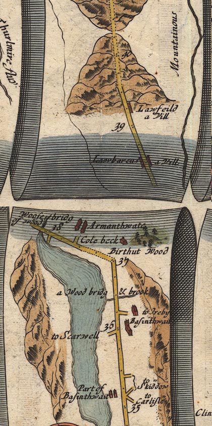 OG96m035.jpg In mile 35, Cumberland. "Part of Basinthwait" houses between the road and the lake on the left of the road. item:- JandMN : 22 Image © see bottom of page |
|
|
|
||
| evidence:- | old map:- Donald 1774 (Cmd) placename:- Braidness |
|
| source data:- | Map, hand coloured engraving, 3x2 sheets, The County of Cumberland, scale about 1
inch to 1 mile, by Thomas Donald, engraved and published by Joseph Hodskinson, 29
Arundel Street, Strand, London, 1774.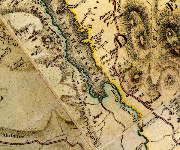 D4NY22NW.jpg "Braidness" block or blocks, labelled in lowercase; a hamlet or just a house item:- Carlisle Library : Map 2 Image © Carlisle Library |
|
|
|
||
| evidence:- | old map:- Crosthwaite 1783-94 (Bas) placename:- Bradness |
|
| source data:- | Map, uncoloured engraving, An Accurate Map of Broadwater or
Bassenthwaite Lake, scale about 3 inches to 1 mile, by Peter
Crosthwaite, Keswick, Cumberland, 1783, version published 1800.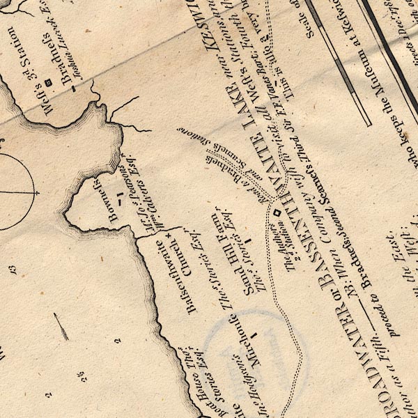 CT6NY22J.jpg "Bradness / Joshua Lucock Esqr." item:- Armitt Library : 1959.191.4 Image © see bottom of page |
|
|
|
||
| evidence:- | old map:- West 1784 map placename:- Bradness |
|
| source data:- | Map, hand coloured engraving, A Map of the Lakes in Cumberland,
Westmorland and Lancashire, scale about 3.5 miles to 1 inch,
engraved by Paas, 53 Holborn, London, about 1784.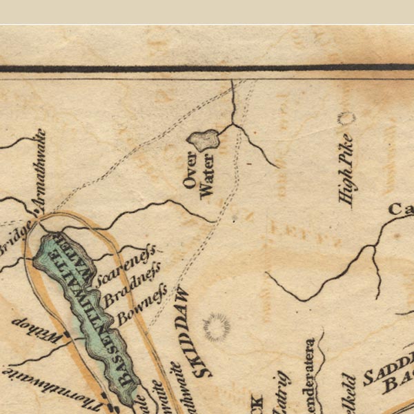 Ws02NY23.jpg item:- Armitt Library : A1221.1 Image © see bottom of page |
|
|
|
||
| evidence:- | old map:- Clarke 1787 map (Bassenthwaite Lake) placename:- Broadness |
|
| source data:- | Map, A Map of Broadwater and its Environs, ie Bassenthwaite
Lake, scale about 6.5 ins to 1 mile, by James Clarke, engraved
by Neele, 352 Strand, published by James Clarke, Penrith,
Cumberland and in London etc, 1787.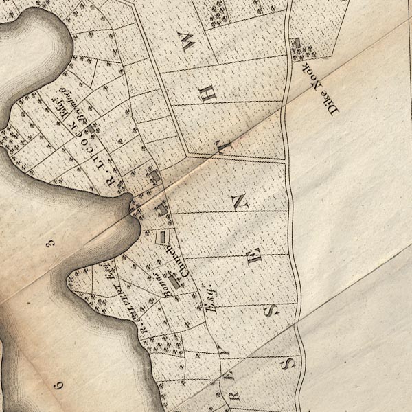 CL8NY22J.jpg "Broadness / R. LUCOCK Esqr." item:- private collection : 10.8 Image © see bottom of page |
|
|
|
||
| evidence:- | old map:- Ford 1839 map placename:- Bradness |
|
| source data:- | Map, uncoloured engraving, Map of the Lake District of
Cumberland, Westmoreland and Lancashire, scale about 3.5 miles
to 1 inch, published by Charles Thurnam, Carlisle, and by R
Groombridge, 5 Paternoster Row, London, 3rd edn 1843.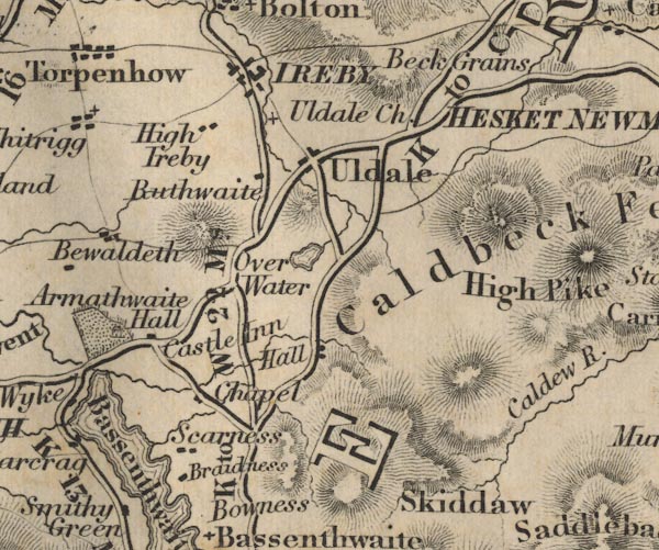 FD02NY23.jpg "Bradness" item:- JandMN : 100.1 Image © see bottom of page |
|
|
|
||
 Lakes Guides menu.