 Old Cumbria Gazetteer
 |
 |
|
| Broad Ness, Bassenthwaite | ||
| Broad Ness | ||
| site name:- | Bassenthwaite Lake | |
| civil parish:- | Bassenthwaite (formerly Cumberland) | |
| county:- | Cumbria | |
| locality type:- | headland | |
| coordinates:- | NY21862971 (etc) | |
| 1Km square:- | NY2129 | |
| 10Km square:- | NY22 | |
|
|
||
| evidence:- | old map:- Crosthwaite 1783-94 (Bas) |
|
| source data:- | Map, uncoloured engraving, An Accurate Map of Broadwater or
Bassenthwaite Lake, scale about 3 inches to 1 mile, by Peter
Crosthwaite, Keswick, Cumberland, 1783, version published 1800.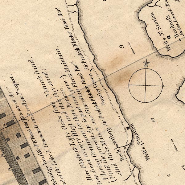 CT6NY22E.jpg item:- Armitt Library : 1959.191.4 Image © see bottom of page |
|
|
|
||
| evidence:- | old text:- Clarke 1787 placename:- Broadness |
|
| source data:- | Guide book, A Survey of the Lakes of Cumberland, Westmorland,
and Lancashire, written and published by James Clarke, Penrith,
Cumberland, and in London etc, 1787; published 1787-93. goto source goto sourcePage 98:- "..." "... A little further [south of Scar Ness] is Broadness; it is also a round hill, jutting into the Lake, as is Bonas, (see plate VIII.) but neither of them so beautiful as Scarn-House, or so rich soil." |
|
|
|
||
| evidence:- | old map:- Clarke 1787 map (Bassenthwaite Lake) |
|
| source data:- | Map, A Map of Broadwater and its Environs, ie Bassenthwaite
Lake, scale about 6.5 ins to 1 mile, by James Clarke, engraved
by Neele, 352 Strand, published by James Clarke, Penrith,
Cumberland and in London etc, 1787.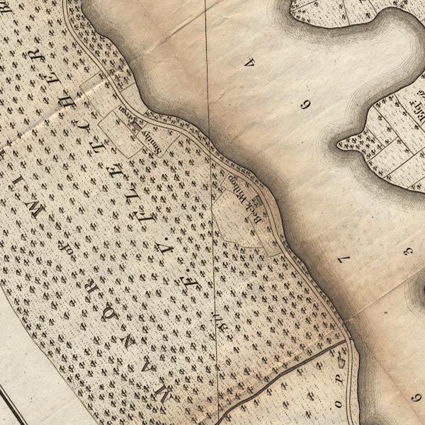 CL8NY22E.jpg item:- private collection : 10.8 Image © see bottom of page |
|
|
|
||
Lakes Guides menu.