 Old Cumbria Gazetteer
 |
 |
|
| Brimmer Head Farm, Easedale | ||
| Brimmer Head Farm | ||
| locality:- | Easedale | |
| civil parish:- | Lakes (formerly Westmorland) | |
| county:- | Cumbria | |
| locality type:- | buildings | |
| coordinates:- | NY32430851 | |
| 1Km square:- | NY3208 | |
| 10Km square:- | NY30 | |
|
|
||
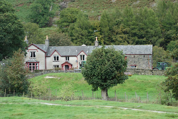 CBU34.jpg (taken 24.9.2014) 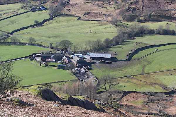 BUF60.jpg (taken 14.3.2011) |
||
|
|
||
| evidence:- | old map:- OS County Series (Wmd 18 16) placename:- Brimmer Head |
|
| source data:- | Maps, County Series maps of Great Britain, scales 6 and 25
inches to 1 mile, published by the Ordnance Survey, Southampton,
Hampshire, from about 1863 to 1948. |
|
|
|
||
| evidence:- | old map:- Jefferys 1770 (Wmd) placename:- High Brimer Head placename:- Brimer Head, High |
|
| source data:- | Map, 4 sheets, The County of Westmoreland, scale 1 inch to 1
mile, surveyed 1768, and engraved and published by Thomas
Jefferys, London, 1770.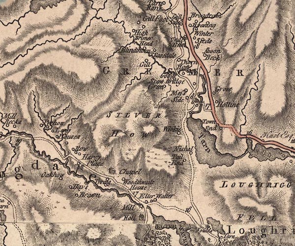 J5NY30NW.jpg "High Brimer Head" circle, labelled in italic lowercase text; settlement, farm, house, or hamlet? item:- National Library of Scotland : EME.s.47 Image © National Library of Scotland |
|
|
|
||
| evidence:- | old map:- Cary 1789 (edn 1805) placename:- High Brimer Head placename:- Brimer Head, High |
|
| source data:- | Map, uncoloured engraving, Westmoreland, scale about 2.5 miles
to 1 inch, by John Cary, London, 1789; edition 1805.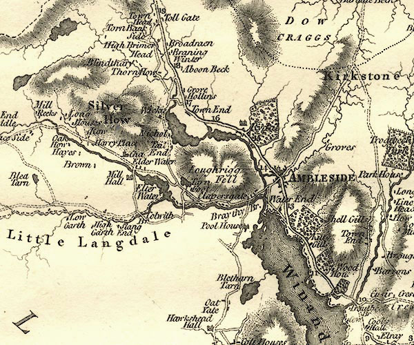 CY24NY30.jpg "High Brimer Head" block/s, labelled in italic lowercase; house, or hamlet item:- JandMN : 129 Image © see bottom of page |
|
|
|
||
| evidence:- | database:- Listed Buildings 2010 placename:- Brimmer Head Farm |
|
| source data:- | courtesy of English Heritage "BRIMMER HEAD FARMHOUSE WITH ADJOINING FARM BUILDING / / / LAKES / SOUTH LAKELAND / CUMBRIA / I / 452084 / NY3245708480" |
|
|
|
||
 Lakes Guides menu.