 Old Cumbria Gazetteer
 |
 |
|
| Crookdale Bridge, Fawcett Forest | ||
| Crookdale Bridge | ||
| Crookgill Bridge | ||
| site name:- | Crookdale Beck | |
| locality:- | Hause Foot | |
| civil parish:- | Fawcett Forest (formerly Westmorland) | |
| civil parish:- | Shap Rural (formerly Westmorland) | |
| county:- | Cumbria | |
| locality type:- | bridge | |
| coordinates:- | NY55020554 | |
| 1Km square:- | NY5505 | |
| 10Km square:- | NY50 | |
|
|
||
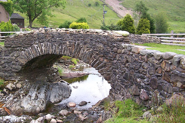 BJQ39.jpg (taken 22.7.2005) |
||
|
|
||
| evidence:- | old map:- Ogilby 1675 (plate 38) |
|
| source data:- | Road strip map, hand coloured engraving, continuation of the
Road from London to Carlisle, scale about 1 inch to 1 mile, by
John Ogilby, London, 1675.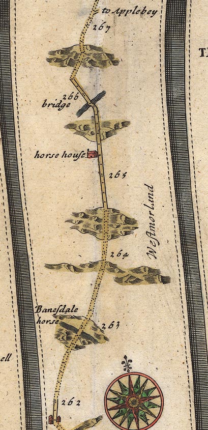 OG38m262.jpg In mile 265, Westmorland. Road crosses a:- "bridge" drawn over a river. item:- JandMN : 21 Image © see bottom of page |
|
|
|
||
| evidence:- | old map:- Bowen 1720 (plate 94) |
|
| source data:- | Strip maps, uncoloured engravings, road maps, The Road from
London to Carlisle, scale about 2 miles to 1 inch, with sections
in Lancashire and Westmorland, published by Emanuel Bowen, St
Katherines, London, 1720.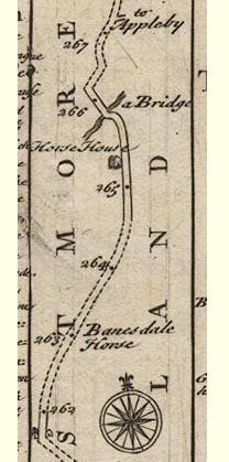 B094m262.jpg A bridge between mile 265 and 266. item:- Dove Cottage : 2007.38.100 Image © see bottom of page |
|
|
|
||
| evidence:- | old map:- Jefferys 1770 (Wmd) |
|
| source data:- | Map, 4 sheets, The County of Westmoreland, scale 1 inch to 1
mile, surveyed 1768, and engraved and published by Thomas
Jefferys, London, 1770. J5NY50NW.jpg double line, road, across a stream; bridge item:- National Library of Scotland : EME.s.47 Image © National Library of Scotland |
|
|
|
||
| evidence:- | old map:- Cary 1789 (edn 1805) |
|
| source data:- | Map, uncoloured engraving, Westmoreland, scale about 2.5 miles
to 1 inch, by John Cary, London, 1789; edition 1805.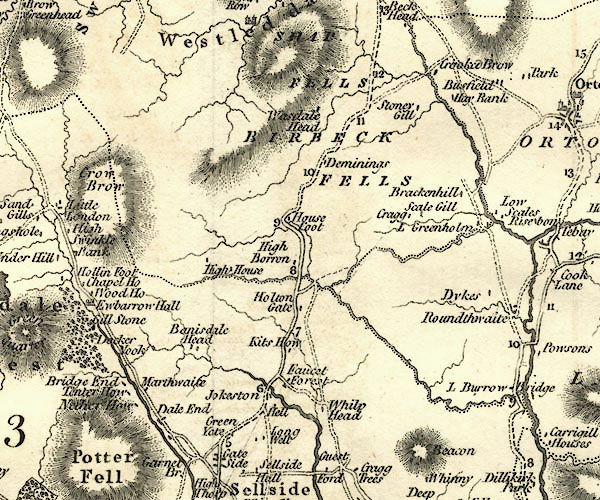 CY24NY50.jpg road across a stream; bridge over the Crookdale Beck item:- JandMN : 129 Image © see bottom of page |
|
|
|
||
| evidence:- | database:- Listed Buildings 2010 placename:- Crookdale Bridge |
|
| source data:- | courtesy of English Heritage "CROOKDALE BRIDGE / / / FAWCETT FOREST / SOUTH LAKELAND / CUMBRIA / II / 75635 / NY5502005552" |
|
| source data:- | courtesy of English Heritage "Bridge over Crookdale Beck. Probably C18. Stone rubble. Segmental arch with thin irregular voussoirs. Low parapets, collapsed to north ends. Roadway approx 3.5m wide. On route of Heron Syke to Eamont Bridge turnpike road, 1756, replaced by new route over Shap Fell, c1826." |
|
|
|
||
| hearsay:- |
Probably 18th century, on the Heron Syke to Eamont Bridge turnpike, 1756. |
|
|
|
||
 Lakes Guides menu.