 Old Cumbria Gazetteer
 |
 |
|
| Bleacrag Bridge, Witherslack | ||
| Bleacrag Bridge | ||
| Blaycrag Bridge | ||
| site name:- | Winster, River | |
| civil parish:- | Witherslack (formerly Westmorland) | |
| civil parish:- | Upper Allithwaite (formerly Lancashire) | |
| county:- | Cumbria | |
| locality type:- | bridge | |
| locality type:- | parish boundary feature | |
| locality type:- | boundary stone | |
| locality type:- | county boundary mark (old) | |
| coordinates:- | SD42258376 | |
| 1Km square:- | SD4283 | |
| 10Km square:- | SD48 | |
| old boundary | ||
| locality:- | Westmorland boundary | |
| locality:- | Lancashire boundary | |
|
|
||
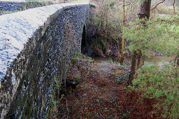 BLM84.jpg (taken 31.12.2005) 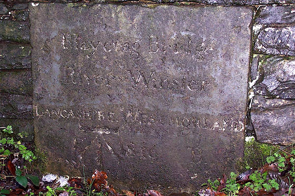 BLM83.jpg Plaque:- "Blaycrag Bridge River Winster LANCASHIRE WESTMORLAND [F] 1816 B" and a cut bench mark, which the Ordnance Survey have inscribed through the existing inscription like vandals. (taken 31.12.2005) |
||
|
|
||
| evidence:- | old map:- OS County Series (Wmd 41 12) placename:- Bleacrag Bridge |
|
| source data:- | Maps, County Series maps of Great Britain, scales 6 and 25
inches to 1 mile, published by the Ordnance Survey, Southampton,
Hampshire, from about 1863 to 1948. |
|
|
|
||
| evidence:- | probably old map:- Bowen and Kitchin 1760 |
|
| source data:- | Map, hand coloured engraving, A New Map of the Counties of
Cumberland and Westmoreland Divided into their Respective Wards,
scale about 4 miles to 1 inch, by Emanuel Bowen and Thomas
Kitchin et al, published by T Bowles, Robert Sayer, and John
Bowles, London, 1760.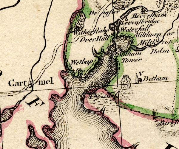 BO18SD37.jpg road across the Winster item:- Armitt Library : 2008.14.10 Image © see bottom of page |
|
|
|
||
| evidence:- | old map:- Jefferys 1770 (Wmd) |
|
| source data:- | Map, 4 sheets, The County of Westmoreland, scale 1 inch to 1
mile, surveyed 1768, and engraved and published by Thomas
Jefferys, London, 1770.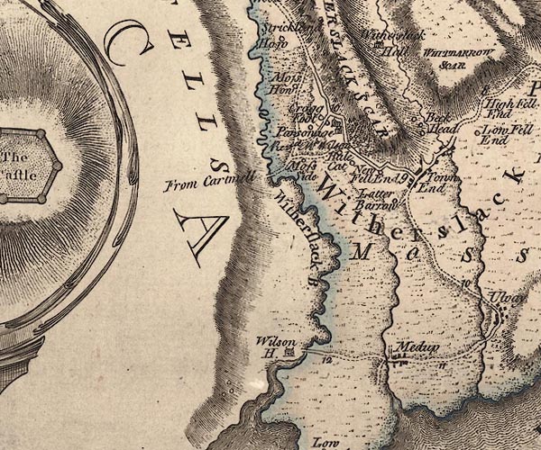 J5SD48SW.jpg double line, road, across a stream; bridge item:- National Library of Scotland : EME.s.47 Image © National Library of Scotland |
|
|
|
||
| evidence:- | database:- Listed Buildings 2010 placename:- Bleacrag Bridge |
|
| source data:- | courtesy of English Heritage "BLEACRAG BRIDGE / / BLEACRAG ROAD / WITHERSLACK / SOUTH LAKELAND / CUMBRIA / II / 77135 / SD4225883770" |
|
| source data:- | courtesy of English Heritage "BLEACRAG BRIDGE (THAT PART IN UPPER ALLITHWAITE) / / HOLME ROAD / UPPER ALLITHWAITE / SOUTH LAKELAND / CUMBRIA / II / 422226 / SD4225883771" |
|
| source data:- | courtesy of English Heritage "Bridge over river Winster. Probably 1816. Stone rubble. Elliptical arch and straight parapets with limestone coping. Plaque to south side of north parapet marking county boundary has inscription: "BLAYCRAG BRIDGE/RIVER WINSTER/ LANCASHIRE : WESTMORLAND/ F 1816 B/88.6 : 59.6/CARTMEL : BEETHAM". Bench mark added. Part of this bridge is in Upper Allithwaite C.P. ..." |
|
|
|
||
| story:- |
Here Richard Taylor murdered Richard Kilner, and was hanged for it on Gallows Hill:- |
|
| "Richard Taylor was buryed whoe suffered the same day at Blakeragge bridge end for
murthering wilfully Rich. Kilner of Witherslack. April 1576." |
||
|
|
||
 Lakes Guides menu.