 Old Cumbria Gazetteer
 |
 |
|
| included in:- |
 rivers, Cumbria rivers, Cumbria |
|
| rivers, Cumbria: distribution of names | ||
| River Name Distribution Maps |
||
| Quite early on in the project we noticed that a river in Cumbria might change its
name as it grew from a small gill tumbling down in a rocky gill into a slower broader
beck or river. But as well as reflecting the land it was flowing through, we thought
that different names such as beck, gill, sike were being used in different parts of
Cumbria. So we plotted the names we had in the gazetteer onto relief maps, which allow
the effect of landscape to be taken into account too. |
||
| They are shown here, but were done in 2008 so do not reflect the present state of
the gazetteer, which includes many more names, particularly of smaller streams. |
||
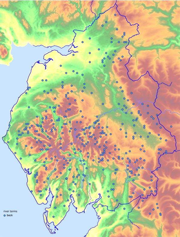 cumbeck.jpg Beck  cumburn.jpg Burn 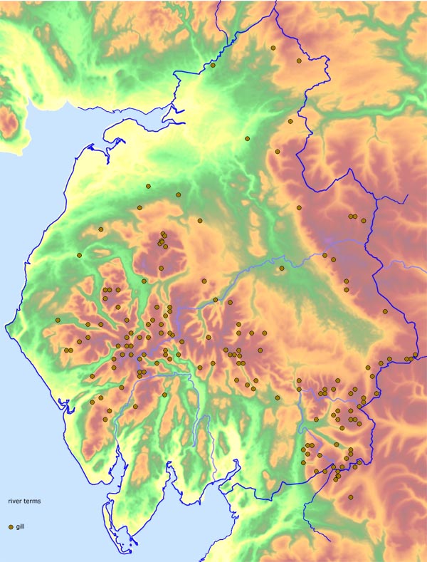 cumgill.jpg Gill 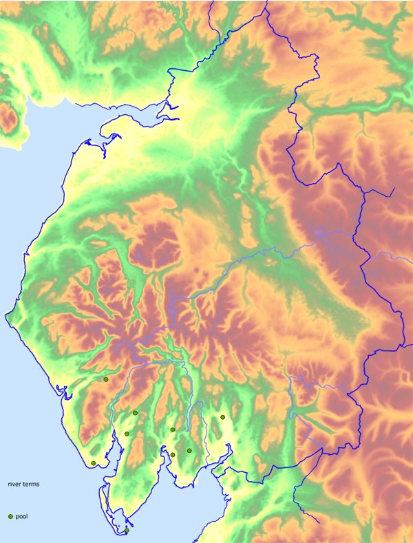 cumpool.jpg Pool 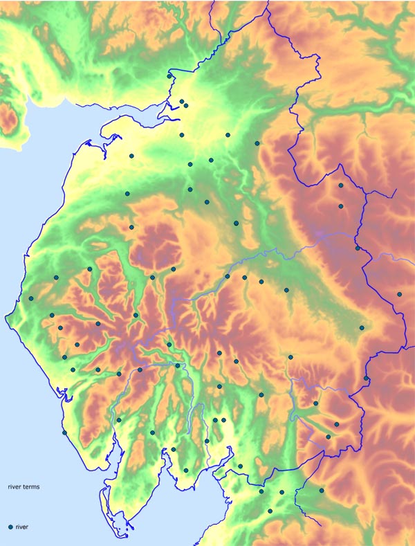 cumriver.jpg River 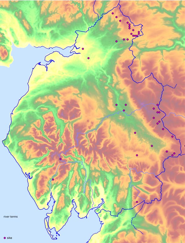 cumsike.jpg Sike 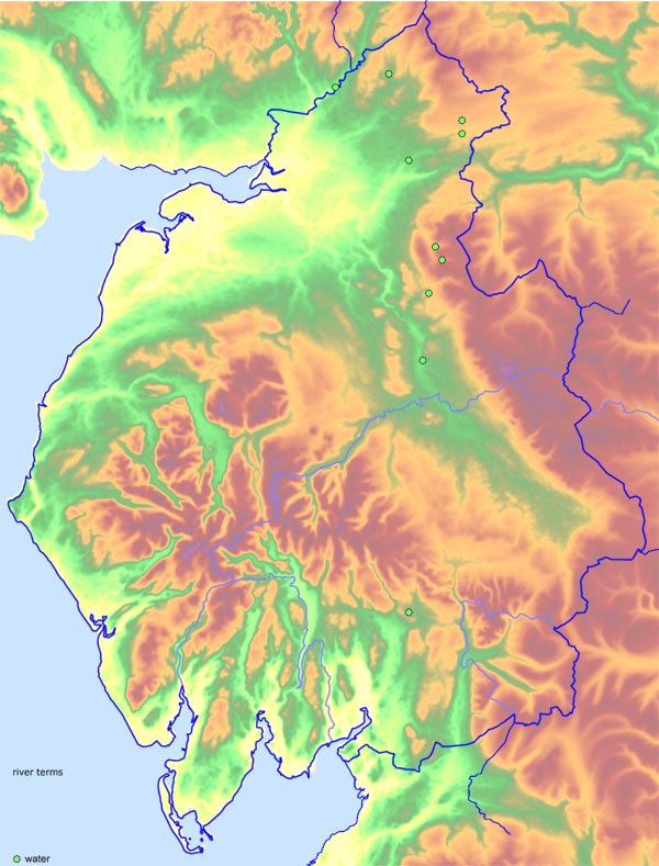 cumwater.jpg Water |
||
|
|
||
Lakes Guides menu.