 Old Cumbria Gazetteer
 |
 |
|
| track, Lakes | ||
| civil parish:- | Lakes (formerly Westmorland) | |
| county:- | Cumbria | |
| locality type:- | track | |
| locality type:- | packhorse road | |
| coordinates:- | NY34711106 (etc) | |
| 1Km square:- | NY3411 | |
| 10Km square:- | NY31 | |
|
|
||
| evidence:- | old map:- OS County Series (Wmd 19 9) placename:- Old Packhorse Road |
|
| source data:- | Maps, County Series maps of Great Britain, scales 6 and 25
inches to 1 mile, published by the Ordnance Survey, Southampton,
Hampshire, from about 1863 to 1948. OS County Series (Wmd 19 5) 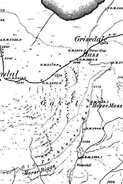 OSPACKRT.jpg N-S route across fells passing east of Grisedale Tarn and Seat Sandal, from Patterdale to Grasmere. This map labels Horse Gap, Horse Moss and Horse Riggs! |
|
|
|
||
 Lakes Guides menu.