 Old Cumbria Gazetteer
 |
 |
|
| Park Head Quarry, Sebergham | ||
| Park Head Quarry | ||
| locality:- | Parkhead | |
| civil parish:- | Sebergham (formerly Cumberland) | |
| county:- | Cumbria | |
| locality type:- | limestone quarry | |
| locality type:- | quarry | |
| locality type:- | limekiln | |
| coordinates:- | NY34014074 (about) | |
| 1Km square:- | NY3440 | |
| 10Km square:- | NY34 | |
|
|
||
| evidence:- | old map:- OS County Series (Cmd 38 9) |
|
| source data:- | Maps, County Series maps of Great Britain, scales 6 and 25
inches to 1 mile, published by the Ordnance Survey, Southampton,
Hampshire, from about 1863 to 1948. "Quarry / Limekiln" |
|
|
|
||
| evidence:- | perhaps old map:- Postlethwaite 1877 (3rd edn 1913) |
|
| source data:- | Map, uncoloured engraving, Map of the Lake District Mining Field, Westmorland, Cumberland,
Lancashire, scale about 5 miles to 1 inch, by John Postlethwaite, published by W H
Moss and Sons, 13 Lowther Street, Whitehaven, Cumberland, 1877 edn 1913.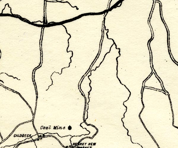 PST2NY34.jpg "Coal Mine" mine symbol, N of Hesket Newmarket; perhaps a mistake for 'Quarry' item:- JandMN : 162.2 Image © see bottom of page |
|
|
|
||
 Lakes Guides menu.