 Old Cumbria Gazetteer
 |
 |
|
| house, Kendal | ||
| Street:- | Castle Street | |
| locality:- | Castle Street Cemetery | |
| locality:- | Kendal | |
| civil parish:- | Kendal (formerly Westmorland) | |
| county:- | Cumbria | |
| locality type:- | buildings | |
| coordinates:- | SD52169299 | |
| 1Km square:- | SD5292 | |
| 10Km square:- | SD59 | |
| SummaryText:- | once the cemetery lodge | |
|
|
||
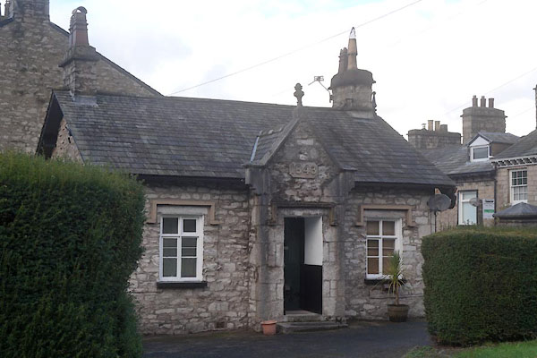 CEK50.jpg (taken 4.12.2015) 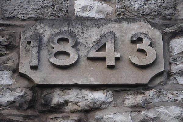 CEK51.jpg Date stone:- "1843" (taken 4.12.2015) |
||
|
|
||
| evidence:- | old map:- OS County Series (Wmd 38 8) |
|
| source data:- | Maps, County Series maps of Great Britain, scales 6 and 25
inches to 1 mile, published by the Ordnance Survey, Southampton,
Hampshire, from about 1863 to 1948. "Lodge" |
|
|
|
||
 Lakes Guides menu.