 Old Cumbria Gazetteer
 |
 |
|
| Whin Sill | ||
| locality:- | High Cup Gill | |
| civil parish:- | Dufton (formerly Westmorland) | |
| civil parish:- | Murton (formerly Westmorland) | |
| county:- | Cumbria | |
| locality type:- | geological site | |
| locality type:- | rocks | |
| coordinates:- | NY74562617 (etc) | |
| 1Km square:- | NY7426 | |
| 10Km square:- | NY72 | |
|
|
||
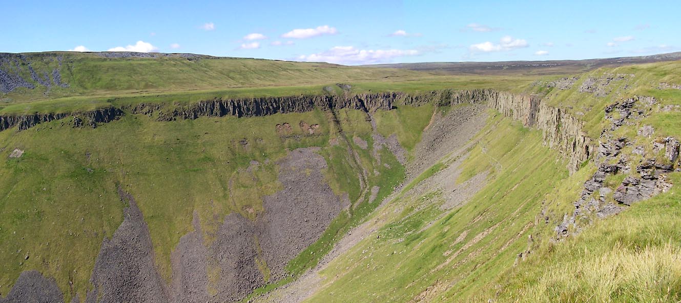 Click to enlarge BVB85.jpg High Cup Scar. (taken 24.7.2011) |
||
|
|
||
| notes:- |
Whin Sill is a horizontal sheet of solidied magma which had spread between layers
of limestone and shale in the north Pennines about 295 Million years ago, late Carboniferous
period. It is up to 90m thick. The igneous rock is called dolerite, or whinstone. |
|
| In the last stages of cooling the magma shrank, resulting in vertical cracks breaking
the rock into rough columns, which can be seen in High Cup Gill. |
||
| Dolerite is very hard. It is made of crystals of: pyroxene, calcium, magnesium, iron
silicates; feldspar, calcium, potassium, aluminum silicates; and iron oxide. |
||
| Quarrymen gave Whin Sill its name; whin because it is hard, sill because it lies horizontally.
The sill part was adopted by geologists for similar igneous formations. |
||
|
|
||
 Lakes Guides menu.