 Old Cumbria Gazetteer
 |
 |
|
| Trout Beck (7) | ||
| runs into:- |  Cairn Beck Cairn Beck |
|
|
|
||
| Trout Beck | ||
| civil parish:- | Hayton (formerly Cumberland) | |
| civil parish:- | Wetheral (formerly Cumberland) | |
| county:- | Cumbria | |
| locality type:- | river | |
| locality type:- | boundary | |
| locality type:- | parish boundary | |
| 1Km square:- | NY4856 (etc) | |
| 10Km square:- | NY45 | |
|
|
||
| evidence:- | old map:- Ogilby 1675 (plate 86) |
|
| source data:- | Road strip map, uncoloured engraving, the Road from Tinmouth ...
to Carlisle, scale about 1 inch to 1 mile, by John Ogilby,
London, 1675.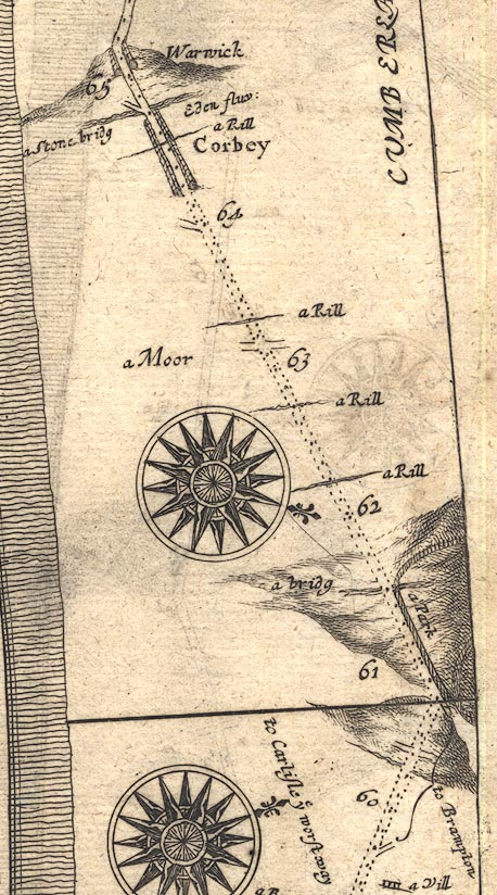 OG86m060.jpg In mile 64, Cumberland. "a Rill" drawn across the road. item:- JandMN : 73 Image © see bottom of page |
|
|
|
||
| evidence:- | old map:- Donald 1774 (Cmd) |
|
| source data:- | Map, hand coloured engraving, 3x2 sheets, The County of Cumberland, scale about 1
inch to 1 mile, by Thomas Donald, engraved and published by Joseph Hodskinson, 29
Arundel Street, Strand, London, 1774.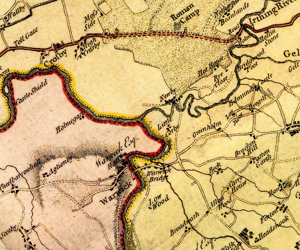 D4NY45NE.jpg single or double wiggly line; a river into the Cairn Beck item:- Carlisle Library : Map 2 Image © Carlisle Library |
|
|
|
||
Lakes Guides menu.