 Old Cumbria Gazetteer
 |
 |
|
| Sepulchre, Kendal | ||
| Street:- | Sepulchre Lane | |
| locality:- | Kendal | |
| civil parish:- | Kendal (formerly Westmorland) | |
| county:- | Cumbria | |
| locality type:- | garden | |
| locality type:- | quaker burial ground (once) | |
| coordinates:- | SD51299263 | |
| 1Km square:- | SD5192 | |
| 10Km square:- | SD59 | |
|
|
||
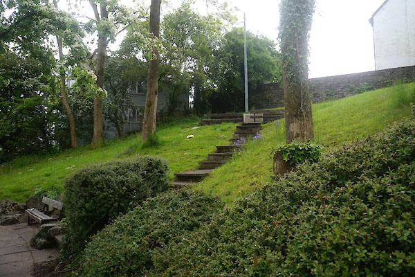 CDD89.jpg (taken 3.6.2015) 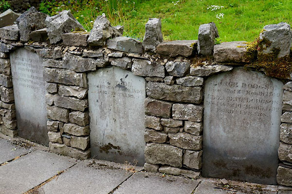 CDD90.jpg Gravestones. (taken 3.6.2015) |
||
|
|
||
| evidence:- | old map:- OS County Series (Wmd 38 8) placename:- Sepulchre |
|
| source data:- | Maps, County Series maps of Great Britain, scales 6 and 25
inches to 1 mile, published by the Ordnance Survey, Southampton,
Hampshire, from about 1863 to 1948. "Sepulchre (Friends' Burial Ground)" |
|
|
|
||
| hearsay:- |
Enclosed by the Quakers in Kendal, 1656. Extended to accommodate Quakers from Underbarrow,
whose burial ground had been ploughed up by a renegade member, 1855. It was made into
a garden in 1863. |
|
|
|
||
 Lakes Guides menu.