 Old Cumbria Gazetteer
 |
 |
|
|
| road, Silloth to Grune Point | |||
| Silloth to Grune Point | |||
| Grune Point to Silloth | |||
| civil parish:- | Silloth-on-Solway (formerly Cumberland) | ||
| county:- | Cumbria | ||
| locality type:- | road route | ||
| 10Km square:- | NY15 | ||
|
|
|||
| evidence:- | old map:- Donald 1774 (Cmd) |
||
| source data:- | Map, hand coloured engraving, 3x2 sheets, The County of Cumberland, scale about 1
inch to 1 mile, by Thomas Donald, engraved and published by Joseph Hodskinson, 29
Arundel Street, Strand, London, 1774. double line, narrower, solid or dotted with a dot and number at 1 mile intervals; road 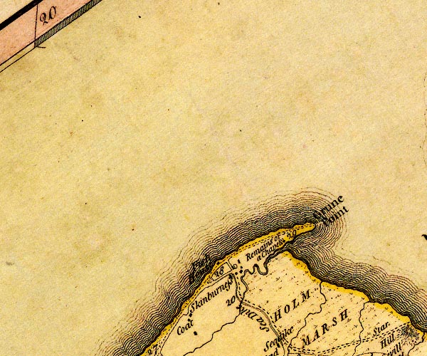 D4NY15NW.jpg distances from Whitehaven 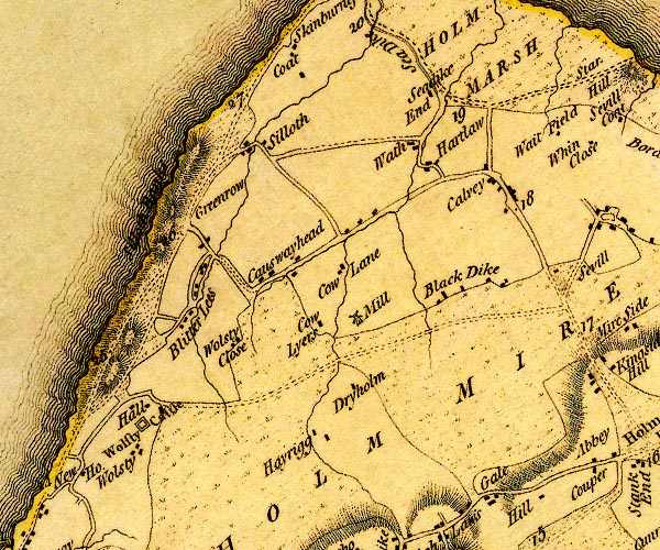 D4NY15SW.jpg further south the road is labelled "A. to GPt. 10:0:0" miles.furlongs.poles; Allonby to Grune Point item:- Carlisle Library : Map 2 Images © Carlisle Library |
||
|
|
|||
| evidence:- | old map:- Wallis 1810 (Cmd) |
||
| source data:- | Road map, hand coloured engraving, Cumberland, scale about 16
miles to 1 inch, by James Wallis, 77 Berwick Stree, Soho,
London, 1810. click to enlarge click to enlargeWL13.jpg double line, light bold; 'Turnpike Road' item:- Dove Cottage : 2009.81.10 Image © see bottom of page |
||
|
|
|||
| place:- |  Silloth Grune Point, Silloth-on-Solway Silloth Grune Point, Silloth-on-Solway |
||
|
|
|||
Lakes Guides menu.