 Old Cumbria Gazetteer
 |
 |
|
|
| road, Cockermouth to Allerby | |||
| suggested | |||
| Cockermouth to Allerby | |||
| Allerby to Cockermouth | |||
| civil parish:- | Cockermouth (formerly Cumberland) | ||
| civil parish:- | Bridekirk (formerly Cumberland) | ||
| civil parish:- | Oughterside and Allerby (formerly Cumberland) | ||
| county:- | Cumbria | ||
| locality type:- | road route | ||
| 10Km square:- | NY13 | ||
| 10Km square:- | NY03 | ||
| references:- | Donald 1774 |
||
|
|
|||
| evidence:- | old map:- Donald 1774 (Cmd) |
||
| source data:- | Map, hand coloured engraving, 3x2 sheets, The County of Cumberland, scale about 1
inch to 1 mile, by Thomas Donald, engraved and published by Joseph Hodskinson, 29
Arundel Street, Strand, London, 1774.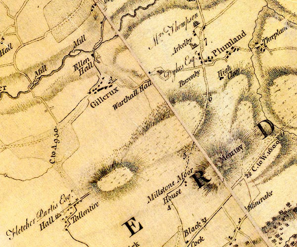 D4NY13NW.jpg "C. to A. 9.5.0." miles.furlongs.poles; Cockermouth to Allerby? item:- Carlisle Library : Map 2 Image © Carlisle Library |
||
|
|
|||
| place:- |  Cockermouth Bridekirk Tallentire, Bridekirk Allerby Cockermouth Bridekirk Tallentire, Bridekirk Allerby |
||
|
|
|||
Lakes Guides menu.