 Old Cumbria Gazetteer
 |
 |
|
| quarry, Tilberthwaite | ||
| locality:- | Tilberthwaite | |
| civil parish:- | Coniston (formerly Lancashire) | |
| county:- | Cumbria | |
| locality type:- | slate quarry | |
| locality type:- | quarry | |
| coordinates:- | NY31070168 (etc) | |
| 1Km square:- | NY3101 | |
| 10Km square:- | NY30 | |
|
|
||
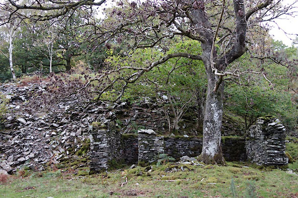 BZN67.jpg (taken 15.10.2013) 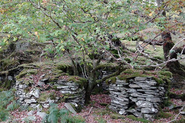 BZN68.jpg (taken 15.10.2013) |
||
|
|
||
| evidence:- | possibly old map:- Postlethwaite 1877 (3rd edn 1913) |
|
| source data:- | Map, uncoloured engraving, Map of the Lake District Mining Field, Westmorland, Cumberland,
Lancashire, scale about 5 miles to 1 inch, by John Postlethwaite, published by W H
Moss and Sons, 13 Lowther Street, Whitehaven, Cumberland, 1877 edn 1913.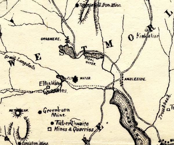 PST2NY30.jpg "Tilberthwaite Mines and Quarries" mine symbol, quarry symbol item:- JandMN : 162.2 Image © see bottom of page |
|
|
|
||
 Lakes Guides menu.