 Old Cumbria Gazetteer
 |
 |
|
| Plumptonhall Mill, Hesket | ||
| Plumptonhall Mill | ||
| site name:- | Petteril, River | |
| locality:- | Plumpton Hall | |
| locality:- | Plumpton | |
| civil parish:- | Hesket (formerly Cumberland) | |
| county:- | Cumbria | |
| locality type:- | buildings | |
| locality type:- | water mill (ex) | |
| locality type:- | mill (ex) | |
| coordinates:- | NY49353580 | |
| 1Km square:- | NY4935 | |
| 10Km square:- | NY43 | |
|
|
||
| evidence:- | old map:- Donald 1774 (Cmd) |
|
| source data:- | Map, hand coloured engraving, 3x2 sheets, The County of Cumberland, scale about 1
inch to 1 mile, by Thomas Donald, engraved and published by Joseph Hodskinson, 29
Arundel Street, Strand, London, 1774.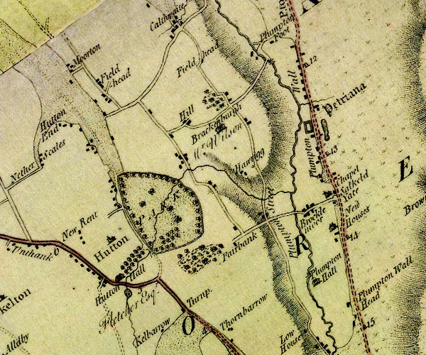 D4NY43NE.jpg circle with rays, mill wheel; a water mill at Plumpton Hall item:- Carlisle Library : Map 2 Image © Carlisle Library |
|
|
|
||
 Lakes Guides menu.