 Old Cumbria Gazetteer
 |
 |
|
||
| Melmerby Beck | ||||
| runs into:- |  Robberby Water Robberby Water |
|||
|
|
||||
| locality:- | Melmerby | |||
| civil parish:- | Ousby (formerly Cumberland) | |||
| county:- | Cumbria | |||
| locality type:- | river | |||
| 1Km square:- | NY6037 (etc) | |||
| 10Km square:- | NY63 | |||
|
|
||||
| evidence:- | possibly old map:- Mercator 1595 (edn?) placename:- |
|||
| source data:- | Map, hand coloured engraving, Northumbria, Cumberlandia, et
Dunelmensis Episcopatus, ie Northumberland, Cumberland and
Durham etc, scale about 6.5 miles to 1 inch, by Gerard Mercator,
Duisberg, Germany, about 1595. MER8CumD.jpg "" double line with stream lines; river, becomes the Robberby Water item:- JandMN : 169 Image © see bottom of page |
|||
|
|
||||
| evidence:- | old map:- Donald 1774 (Cmd) |
|||
| source data:- | Map, hand coloured engraving, 3x2 sheets, The County of Cumberland, scale about 1
inch to 1 mile, by Thomas Donald, engraved and published by Joseph Hodskinson, 29
Arundel Street, Strand, London, 1774.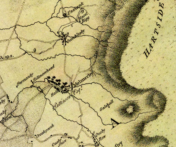 D4NY63NW.jpg single or double wiggly line; a river item:- Carlisle Library : Map 2 Image © Carlisle Library |
|||
|
|
||||
| places:- |
|
|||
|
||||
Lakes Guides menu.