 Old Cumbria Gazetteer
 |
 |
|
| chapel, Garsdale | ||
| locality:- | Garsdale | |
| civil parish:- | Garsdale (formerly Yorkshire) | |
| county:- | Cumbria | |
| locality type:- | chapel | |
| locality type:- | methodist chapel | |
| coordinates:- | SD71879053 | |
| 1Km square:- | SD7190 | |
| 10Km square:- | SD79 | |
|
|
||
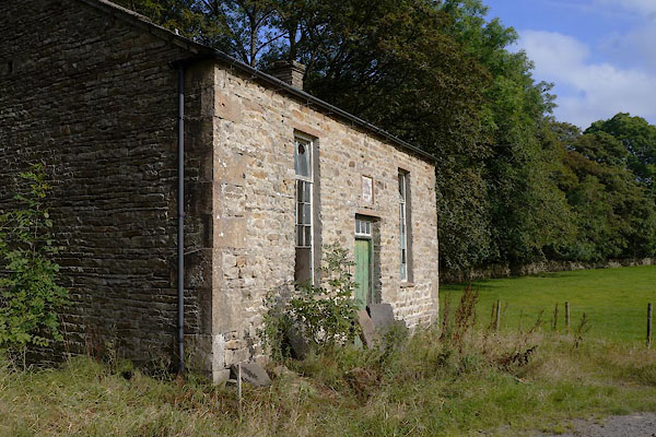 CBS74.jpg (taken 19.9.2014) 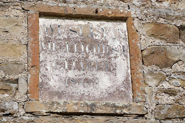 CBS75.jpg Plaque:- "WESLEYAN / METHODIST / CHAPEL / 1863" (taken 19.9.2014) |
||
|
|
||
| evidence:- | old map:- OS County Series (Yrk 64 2) |
|
| source data:- | Maps, County Series maps of Great Britain, scales 6 and 25
inches to 1 mile, published by the Ordnance Survey, Southampton,
Hampshire, from about 1863 to 1948. "Methodist Chapel (Wesleyan)" |
|
|
|
||
 Lakes Guides menu.