 Old Cumbria Gazetteer
 |
 |
|
| chapel, Dalton-in-Furness (2) | ||
| Street:- | Broughton Road (?) | |
| locality:- | Dalton-in-Furness | |
| civil parish:- | Dalton Town with Newton (formerly Lancashire) | |
| county:- | Cumbria | |
| locality type:- | buildings | |
| locality type:- | chapel (ex) | |
| locality type:- | baptist chapel (ex) | |
| locality type:- | school (ex) | |
| locality type:- | Sunday school (ex) | |
| coordinates:- | SD23207424 | |
| 1Km square:- | SD2374 | |
| 10Km square:- | SD27 | |
|
|
||
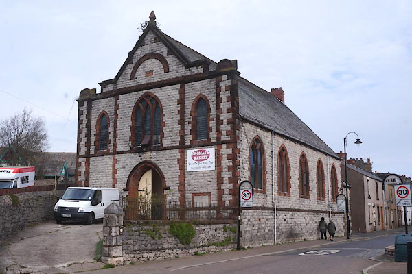 CCV85.jpg (taken 17.4.2015) 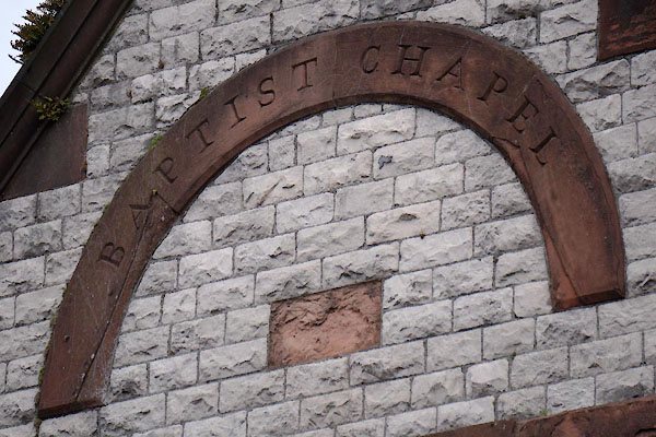 CCV86.jpg "BAPTIST CHAPEL" (taken 17.4.2015) |
||
|
|
||
| evidence:- | old map:- OS County Series (Lan 16 13) |
|
| source data:- | Maps, County Series maps of Great Britain, scales 6 and 25
inches to 1 mile, published by the Ordnance Survey, Southampton,
Hampshire, from about 1863 to 1948. "Baptist Chapel (Particular) / Sunday School" |
|
|
|
||
 Lakes Guides menu.