 Old Cumbria Gazetteer
 |
 |
|
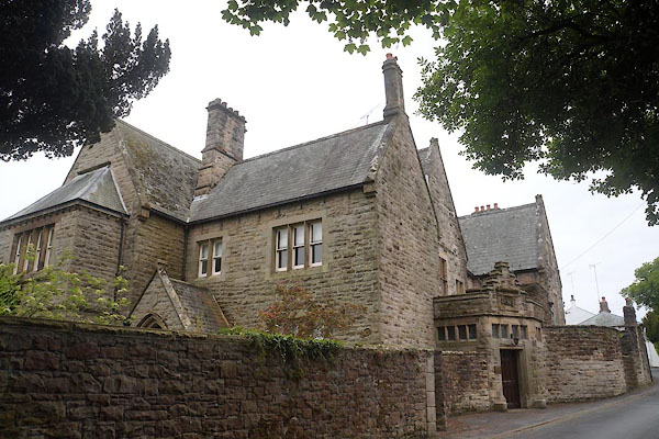
| Burroughs, Papcastle | ||
| Burroughs | ||
| locality:- | Papcastle | |
| civil parish:- | Papcastle (formerly Cumberland) | |
| county:- | Cumbria | |
| locality type:- | buildings | |
| coordinates:- | NY11063124 | |
| 1Km square:- | NY1131 | |
| 10Km square:- | NY13 | |
|
|
||
 CAT87.jpg (taken 30.5.2014) 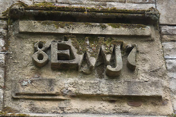 CAT88.jpg Defaced date stone:- "[ ]8 EWVJ 7[5]" (taken 30.5.2014) |
||
|
|
||
| evidence:- | old map:- OS County Series (Cmd 54 4) placename:- Burroughs, The |
|
| source data:- | Maps, County Series maps of Great Britain, scales 6 and 25
inches to 1 mile, published by the Ordnance Survey, Southampton,
Hampshire, from about 1863 to 1948. |
|
|
|
||
 Lakes Guides menu.