 Old Cumbria Gazetteer
 |
 |
|
|
| road, through Hutton Roof | |||
| Hutton Roof road | |||
| Burton to Kirkby Lonsdale | |||
| Kirkby Lonsdale to Burton | |||
| Gallowber Lane | |||
| civil parish:- | Burton-in-Kendal (formerly Westmorland) | ||
| civil parish:- | Hutton Roof (formerly Westmorland) | ||
| civil parish:- | Kirkby Lonsdale (formerly Westmorland) | ||
| county:- | Cumbria | ||
| locality type:- | road route | ||
| 10Km square:- | SD57 | ||
| 10Km square:- | SD67 | ||
|
|
|||
| evidence:- | old map:- Jefferys 1770 (Wmd) |
||
| source data:- | Map, 4 sheets, The County of Westmoreland, scale 1 inch to 1
mile, surveyed 1768, and engraved and published by Thomas
Jefferys, London, 1770.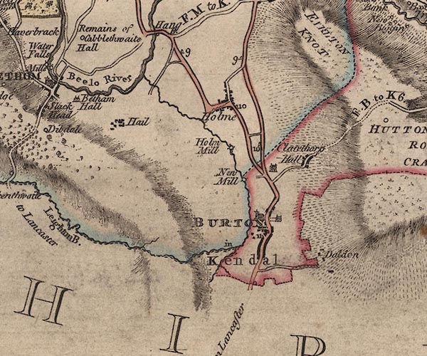 J5SD57NW.jpg 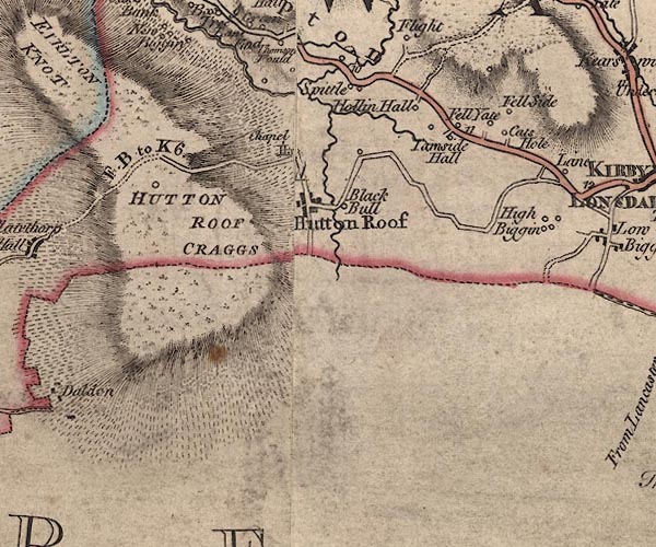 J5SD57NE.jpg "F. B. to K. 6.[1]" 'From Burton to Kirkby Lonsdale 6 miles 1 furlong?' 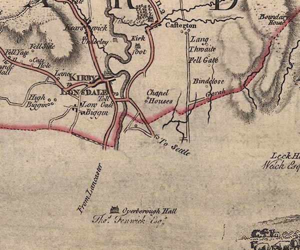 J5SD67NW.jpg double line; road item:- National Library of Scotland : EME.s.47 Images © National Library of Scotland |
||
|
|
|||
| place:- |  Burton-in-Kendal Clawthorpe, Burton-in-Kendal Hutton Roof Kirkby Lonsdale Burton-in-Kendal Clawthorpe, Burton-in-Kendal Hutton Roof Kirkby Lonsdale |
||
|
|
|||
Lakes Guides menu.