 Old Cumbria Gazetteer
 |
 |
|
|
| road, Sampool Bridge to Windermere | |||
| Sampool Bridge to Windermere | |||
| Windermere to Sampool Bridge | |||
| A5074 | |||
| civil parish:- | Levens (formerly Westmorland) | ||
| civil parish:- | Crosthwaite and Lyth (formerly Westmorland) | ||
| civil parish:- | Crook (formerly Westmorland) | ||
| civil parish:- | Windermere (formerly Westmorland) | ||
| county:- | Cumbria | ||
| locality type:- | route | ||
| 10Km square:- | SD48 | ||
| 10Km square:- | SD49 | ||
|
|
|||
| evidence:- | old map:- Jefferys 1770 (Wmd) |
||
| source data:- | Map, 4 sheets, The County of Westmoreland, scale 1 inch to 1
mile, surveyed 1768, and engraved and published by Thomas
Jefferys, London, 1770.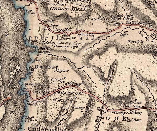 J5SD49NW.jpg 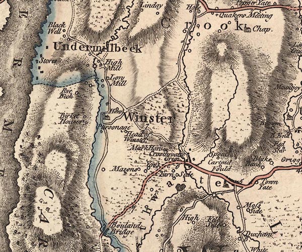 J5SD49SW.jpg 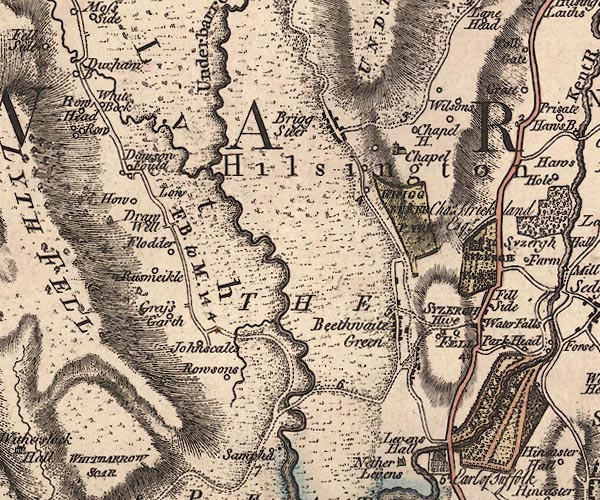 J5SD48NE.jpg "F. B. to M. 14 4" double line; road; 'From Bowness to ?Milnthorpe 14 miles 4 furlongs' item:- National Library of Scotland : EME.s.47 Images © National Library of Scotland |
||
|
|
|||
| places:- |  Sampool Bridge, Levens Winster, Crook Bowness-on-Windermere Windermere Sampool Bridge, Levens Winster, Crook Bowness-on-Windermere Windermere |
||
|
|
|||
Lakes Guides menu.