 Old Cumbria Gazetteer
 |
 |
|
| road, Garnett Bridge to Sadgill | ||
| Garnett Bridge to Sadgill | ||
| Sadgill to Garnett Bridge | ||
| civil parish:- | Whitwell and Selside (formerly Westmorland) | |
| civil parish:- | Longsleddale (formerly Westmorland) | |
| county:- | Westmorland | |
| locality type:- | road route | |
| 10Km square:- | SD59 | |
| 10Km square:- | NY50 | |
| 10Km square:- | NY40 | |
| SummaryText:- | Road from Garnett Bridge to Sadgill; single track road with passing places. | |
|
|
||
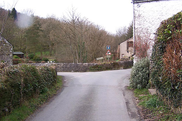
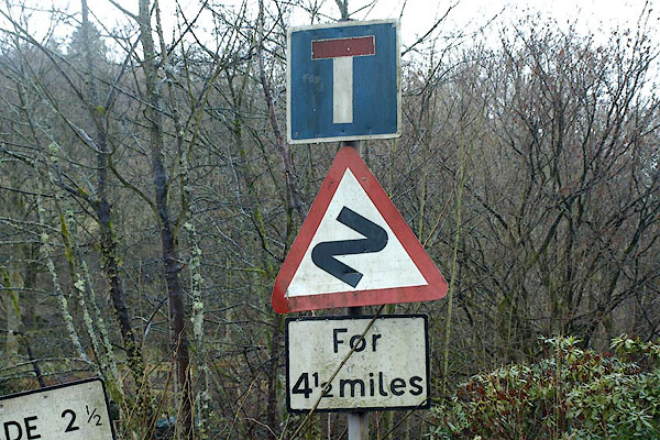 BSF04.jpg Roadsigns at Garnett Bridge. (taken 26.2.2010) |
||
| The rain makes these signs green. We once met two valley wives scrubbing the signs
clean when a lot of visitors were expected. |
||
|
|
||
| evidence:- | old map:- OS County Series (Wmd 27 6) |
|
| source data:- | Maps, County Series maps of Great Britain, scales 6 and 25
inches to 1 mile, published by the Ordnance Survey, Southampton,
Hampshire, from about 1863 to 1948. OS County Series (Wmd 27 7) OS County Series (Wmd 27 11) OS County Series (Wmd 27 15) OS County Series (Wmd 27 16) OS County Series (Wmd 33 4) Spot heights and bench marks are shown along the road. |
|
|
|
||
| evidence:- | old map:- Jefferys 1770 (Wmd) |
|
| source data:- | Map, 4 sheets, The County of Westmoreland, scale 1 inch to 1
mile, surveyed 1768, and engraved and published by Thomas
Jefferys, London, 1770.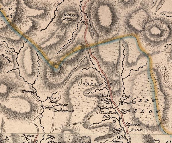 J5NY40NE.jpg  J5NY40SE.jpg  J5NY50SW.jpg double line; road, with mile numbers item:- National Library of Scotland : EME.s.47 Images © National Library of Scotland |
|
|
|
||
| evidence:- | descriptive text:- West 1778 (11th edn 1821) |
|
| source data:- | Guide book, A Guide to the Lakes, by Thomas West, published by
William Pennington, Kendal, Cumbria once Westmorland, and in
London, 1778 to 1821. goto source goto sourcePage 166:- "... The road along the vale is tolerable, and joins the great road at Watch-gate, about four miles from Kendal." |
|
|
|
||
| evidence:- | descriptive text:- Rose 1832-35 |
|
| source data:- | Set of prints, 3 volumes, Westmorland, Cumberland, Durham and
Northumberland Illustrated; from drawings by Thomas Allom,
George Pickering, and H Gastineau, described by Thomas Rose,
published by H Fisher, R Fisher, and P Jackson, Newgate Street,
London, 1832-35. Descriptive text with the plate of Long Sleddale Slate Quarry, includes:- "... This vale [Long Sleddale] is intersected by the Sprint rivulet, which runs parallel with the road by which tourists from Kendal approach the sublime mountain scenery around Hawes Water. ..." |
|
|
|
||
| evidence:- | old map:- Ford 1839 map |
|
| source data:- | Map, uncoloured engraving, Map of the Lake District of
Cumberland, Westmoreland and Lancashire, scale about 3.5 miles
to 1 inch, published by Charles Thurnam, Carlisle, and by R
Groombridge, 5 Paternoster Row, London, 3rd edn 1843.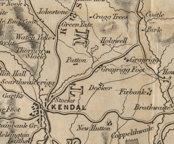 FD02SD59.jpg 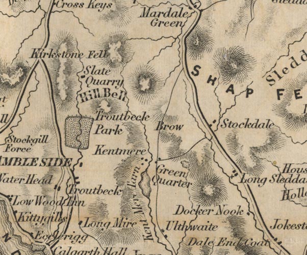 FD02NY40.jpg Road. item:- JandMN : 100.1 Image © see bottom of page |
|
|
|
||
| evidence:- | old map:- OS 1881-82 New Series (outline edition) |
|
| source data:- | Map, engraving, area north of Kendal, Westmorland, New Series
one inch map, outline edition, sheet 39, scale 1 inch to 1 mile,
published by the Ordnance Survey, Southampton, Hampshire,
1881-82.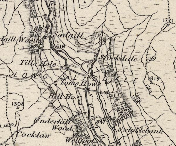 O21NY40X.jpg 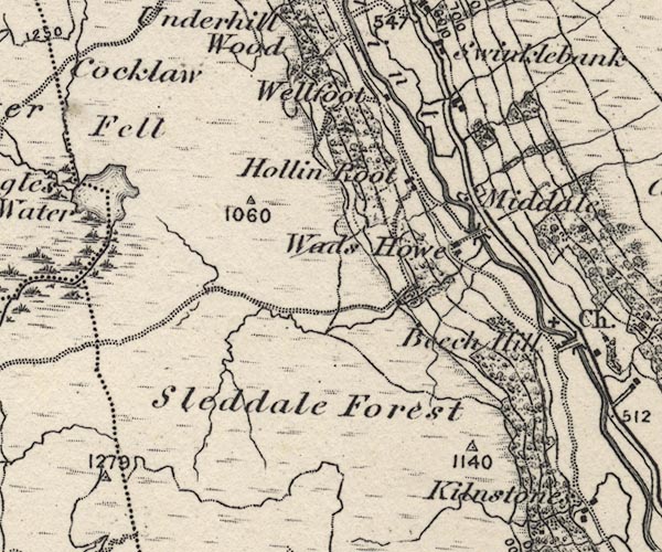 O21NY40W.jpg 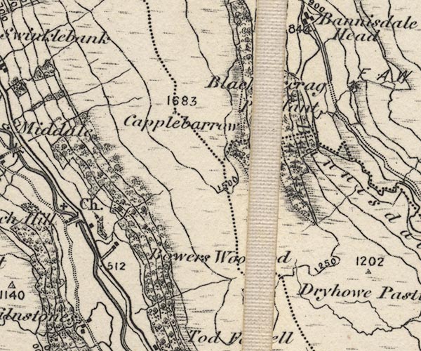 O21NY50B.jpg 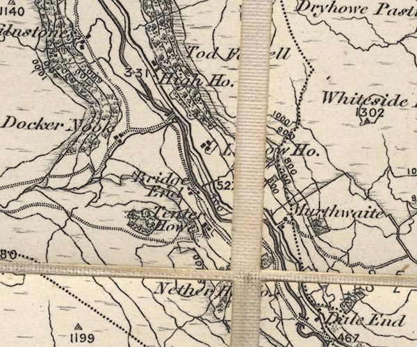 O21NY50A.jpg item:- JandMN : 61 Image © see bottom of page |
|
|
|
||
 walk 1, Sadgill to St Mary's Church: 7.6.2007 walk 1, Sadgill to St Mary's Church: 7.6.2007 |
||
|
|
||
| walk 2, St Mary's Church to Sadgill, 9.2.2008 |
||
|
|
||
| walk 3, St Mary's Church to Katebarrow, 9.4.2008 |
||
|
|
||
| walk 4, Katebarrow to St Mary's Church, 26.5.2008 |
||
|
|
||
| flowers (Katebarrow - St Mary's Church) 2008 - 2011 |
||
|
|
||
| species (Dale End - Murthwaite) 2004 |
||
|
|
||
| species (Yewbarrow - St Mary's Church) 2004 |
||
|
|
||
JandMN : 402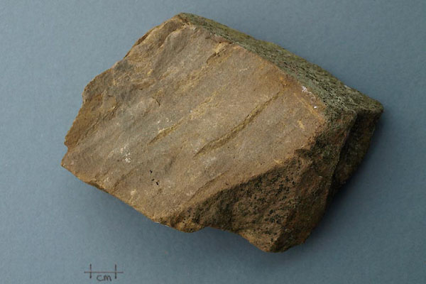 BXO44.jpg Rock, hand specimen of a sedimentary mudstone from a wall by the road from Garnett Bridge to Sadgill, Longsleddale, Westmorland, about NY50090290, 13 October 2012. Silurian, Ludlow; Kendal group, Bannisdale Formation. (taken 13.10.2012) |
||
|
|
||
 BNJ98.jpg Junction at Garnett Bridge. (taken 19.3.2007) 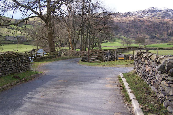 BNK06.jpg Junction at Stockdale Bridge. (taken 19.3.2007) 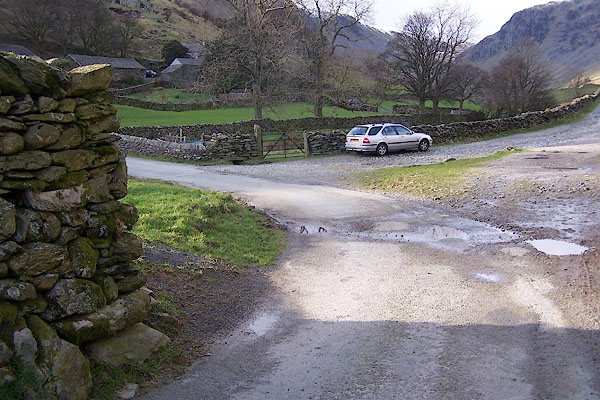 BNK07.jpg Road end at Sadgill. (taken 19.3.2007) |
||
|
|
||
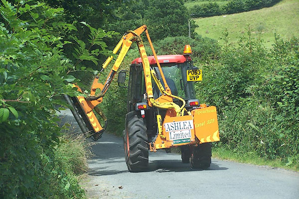 BJR20.jpg Hedge Trimmimg. (taken 3.8.2005) |
||
|
|
||
| MN photo:- |
Sometimes we have heavy rain, and there are unexpected streams. |
|
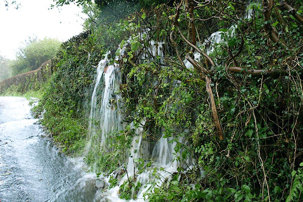 BPU08.jpg Leaking hedge! just below Dale End. (taken 24.10.2008) |
||
|
|
||
| MN photo:- |
There are 3 types of drainage; drains, culverts, and 'holes'. |
|
| Culverts are water channels piped under the road, best found by listening. |
||
| Most of the 78 drain covers are from ironfoundries outside Westmorland and Cumberland.
Two have been found with local interest, both cast in Kendal:- |
||
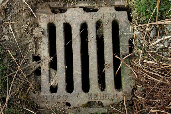 BSN87.jpg cast iron:- "GILKES KENDAL ..." (taken 16.4.2010) 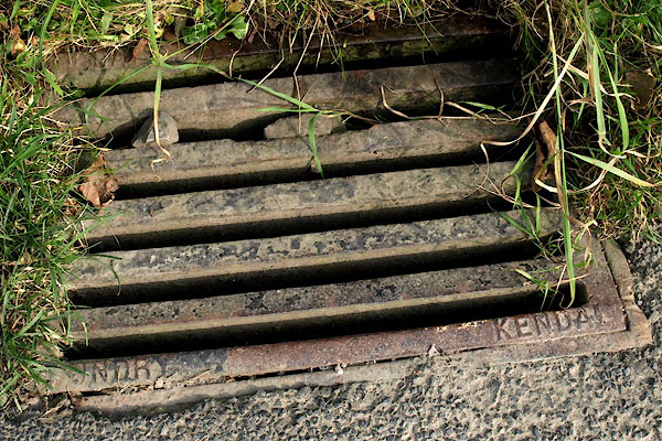 BVK70.jpg cast iron:- "H DAY CAST[LE] / FOUNDRY KENDAL" (taken 30.9.2011) |
||
|
|
||
| MN photo:- |
Sometimes it snows. There is excellent snow clearance in the valley. |
|
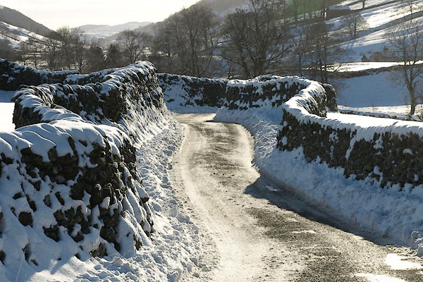 BTU99.jpg (taken 5.12.2010) 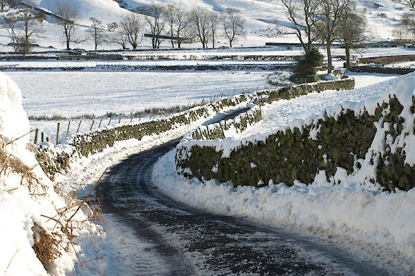 BTV08.jpg (taken 5.12.2010) 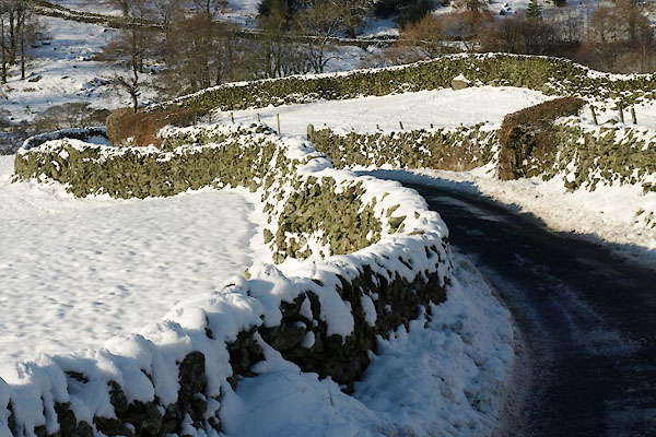 BTV09.jpg (taken 5.12.2010) |
||
|
|
||
Lakes Guides menu.