Old Cumbria Gazetteer
 |
 |
|
||
| Red Hills, Dacre | ||||
| Red Hills | ||||
| civil parish:- | Dacre (formerly Cumberland) | |||
| county:- | Cumbria | |||
| locality type:- | locality | |||
| locality type:- | buildings | |||
| coordinates:- | NY50462859 (etc) | |||
| 1Km square:- | NY5028 | |||
| 10Km square:- | NY52 | |||
|
|
||||
| evidence:- | old map:- OS County Series (Cmd 58 8) placename:- Red Hills |
|||
| source data:- | Maps, County Series maps of Great Britain, scales 6 and 25
inches to 1 mile, published by the Ordnance Survey, Southampton,
Hampshire, from about 1863 to 1948. |
|||
|
|
||||
| evidence:- | old map:- Jefferys 1770 (Wmd) placename:- Redhills |
|||
| source data:- | Map, 4 sheets, The County of Westmoreland, scale 1 inch to 1
mile, surveyed 1768, and engraved and published by Thomas
Jefferys, London, 1770.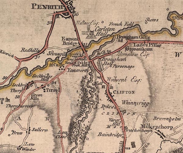 J5NY52NW.jpg "Redhills" circle, labelled in italic lowercase text; settlement, farm, house, or hamlet? item:- National Library of Scotland : EME.s.47 Image © National Library of Scotland |
|||
|
|
||||
| evidence:- | old map:- Donald 1774 (Cmd) placename:- Red Hill |
|||
| source data:- | Map, hand coloured engraving, 3x2 sheets, The County of Cumberland, scale about 1
inch to 1 mile, by Thomas Donald, engraved and published by Joseph Hodskinson, 29
Arundel Street, Strand, London, 1774.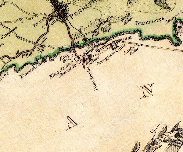 D4NY52NW.jpg "Red Hill" block or blocks, labelled in lowercase; a hamlet or just a house item:- Carlisle Library : Map 2 Image © Carlisle Library |
|||
|
|
||||
| places:- |
|
|||
|
||||
 Lakes Guides menu.