 Old Cumbria Gazetteer
 |
 |
|
| Redhills Limekilns, Dacre | ||
| Redhills Limekilns | ||
| locality:- | Red Hills | |
| civil parish:- | Dacre (formerly Cumberland) | |
| county:- | Cumbria | |
| locality type:- | limekiln | |
| coordinates:- | NY49752835 (about) | |
| 1Km square:- | NY4928 | |
| 10Km square:- | NY42 | |
| references:- | OS County Series |
|
|
|
||
 BXL34.jpg (taken 5.10.2012) 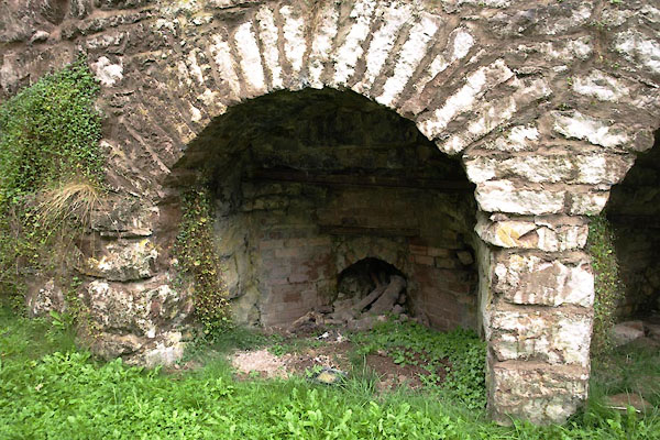 BXL35.jpg (taken 5.10.2012) |
||
|
|
||
| evidence:- | old map:- OS County Series (Cmd 58 8) placename:- Redhills Limekilns |
|
| source data:- | Maps, County Series maps of Great Britain, scales 6 and 25
inches to 1 mile, published by the Ordnance Survey, Southampton,
Hampshire, from about 1863 to 1948. "Redhills Limekilns" |
|
|
|
||
| evidence:- | database:- Listed Buildings 2010 placename:- Redhill Limekilns |
|
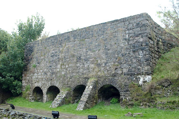
| source data:- | courtesy of English Heritage "REDHILL LIMEKILNS, 120 METRES SOUTH EAST OF SLAPESTONES ROUNDABOUT / / / DACRE / EDEN / CUMBRIA / II / 74013 / NY4977228332" |
|
| source data:- | courtesy of English Heritage "Limekiln block. Early to mid C19. Rubble limestone. Kiln block with two pairs of arched openings (2, perhaps 3 draw arches and one access tunnel), with 2 (perhaps 3) charging holes visible above, all blocked. Two of the lower openings are partially blocked, but those to the left contain the draw holes. Two low buttresses are later additions." |
|
|
|
||
 Lakes Guides menu.