 Old Cumbria Gazetteer
 |
 |
|
| Grained Tree, Stainmore | ||
| suggested | ||
| Grained Tree | ||
| locality:- | Black Riggs | |
| civil parish:- | Stainmore (formerly Westmorland) | |
| county:- | Cumbria | |
| locality type:- | locality (?) | |
| locality type:- | tree (?) | |
| coordinates:- | NY877128 (guess) | |
| 1Km square:- | NY8712 | |
| 10Km square:- | NY81 | |
| references:- | Jefferys 1770 |
|
|
|
||
| evidence:- | old map:- Jefferys 1770 (Wmd) placename:- Grained Tree |
|
| source data:- | Map, 4 sheets, The County of Westmoreland, scale 1 inch to 1
mile, surveyed 1768, and engraved and published by Thomas
Jefferys, London, 1770.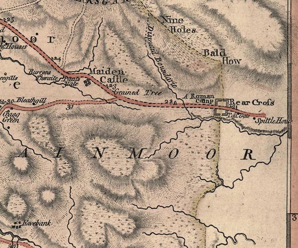 J5NY81SE.jpg "Grained Tree" no symbol item:- National Library of Scotland : EME.s.47 Image © National Library of Scotland |
|
|
|
||
 Lakes Guides menu.