 Old Cumbria Gazetteer
 |
 |
|
| Common Garden, Kendal | ||
| suggested | ||
| Common Garden | ||
| locality:- | Kendal | |
| civil parish:- | Kendal (formerly Westmorland) | |
| county:- | Cumbria | |
| locality type:- | locality | |
| locality type:- | common (?) | |
| locality type:- | allotments (?) | |
| coordinates:- | SD522926 (etc) | |
| 1Km square:- | SD5292 | |
| 10Km square:- | SD59 | |
| references:- | Jefferys 1770 |
|
|
|
||
| evidence:- | old map:- Jefferys 1770 placename:- Common Garden |
|
| source data:- | Map, 4 sheets, The County of Westmoreland, scale 1 inch to 1
mile, surveyed 1768, and engraved and published by Thomas
Jefferys, London, 1770.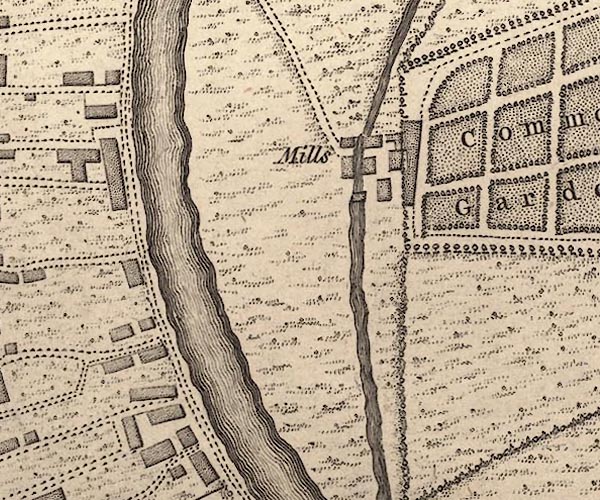 J55192S.jpg 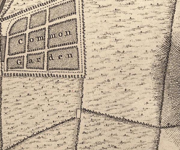 J55192X.jpg "Common Garden" gardens item:- National Library of Scotland : EME.s.47 Images © National Library of Scotland |
|
|
|
||
| evidence:- | old map:- Jefferys 1770 (Wmd) placename:- Common Garden |
|
| source data:- | Map, 4 sheets, The County of Westmoreland, scale 1 inch to 1
mile, surveyed 1768, and engraved and published by Thomas
Jefferys, London, 1770. J5SD59SW.jpg "Common Garden" an inclosure? item:- National Library of Scotland : EME.s.47 Image © National Library of Scotland |
|
|
|
||
 Lakes Guides menu.