 Old Cumbria Gazetteer
 |
 |
|
|
| Cockermouth: Castlegate | |||
| Castlegate | |||
| locality:- | Cockermouth | ||
| civil parish:- | Cockermouth (formerly Cumberland) | ||
| county:- | Cumbria | ||
| locality type:- | street | ||
| coordinates:- | NY12343081 (etc) | ||
| 1Km square:- | NY1230 | ||
| 10Km square:- | NY11 | ||
|
|
|||
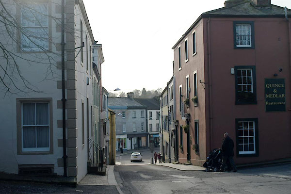 BVY55.jpg (taken 24.2.2012) 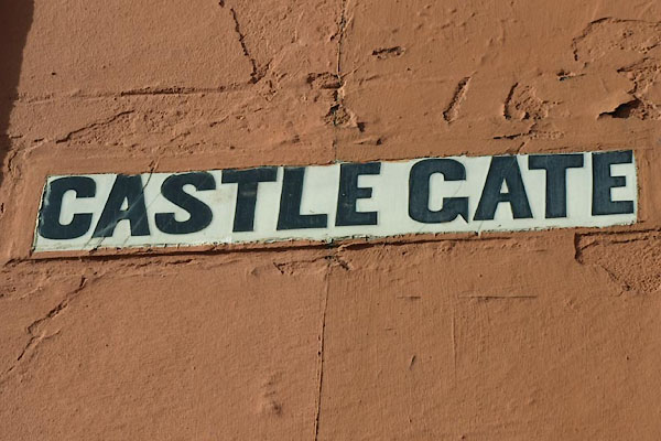 BVY56.jpg Name sign. (taken 24.2.2012) |
|||
|
|
|||
| evidence:- | old map:- OS County Series (Cmd 54 4) placename:- Castlegate |
||
| source data:- | Maps, County Series maps of Great Britain, scales 6 and 25
inches to 1 mile, published by the Ordnance Survey, Southampton,
Hampshire, from about 1863 to 1948. |
||
|
|
|||
| evidence:- | old map:- Donald 1774 (Cmd) placename:- Castle Gate |
||
| source data:- | Map, hand coloured engraving, 3x2 sheets, The County of Cumberland, scale about 1
inch to 1 mile, by Thomas Donald, engraved and published by Joseph Hodskinson, 29
Arundel Street, Strand, London, 1774.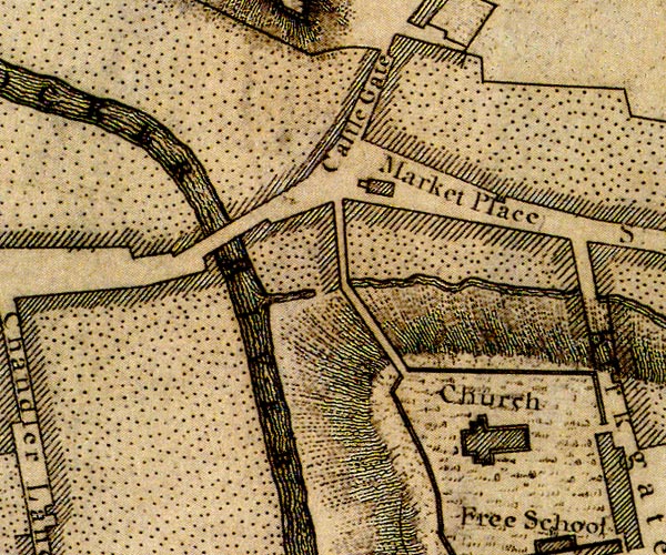 D41230I.jpg "Castle Gate" street item:- Carlisle Library : Map 2 Image © Carlisle Library |
||
|
|
|||
| evidence:- | old text:- Capper 1808 |
||
| source data:- | Gazetteer, A Topographical Dictionary of the United Kingdom,
compiled by Benjamin Pitts Capper, published by Richard
Phillips, Bridge Street, Blackfriars, London, 1808; published
1808-29. goto source goto source"[Cockermouth] ... there are several modern and well built streets and houses, particularly the one ascending to the castle gate, which is very steep; ..." |
||
|
|
|||
| mapping:- | Cockermouth: Market Place Cockermouth: Market Place |
||
|
|
|||
Lakes Guides menu.