 Old Cumbria Gazetteer
 |
 |
|
| Chapel Cottage, Kirkby Thore | ||
| Chapel Cottage | ||
| Street:- | Cross Street | |
| locality:- | Kirkby Thore | |
| civil parish:- | Kirkby Thore (formerly Westmorland) | |
| county:- | Cumbria | |
| locality type:- | buildings | |
| locality type:- | chapel (ex) | |
| coordinates:- | NY63852579 | |
| 1Km square:- | NY6325 | |
| 10Km square:- | NY62 | |
|
|
||
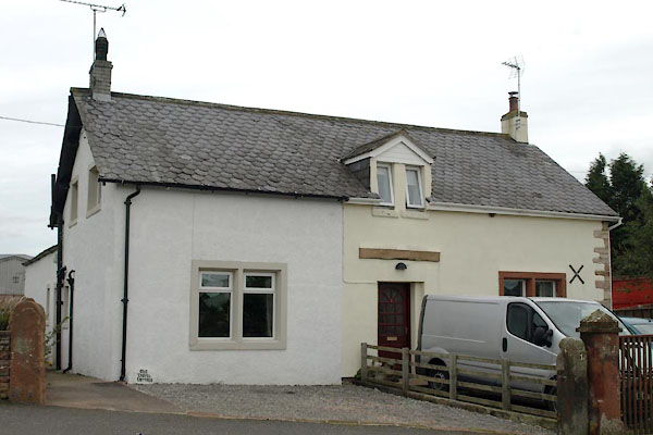 BXF29.jpg (taken 31.8.2012) |
||
|
|
||
| evidence:- | old map:- OS County Series (Wmd 9 1) placename:- Bethel Chapel |
|
| source data:- | Maps, County Series maps of Great Britain, scales 6 and 25
inches to 1 mile, published by the Ordnance Survey, Southampton,
Hampshire, from about 1863 to 1948. "Bethel Chapel (New Connexion)" |
|
|
|
||
 Lakes Guides menu.