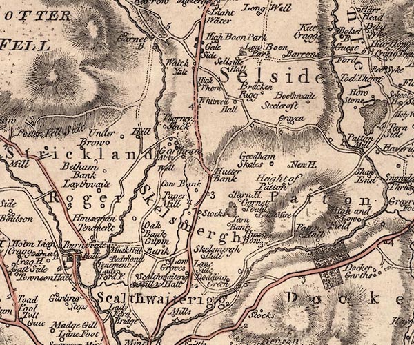


placename:- Abby Well

J5SD59NW.jpg
"Abby Well"
circle; spring
item:- National Library of Scotland : EME.s.47
Image © National Library of Scotland
 Old Cumbria Gazetteer
 |
 |
   |
| St John's Well, Skelsmergh | ||
| St John's Well | ||
| St John's Chapel | ||
| Chapel Well | ||
| locality:- | Otter Bank | |
| locality:- | Garth Row | |
| civil parish:- | Skelsmergh (formerly Westmorland) | |
| county:- | Cumbria | |
| locality type:- | spring | |
| locality type:- | well | |
| locality type:- | chapel | |
| coordinates:- | SD53039709 | |
| 1Km square:- | SD5397 | |
| 10Km square:- | SD59 | |
|
|
||
| evidence:- | possibly old map:- Jefferys 1770 (Wmd) placename:- Abby Well |
|
| source data:- | Map, 4 sheets, The County of Westmoreland, scale 1 inch to 1
mile, surveyed 1768, and engraved and published by Thomas
Jefferys, London, 1770. J5SD59NW.jpg "Abby Well" circle; spring item:- National Library of Scotland : EME.s.47 Image © National Library of Scotland |
|
|
|
||
| notes:- |
A holy well; the chapel built over the well. |
|
| Shown on an estate map of Otter Bank, 1840 |
||
| Tyson, Blake: 1998: St John's Well and Chapel, Skelsmergh: CWAAS: series 2 vol.98:
pp.155-167 |
||
|
|
||
 Lakes Guides menu.