 Old Cumbria Gazetteer
 |
 |
|
| Woad Holes, Derwent Water | ||
| perhaps | ||
| Woad Holes | ||
| site name:- | Derwent Water | |
| civil parish:- | Above Derwent (formerly Cumberland) | |
| county:- | Cumbria | |
| locality type:- | deep (?) | |
| locality type:- | area | |
| coordinates:- | NY254206 (?) | |
| 1Km square:- | NY2520 | |
| 10Km square:- | NY22 | |
| references:- | Clarke 1787 |
|
|
|
||
| evidence:- | old map:- Clarke 1787 map (Der) placename:- Woad Holes |
|
| source data:- | Map, uncoloured engraving, Map of Derwentwater and its Environs,
scale about 13 ins to 1 mile, by James Clarke, engraved by S J
Neele, published by James Clarke, Penrith, Cumberland and in
London etc, 1787.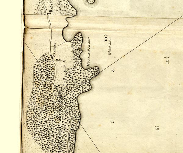 CL152520.jpg "Woad Holes" labelled in the lake by depth reading 10½ item:- private collection : 169 Image © see bottom of page |
|
|
|
||
 Lakes Guides menu.