 Old Cumbria Gazetteer
 |
 |
|
| toll gate, Keswick | ||
| gone | ||
| site name:- | road, Keswick to Cockermouth | |
| locality:- | Great Crosthwaite | |
| locality:- | High Hill | |
| civil parish:- | Keswick (formerly Cumberland) | |
| county:- | Cumbria | |
| locality type:- | toll gate (site) | |
| coordinates:- | NY26152389 | |
| 1Km square:- | NY2623 | |
| 10Km square:- | NY22 | |
| references:- | Clarke 1787 |
|
|
|
||
| evidence:- | old map:- OS County Series (Cmd 64 2) |
|
| source data:- | Maps, County Series maps of Great Britain, scales 6 and 25
inches to 1 mile, published by the Ordnance Survey, Southampton,
Hampshire, from about 1863 to 1948. "TP" line across the road |
|
|
|
||
| evidence:- | old map:- Donald 1774 (Cmd) |
|
| source data:- | Map, hand coloured engraving, 3x2 sheets, The County of Cumberland, scale about 1
inch to 1 mile, by Thomas Donald, engraved and published by Joseph Hodskinson, 29
Arundel Street, Strand, London, 1774.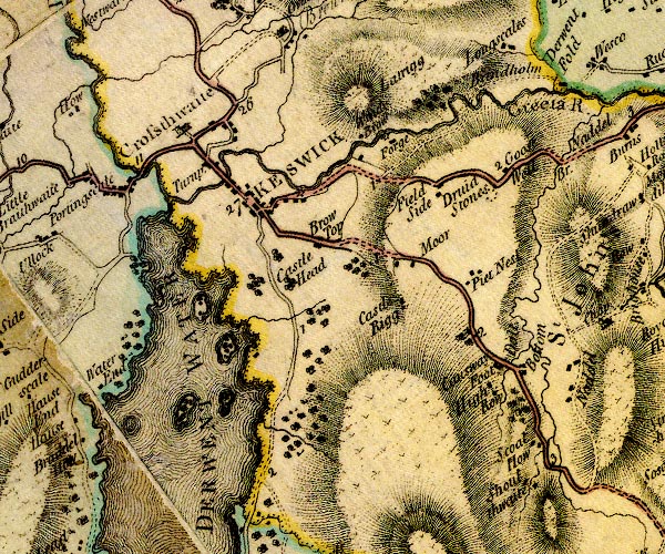 D4NY22SE.jpg "Turnp." block on road between Great Crosthwaite and Keswick; toll house and toll gate item:- Carlisle Library : Map 2 Image © Carlisle Library |
|
|
|
||
| evidence:- | old map:- Clarke 1787 map (Der) |
|
| source data:- | Map, uncoloured engraving, Map of Derwentwater and its Environs,
scale about 13 ins to 1 mile, by James Clarke, engraved by S J
Neele, published by James Clarke, Penrith, Cumberland and in
London etc, 1787.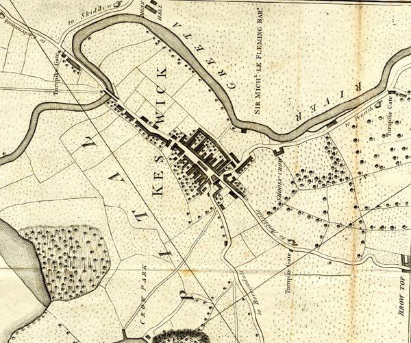 CL152623.jpg "Turnpike Gate" line across the road to Cockermouth, and perhaps the toll house item:- private collection : 169 Image © see bottom of page |
|
|
|
||
| evidence:- | old directory:- Jollie 1811 placename:- High Hill Tollgate |
|
| source data:- | Guide book, Jollie's Cumberland Guide and Directory, published
by Francis Jollie and Sons, Carlisle, Cumberland, 1811. "Birkett Fleming, High-hill toll-gate" |
|
|
|
||
 Act of Parliament Act of Parliament |
||
|
|
||
 Lakes Guides menu.