 Old Cumbria Gazetteer
 |
 |
|
|
| included in:- |
 road, Ulverston to Coniston partly road, Ulverston to Coniston partly
|
||
| road, Broughton to Coniston | |||
| Broughton in Furness to Coniston | |||
| Coniston to Broughton in Furness | |||
| A593 | |||
| civil parish:- | Broughton West (formerly Lancashire) | ||
| civil parish:- | Torver (formerly Lancashire) | ||
| civil parish:- | Coniston (formerly Lancashire) | ||
| county:- | Cumbria | ||
| locality type:- | road route | ||
| 10Km square:- | SD28 | ||
| 10Km square:- | SD29 | ||
|
|
|||
| evidence:- | road map:- Cary 1790 (Lan/edn 1792) |
||
| source data:- | Road map, hand coloured engraving, Lancashire, scale about 18
miles to 1 inch, by John Cary, 181 Strand, London, 1790, edn
1792.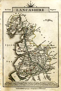 click to enlarge click to enlargeCY46.jpg double line, with road distances from Broughton in Furness item:- JandMN : 418 Image © see bottom of page |
||
|
|
|||
| evidence:- | old map:- Cooke 1802 |
||
| source data:- | Map, Lancashire, scale about 18 miles to 1 inch, by George
Cooke, 1802, bound in Gray's New Book of Roads, 1824, published
by Sherwood, Jones and Co, Paternoster Road, London, 1824.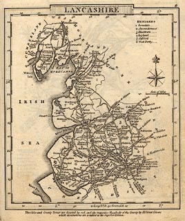 click to enlarge click to enlargeGRA1La.jpg "from Ravenglass" double line, light dark solid; road item:- Hampshire Museums : FA2000.62.6 Image © see bottom of page |
||
|
|
|||
| evidence:- | old map:- Laurie and Whittle 1806 |
||
| source data:- | Road map, Completion of the Roads to the Lakes, scale about 10
miles to 1 inch, by Nathaniel Coltman? 1806, published by Robert
H Laurie, 53 Fleet Street, London, 1834. click to enlarge click to enlargeLw18.jpg light line; 'Other Direct Roads from LONDON' item:- private collection : 18.18 Image © see bottom of page |
||
|
|
|||
| evidence:- | old map:- Ford 1839 map |
||
| source data:- | Map, uncoloured engraving, Map of the Lake District of
Cumberland, Westmoreland and Lancashire, scale about 3.5 miles
to 1 inch, published by Charles Thurnam, Carlisle, and by R
Groombridge, 5 Paternoster Row, London, 3rd edn 1843.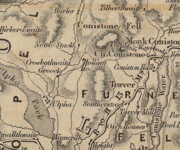 FD02SD29.jpg "B to H 13" Broughton in Furness to Hawkshead 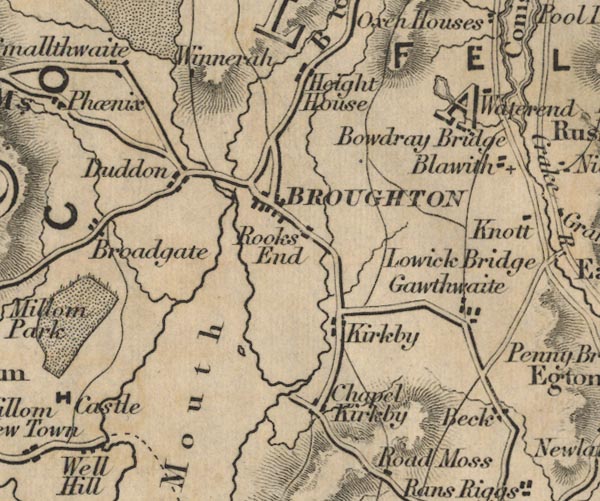 FD02SD28.jpg item:- JandMN : 100.1 Image © see bottom of page |
||
|
|
|||
| places:- | Broughton in Furness Torver Coniston |
||
|
|
|||
Lakes Guides menu.